TopoQuest Logo
Do you find TopoQuest useful?
Help keep TopoQuest running and adding new maps/features by donating!
Bitcoin:  19c7KJd3qBynnjoSw5npx9KScwjBe4ifkT
Litecoin:  LXs6TkuXGGXo1vDsWCkWVdjQX94eUKd6ui
Home View Maps Find Maps Find Places Resources & Links


Clarkston, Utah Topographic Map

USGS Map Title: Clarkston, UT
USGS Map MRC: 41112H1
DRG (GeoTIFF) Download: o41112h1.tif


Neighboring USGS Topographic Map Quads:


  Henderson Creek, ID  
42112A2
 

  Weston Canyon, ID  
42112A1
 

  Weston, ID  
42111A8
 

  Portage, UT  
41112H2
 

  Clarkston, UT  
41112H1
 

  Trenton, UT  
41111H8
 

  Riverside, UT  
41112G2
 

  Cutler Dam, UT  
41112G1
 

  Newton, UT  
41111G8


Map MRC Location:

N42°
W113°
N42°
W112°
H8 H7 H6 H5 H4 H3 H2 H1
G8 G7 G6 G5 G4 G3 G2 G1
F8 F7 F6 F5 F4 F3 F2 F1
E8 E7 E6 E5 E4 E3 E2 E1
D8 D7 D6 D5 D4 D3 D2 D1
C8 C7 C6 C5 C4 C3 C2 C1
B8 B7 B6 B5 B4 B3 B2 B1
A8 A7 A6 A5 A4 A3 A2 A1
N41°
W113°
N41°
W112°

Clarkston, UT USGS 1:24K Topographic Map Preview:
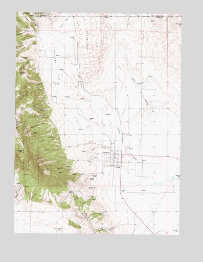
Clarkston, UT USGS Topographic Map
Click on map above to begin viewing in our Map Viewer.

This topographic map contains these locations and features:
Feature Name Type Latitude Longitude GNIS ID View Map
Al Archibald HollowValleyN41.8969°W112.0602°1425062View Map
Bensons HollowValleyN41.8833°W112.0386°1425437View Map
Bergeson HillSummitN41.9938°W112.0002°1425440View Map
Birch CreekStreamN41.9524°W112.0688°1425599View Map
Bob Archibald HollowValleyN41.8883°W112.0536°1425847View Map
Broken Back CanyonValleyN41.9894°W112.1191°1439151View Map
Casper SpringSpringN41.9066°W112.0687°1426371View Map
City CreekStreamN41.9238°W112.0405°1426651View Map
ClarkstonPopulated PlaceN41.9202°W112.0500°1426671View Map
Clarkston City CemeteryCemeteryN41.9314°W112.0402°1437251View Map
Clarkston CreekStreamN41.9033°W112.0222°1426672View Map
Clarkston Fire DepartmentBuildingN41.9199°W112.0500°2627377View Map
Clarkston MountainSummitN41.9319°W112.1227°1439770View Map
Clarkston Post OfficePost OfficeN41.9224°W112.0463°2781548View Map
Cold Water CanyonValleyN41.9733°W112.1119°1439883View Map
Cold Water SpringsSpringN41.9658°W112.1230°1426797View Map
Dahle HollowValleyN41.9288°W112.0263°1427183View Map
Dirty HeadFlatN41.9941°W112.0886°1427409View Map
Elbow CanyonValleyN41.9449°W112.0961°1427775View Map
Gowans HollowValleyN41.9902°W112.1066°382477View Map
Gowans HollowValleyN41.9888°W112.1041°1428294View Map
Green CanyonValleyN41.9241°W112.0880°1428391View Map
Gunsight SpringSpringN41.9213°W112.1198°1428448View Map
Hammond FlatFlatN41.9696°W112.0944°1428497View Map
James Barnet Cole Burial GroundCemeteryN41.8786°W112.0943°2769277View Map
Kinnikinick SpringSpringN41.9013°W112.0697°1429364View Map
KUSU-FM (Logan)TowerN41.8863°W112.0722°1455821View Map
Mikes CanyonValleyN41.9458°W112.0972°1430312View Map
Miller CanyonValleyN41.9166°W112.0783°1430338View Map
Myler CreekStreamN41.9277°W112.0508°1430623View Map
Myler GroveWoodsN41.9308°W112.1100°1430624View Map
New Quigley CanyonValleyN41.9563°W112.1044°1430700View Map
North CanyonValleyN41.9852°W112.1100°1443862View Map
Old CanyonValleyN41.9166°W112.0800°1430968View Map
Old Quigley CanyonValleyN41.9810°W112.1105°1444075View Map
Raglanite CanyonValleyN41.9377°W112.0952°1431547View Map
Round KnollSummitN41.9077°W112.0655°1432022View Map
Sam Stuart CanyonValleyN41.9605°W112.1044°1432156View Map
Short DivideGapN41.8977°W112.0802°1432423View Map
South CanyonValleyN41.9230°W112.0525°1432654View Map
Steel CanyonValleyN41.9880°W112.1119°391397View Map
Steel CanyonValleyN41.9877°W112.1080°1446117View Map
Straight CanyonValleyN41.9133°W112.0822°1432999View Map
The Church of Jesus Christ of Latter Day SaintsChurchN41.9185°W112.0500°1436856View Map
Thompson SpringSpringN41.9742°W112.1169°1433475View Map
Town of ClarkstonCivilN41.9205°W112.0504°2413207View Map
WashboardsAreaN41.9869°W112.0700°392915View Map
WashboardsFlatN41.9960°W112.0705°1433986View Map
Water CanyonValleyN41.8971°W112.1166°1434000View Map
Winter CanyonValleyN41.9310°W112.0902°1434412View Map

Note: Coordinates in the location and feature list above are referenced to NAD83 datum.


Copyright (C) 2008-2025 Ryan Niemi / Sunset Dynamics ... All Rights Reserved