TopoQuest Logo
Do you find TopoQuest useful?
Help keep TopoQuest running and adding new maps/features by donating!
Bitcoin:  19c7KJd3qBynnjoSw5npx9KScwjBe4ifkT
Litecoin:  LXs6TkuXGGXo1vDsWCkWVdjQX94eUKd6ui
Home View Maps Find Maps Find Places Resources & Links


Warthen NE, Georgia Topographic Map

USGS Map Title: Warthen NE, GA
USGS Map MRC: 33082B7
DRG (GeoTIFF) Download: o33082b7.tif


Neighboring USGS Topographic Map Quads:


  Sparta, GA  
33082C8
 

  Jewell, GA  
33082C7
 

  Beall Springs, GA  
33082C6
 

  Warthen NW, GA  
33082B8
 

  Warthen NE, GA  
33082B7
 

  Mitchell, GA  
33082B6
 

  Deepstep, GA  
33082A8
 

  Warthen, GA  
33082A7
 

  Downs, GA  
33082A6


Map MRC Location:

N34°
W83°
N34°
W82°
H8 H7 H6 H5 H4 H3 H2 H1
G8 G7 G6 G5 G4 G3 G2 G1
F8 F7 F6 F5 F4 F3 F2 F1
E8 E7 E6 E5 E4 E3 E2 E1
D8 D7 D6 D5 D4 D3 D2 D1
C8 C7 C6 C5 C4 C3 C2 C1
B8 B7 B6 B5 B4 B3 B2 B1
A8 A7 A6 A5 A4 A3 A2 A1
N33°
W83°
N33°
W82°

Warthen NE, GA USGS 1:24K Topographic Map Preview:
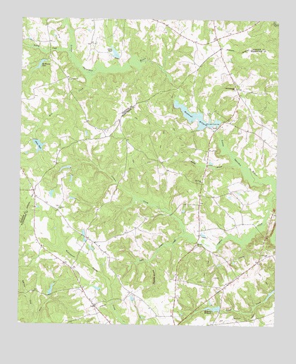
Warthen NE, GA USGS Topographic Map
Click on map above to begin viewing in our Map Viewer.

This topographic map contains these locations and features:
Feature Name Type Latitude Longitude GNIS ID View Map
Adams Pond NorthReservoirN33.1888°W82.8531°340801View Map
Adams Pond North DamDamN33.1885°W82.8499°340800View Map
Adams Pond SouthReservoirN33.1845°W82.8499°340803View Map
Adams Pond South DamDamN33.1851°W82.8499°340802View Map
Aiken PondReservoirN33.2360°W82.8295°354266View Map
Aiken Pond DamDamN33.2340°W82.8282°336426View Map
Burgamy CemeteryCemeteryN33.1751°W82.7871°348295View Map
Burgamy MillpondReservoirN33.1320°W82.7795°354910View Map
Burgamy Millpond DamDamN33.1313°W82.7765°336356View Map
Centralia School (historical)SchoolN33.1588°W82.8382°348297View Map
Cummings CemeteryCemeteryN33.1535°W82.7537°313217View Map
Eureka (historical)Populated PlaceN33.2049°W82.8332°348203View Map
Glenn PondReservoirN33.1981°W82.8663°314640View Map
Glenn Pond DamDamN33.2001°W82.8676°336424View Map
Hamburg Mill Pond DamDamN33.2065°W82.7790°336380View Map
Hamburg State ParkParkN33.2051°W82.7771°348327View Map
Hamburgh MillpondReservoirN33.2101°W82.7891°336381View Map
Lindsey (historical)Populated PlaceN33.1299°W82.8346°348344View Map
Little Cowpen CreekStreamN33.1618°W82.7937°317000View Map
McWhorter PondReservoirN33.2313°W82.8655°317978View Map
Meek BranchStreamN33.1832°W82.8285°348354View Map
Mill CreekStreamN33.2274°W82.8407°318202View Map
Mineral Springs CemeteryCemeteryN33.2213°W82.7710°348358View Map
Mineral Springs ChurchChurchN33.2218°W82.7707°318314View Map
Mount Hope Church (historical)ChurchN33.2279°W82.8551°348231View Map
New Hope ChurchChurchN33.1840°W82.7862°319407View Map
Patterson CreekStreamN33.1257°W82.8668°320277View Map
Pine Hill ChurchChurchN33.1576°W82.7879°320603View Map
Ralph Walker LakeReservoirN33.1388°W82.8591°336391View Map
Ralph Walker Lake DamDamN33.1385°W82.8599°336390View Map
Reynolds BranchStreamN33.1510°W82.8115°321537View Map
Rocky BranchStreamN33.2054°W82.7890°348385View Map
Saint James ChurchChurchN33.1726°W82.8557°322091View Map
Saint Pauls ChurchChurchN33.2249°W82.8507°322275View Map
Stabley BranchStreamN33.1918°W82.7693°323493View Map
Turkey CreekStreamN33.2365°W82.8515°324380View Map
Victor School (historical)SchoolN33.1707°W82.7879°348424View Map
Victorwick School (historical)SchoolN33.1532°W82.7749°348425View Map
Warthen DivisionCivilN33.1346°W82.7907°1936628View Map

Note: Coordinates in the location and feature list above are referenced to NAD83 datum.


Copyright (C) 2008-2025 Ryan Niemi / Sunset Dynamics ... All Rights Reserved