TopoQuest Logo
Do you find TopoQuest useful?
Help keep TopoQuest running and adding new maps/features by donating!
Bitcoin:  19c7KJd3qBynnjoSw5npx9KScwjBe4ifkT
Litecoin:  LXs6TkuXGGXo1vDsWCkWVdjQX94eUKd6ui
Home View Maps Find Maps Find Places Resources & Links


Dayton Hollow Dam, Minnesota Topographic Map

USGS Map Title: Dayton Hollow Dam, MN
USGS Map MRC: 46096B1
DRG (GeoTIFF) Download: o46096b1.tif


Neighboring USGS Topographic Map Quads:


  Carlisle, MN  
46096C2
 

  Fergus Falls, MN  
46096C1
 

  Wall Lake, MN  
46095C8
 

  Orwell Lake, MN  
46096B2
 

  Dayton Hollow Dam, MN  
46096B1
 

  Dalton, MN  
46095B8
 

  Stony Lake, MN  
46096A2
 

  Wendell, MN  
46096A1
 

  Fourmile Lake, MN  
46095A8


Map MRC Location:

N47°
W97°
N47°
W96°
H8 H7 H6 H5 H4 H3 H2 H1
G8 G7 G6 G5 G4 G3 G2 G1
F8 F7 F6 F5 F4 F3 F2 F1
E8 E7 E6 E5 E4 E3 E2 E1
D8 D7 D6 D5 D4 D3 D2 D1
C8 C7 C6 C5 C4 C3 C2 C1
B8 B7 B6 B5 B4 B3 B2 B1
A8 A7 A6 A5 A4 A3 A2 A1
N46°
W97°
N46°
W96°

Dayton Hollow Dam, MN USGS 1:24K Topographic Map Preview:
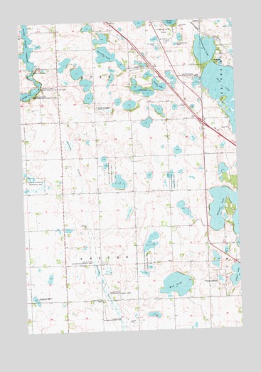
Dayton Hollow Dam, MN USGS Topographic Map
Click on map above to begin viewing in our Map Viewer.

This topographic map contains these locations and features:
Feature Name Type Latitude Longitude GNIS ID View Map
Aastad CemeteryCemeteryN46.1378°W96.0833°2072725View Map
Aastad ChurchChurchN46.1377°W96.0842°639182View Map
Aastad State Wildlife Management AreaParkN46.1463°W96.0814°639183View Map
Alkali LakeLakeN46.1466°W96.0029°639285View Map
Bethlehem Lutheran CemeteryCemeteryN46.2111°W96.0500°2072718View Map
Chautauqua LakeLakeN46.2379°W96.0170°641135View Map
Country Manor Mobile Home ParkPopulated PlaceN46.2417°W96.0389°2071815View Map
Dayton Hollow DamDamN46.2311°W96.1176°642666View Map
Dayton Hollow ReservoirReservoirN46.2474°W96.1222°642667View Map
Hi-view State Wildlife Management AreaParkN46.2269°W96.0345°644923View Map
Horseshoe LakeLakeN46.2365°W96.0754°645224View Map
Interchange 61CrossingN46.2083°W96.0192°2073155View Map
Iverson LakeLakeN46.2238°W96.0445°645549View Map
Knollwood CemeteryCemeteryN46.2405°W96.0434°646214View Map
Lake Iverson East Bound Rest AreaLocaleN46.2269°W96.0428°2073157View Map
Mineral LakeLakeN46.1784°W96.0049°647903View Map
Mud LakeLakeN46.1432°W96.0375°648279View Map
ParkdalePopulated PlaceN46.2333°W96.0128°654871View Map
Parkdale (historical)LocaleN46.2333°W96.0125°2072991View Map
Pebble Lake Golf CourseLocaleN46.2458°W96.0417°2071816View Map
Pebble Lake ParkParkN46.2480°W96.0412°649221View Map
School Number 118 (historical)SchoolN46.1722°W96.0403°2119805View Map
School Number 119 (historical)SchoolN46.1306°W96.1225°2119807View Map
School Number 157 (historical)SchoolN46.1664°W96.1028°2119804View Map
School Number 30 (historical)SchoolN46.2103°W96.1128°2119800View Map
School Number 31 (historical)SchoolN46.2197°W96.0542°2119799View Map
School Number 46 (historical)SchoolN46.2386°W96.0872°2119798View Map
School Number 64 (historical)SchoolN46.1303°W96.0600°2119806View Map
SquierPopulated PlaceN46.1375°W96.0817°654958View Map
Squier Post Office (historical)Post OfficeN46.1375°W96.0814°2072976View Map
Swan LakeLakeN46.2206°W96.0062°652901View Map
The Land of Ten Thousand Lakes Historical MarkerParkN46.2269°W96.0428°2073156View Map
Township of AastadCivilN46.1519°W96.0804°663375View Map
Township of BuseCivilN46.2341°W96.0829°663713View Map
United States Fish and Wildlife Service Fergus Falls Wetland Management DistrictBuildingN46.2385°W96.0411°2666538View Map
Valdine State Wildlife Management AreaParkN46.2327°W96.0534°653585View Map

Note: Coordinates in the location and feature list above are referenced to NAD83 datum.


Copyright (C) 2008-2025 Ryan Niemi / Sunset Dynamics ... All Rights Reserved