TopoQuest Logo
Do you find TopoQuest useful?
Help keep TopoQuest running and adding new maps/features by donating!
Bitcoin:  19c7KJd3qBynnjoSw5npx9KScwjBe4ifkT
Litecoin:  LXs6TkuXGGXo1vDsWCkWVdjQX94eUKd6ui
Home View Maps Find Maps Find Places Resources & Links


Tilden, Alabama Topographic Map

USGS Map Title: Tilden, AL
USGS Map MRC: 32087A2
DRG (GeoTIFF) Download: o32087a2.tif


Neighboring USGS Topographic Map Quads:


  Crumptonia, AL  
32087B3
 

  Tasso, AL  
32087B2
 

  Elm Bluff, AL  
32087B1
 

  Camden North, AL  
32087A3
 

  Tilden, AL  
32087A2
 

  Carlowville, AL  
32087A1
 

  Camden South, AL  
31087H3
 

  Rosebud, AL  
31087H2
 

  Oak Hill, AL  
31087H1


Map MRC Location:

N33°
W88°
N33°
W87°
H8 H7 H6 H5 H4 H3 H2 H1
G8 G7 G6 G5 G4 G3 G2 G1
F8 F7 F6 F5 F4 F3 F2 F1
E8 E7 E6 E5 E4 E3 E2 E1
D8 D7 D6 D5 D4 D3 D2 D1
C8 C7 C6 C5 C4 C3 C2 C1
B8 B7 B6 B5 B4 B3 B2 B1
A8 A7 A6 A5 A4 A3 A2 A1
N32°
W88°
N32°
W87°

Tilden, AL USGS 1:24K Topographic Map Preview:
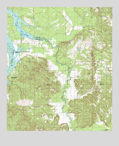
Tilden, AL USGS Topographic Map
Click on map above to begin viewing in our Map Viewer.

This topographic map contains these locations and features:
Feature Name Type Latitude Longitude GNIS ID View Map
Boykin CemeteryCemeteryN32.1054°W87.2242°114795View Map
Butler CemeteryCemeteryN32.0768°W87.1464°115309View Map
Campbell CemeteryCemeteryN32.0229°W87.2169°158385View Map
Choctaw County School LakeReservoirN32.0773°W87.2355°130112View Map
Choctaw County School Lake DamDamN32.0768°W87.2350°130113View Map
County Line ChurchChurchN32.0804°W87.1428°116726View Map
County Line Church Number 2ChurchN32.1110°W87.2133°116736View Map
Frank Cothran DamDamN32.0551°W87.1283°130092View Map
Frank Cothran LakeReservoirN32.0551°W87.1283°130091View Map
Hawthornes Store (historical)LocaleN32.0124°W87.1494°138482View Map
Hurricane BluffCliffN32.0829°W87.2417°138492View Map
Little Rock ChurchChurchN32.0418°W87.1339°158389View Map
Mount Calvary SchoolSchoolN32.0635°W87.1314°152402View Map
New Hope Church (historical)ChurchN32.1126°W87.2439°138535View Map
Oak Grove ChurchChurchN32.0193°W87.1300°152731View Map
Older Hill CemeteryCemeteryN32.0012°W87.2069°124273View Map
Proctor LandingLocaleN32.0599°W87.2489°138560View Map
Roland Cooper State ParkParkN32.0571°W87.2492°138567View Map
Rosemary Church (historical)ChurchN32.0554°W87.2378°138569View Map
Rosemary SchoolSchoolN32.0554°W87.2378°125947View Map
Saint John BarBarN32.0693°W87.2444°138572View Map
Saint Paul ChurchChurchN32.1060°W87.1489°153282View Map
Society Hill CemeteryCemeteryN32.0012°W87.2070°158396View Map
TildenPopulated PlaceN32.0660°W87.1430°127978View Map
Tilden SchoolSchoolN32.0929°W87.1480°127979View Map
Union ChurchChurchN32.0413°W87.2133°128289View Map
US Steel LakeReservoirN32.0785°W87.1633°163338View Map
US Steel Lake DamDamN32.0785°W87.1633°163339View Map

Note: Coordinates in the location and feature list above are referenced to NAD83 datum.


Copyright (C) 2008-2024 Ryan Niemi / Sunset Dynamics ... All Rights Reserved