TopoQuest Logo
Do you find TopoQuest useful?
Help keep TopoQuest running and adding new maps/features by donating!
Bitcoin:  19c7KJd3qBynnjoSw5npx9KScwjBe4ifkT
Litecoin:  LXs6TkuXGGXo1vDsWCkWVdjQX94eUKd6ui
Home View Maps Find Maps Find Places Resources & Links


Cass, West Virginia Topographic Map

USGS Map Title: Cass, WV
USGS Map MRC: 38079D8
DRG (GeoTIFF) Download: o38079d8.tif


Neighboring USGS Topographic Map Quads:


  Valley Head, WV  
38080E1
 

  Snyder Knob, WV  
38079E8
 

  Durbin, WV  
38079E7
 

  Mingo, WV  
38080D1
 

  Cass, WV  
38079D8
 

  Green Bank, WV  
38079D7
 

  Edray, WV  
38080C1
 

  Clover Lick, WV  
38079C8
 

  Paddy Knob, WV  
38079C7


Map MRC Location:

N39°
W80°
N39°
W79°
H8 H7 H6 H5 H4 H3 H2 H1
G8 G7 G6 G5 G4 G3 G2 G1
F8 F7 F6 F5 F4 F3 F2 F1
E8 E7 E6 E5 E4 E3 E2 E1
D8 D7 D6 D5 D4 D3 D2 D1
C8 C7 C6 C5 C4 C3 C2 C1
B8 B7 B6 B5 B4 B3 B2 B1
A8 A7 A6 A5 A4 A3 A2 A1
N38°
W80°
N38°
W79°

Cass, WV USGS 1:24K Topographic Map Preview:
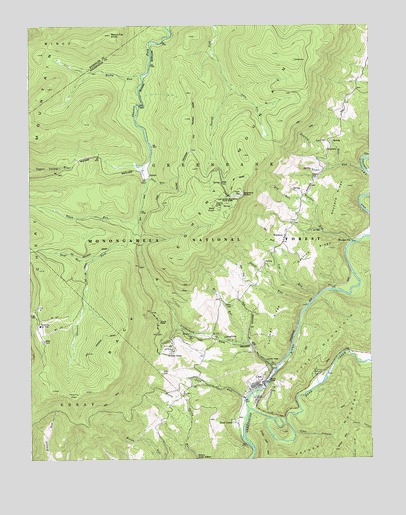
Cass, WV USGS Topographic Map
Click on map above to begin viewing in our Map Viewer.

This topographic map contains these locations and features:
Feature Name Type Latitude Longitude GNIS ID View Map
Arlie Righter SpringSpringN38.4237°W79.9323°1558057View Map
Back Allegheny MountainRidgeN38.4898°W79.9017°1550130View Map
Bald KnobSummitN38.4479°W79.9312°1553787View Map
Bald Knob Lookout TowerTowerN38.4482°W79.9312°1727996View Map
Beech Flat KnobSummitN38.4973°W79.9698°1550245View Map
Black RunStreamN38.4423°W79.9609°1557371View Map
CassPopulated PlaceN38.3968°W79.9148°1554083View Map
Cass Census Designated PlaceCensusN38.3963°W79.9191°2586778View Map
Cass Historical DistrictParkN38.3968°W79.9162°1728025View Map
Cass Historical MuseumBuildingN38.3973°W79.9148°2727831View Map
Cass Scenic Railroad State ParkParkN38.4487°W79.9273°1550645View Map
Cass School (historical)SchoolN38.3954°W79.9195°1728027View Map
Cass Volunteer Fire and RescueBuildingN38.3935°W79.9214°2577743View Map
Clay HollowValleyN38.3826°W79.9028°1550717View Map
Cold RunStreamN38.3918°W79.9212°1550759View Map
Cold Run School (historical)SchoolN38.3985°W79.9401°1728032View Map
Cup RunStreamN38.4215°W79.8948°1550863View Map
Deer CreekPopulated PlaceN38.3865°W79.9251°1550898View Map
Deer CreekStreamN38.3896°W79.9201°1550900View Map
Deever RunStreamN38.4193°W79.8978°1550904View Map
Dry RunStreamN38.4485°W79.8951°1550976View Map
Duysard RidgeRidgeN38.4496°W79.8851°1550999View Map
Galfred RidgeRidgeN38.4340°W79.8948°1551196View Map
Hilltop CemeteryCemeteryN38.4193°W79.9256°1551450View Map
Leatherbark RunStreamN38.4004°W79.9098°1551759View Map
McLaughlin Church (historical)ChurchN38.3973°W79.9406°1728109View Map
Mill RunStreamN38.4079°W79.9214°1552117View Map
NidaPopulated PlaceN38.4621°W79.8767°1555224View Map
Oats RunStreamN38.4548°W79.9573°1552365View Map
Odey RunStreamN38.4815°W79.9253°1552368View Map
Oliver School (historical)SchoolN38.4210°W79.9231°1728134View Map
Peters MountainSummitN38.3887°W79.8878°1555331View Map
Peters Mountain TrailTrailN38.3768°W79.8889°1552462View Map
Roaring Springs RunStreamN38.4596°W79.8859°1552691View Map
Rocky RunStreamN38.4857°W79.9587°1552720View Map
Shavers Fork Fire Department and RescueBuildingN38.4348°W79.9975°2577799View Map
Shavers Lake DamDamN38.4418°W79.9665°1559225View Map
Slide RunStreamN38.4329°W79.9765°1552931View Map
Snowshoe Mountain Response TeamBuildingN38.4351°W79.9961°2581212View Map
Snowshoe Ski AreaLocaleN38.4140°W79.9967°1557891View Map
SprucePopulated PlaceN38.4568°W79.9559°1555697View Map
Spruce School (historical)SchoolN38.4571°W79.9567°1728164View Map
Tallman RidgeRidgeN38.4143°W79.9092°1553172View Map
Thorny FlatFlatN38.3937°W79.9840°1553226View Map
Trout RunStreamN38.4585°W79.8770°1553268View Map
Trout Run SpringsSpringN38.4585°W79.8914°1558165View Map
WanlessPopulated PlaceN38.4373°W79.9070°1553371View Map
Wanless CemeteryCemeteryN38.4434°W79.9017°1728187View Map
Wanless Elementary School (historical)SchoolN38.4401°W79.9053°1728188View Map
Wanless RunStreamN38.4371°W79.8814°1553372View Map
Wanless StationLocaleN38.4376°W79.8814°1553373View Map
Wanless United Methodist ChurchChurchN38.4382°W79.9067°1728190View Map
Whitaker StationLocaleN38.4057°W79.9484°1553419View Map

Note: Coordinates in the location and feature list above are referenced to NAD83 datum.


Copyright (C) 2008-2024 Ryan Niemi / Sunset Dynamics ... All Rights Reserved