TopoQuest Logo
Do you find TopoQuest useful?
Help keep TopoQuest running and adding new maps/features by donating!
Bitcoin:  19c7KJd3qBynnjoSw5npx9KScwjBe4ifkT
Litecoin:  LXs6TkuXGGXo1vDsWCkWVdjQX94eUKd6ui
Home View Maps Find Maps Find Places Resources & Links


Elk City, Oregon Topographic Map

USGS Map Title: Elk City, OR
USGS Map MRC: 44123E7
DRG (GeoTIFF) Download: o44123e7.tif


Neighboring USGS Topographic Map Quads:


  Toledo North, OR  
44123F8
 

  Eddyville, OR  
44123F7
 

  Nortons, OR  
44123F6
 

  Toledo South, OR  
44123E8
 

  Elk City, OR  
44123E7
 

  Harlan, OR  
44123E6
 

  Tidewater, OR  
44123D8
 

  Hellion Rapids, OR  
44123D7
 

  Grass Mountain, OR  
44123D6


Map MRC Location:

N45°
W124°
N45°
W123°
H8 H7 H6 H5 H4 H3 H2 H1
G8 G7 G6 G5 G4 G3 G2 G1
F8 F7 F6 F5 F4 F3 F2 F1
E8 E7 E6 E5 E4 E3 E2 E1
D8 D7 D6 D5 D4 D3 D2 D1
C8 C7 C6 C5 C4 C3 C2 C1
B8 B7 B6 B5 B4 B3 B2 B1
A8 A7 A6 A5 A4 A3 A2 A1
N44°
W124°
N44°
W123°

Elk City, OR USGS 1:24K Topographic Map Preview:
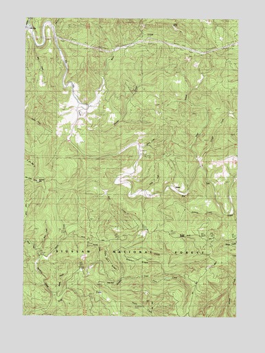
Elk City, OR USGS Topographic Map
Click on map above to begin viewing in our Map Viewer.

This topographic map contains these locations and features:
Feature Name Type Latitude Longitude GNIS ID View Map
Baber ButteSummitN44.6223°W123.7898°1135658View Map
Baber LookoutLocaleN44.6218°W123.7898°1137370View Map
Bear CreekStreamN44.5879°W123.8398°1137661View Map
Beaver CreekStreamN44.5862°W123.8440°1137806View Map
Big Elk CreekStreamN44.6215°W123.8748°1141754View Map
Blair CreekStreamN44.6140°W123.8709°1153589View Map
Bull CreekStreamN44.5557°W123.8237°1138897View Map
Bull Run TrailTrailN44.5115°W123.7757°1138923View Map
Bush CreekStreamN44.5285°W123.8665°1159289View Map
Camp CreekStreamN44.5526°W123.8057°1135515View Map
Cape HornCliffN44.5143°W123.8221°1135517View Map
Cape Horn CreekStreamN44.5160°W123.8179°1139348View Map
Cape Horn RidgeRidgeN44.5248°W123.8262°1135518View Map
Cougar CreekStreamN44.5654°W123.7743°1159353View Map
Deer CreekStreamN44.5629°W123.7737°1158201View Map
Devils Well CreekStreamN44.6223°W123.8629°1140977View Map
Elk City County ParkParkN44.6212°W123.8748°1153590View Map
Errol RidgeRidgeN44.5498°W123.8496°1153592View Map
Flynn CreekStreamN44.5243°W123.8671°1142280View Map
Flynn Creek Research AreaParkN44.5457°W123.8582°1167200View Map
Glen (historical)Populated PlaceN44.5165°W123.8179°1153591View Map
Glen Post Office (historical)Post OfficeN44.5165°W123.8179°1165311View Map
Glenwood CemeteryCemeteryN44.5181°W123.8400°1153594View Map
Gopher CreekStreamN44.5185°W123.8451°1142860View Map
Gopher RidgeRidgeN44.5240°W123.8082°1135516View Map
Harve CreekStreamN44.5707°W123.8098°1143341View Map
Horse CreekStreamN44.5246°W123.8676°1143753View Map
Jackass CreekStreamN44.5435°W123.7587°1135519View Map
Meadow CreekStreamN44.5087°W123.8590°1146050View Map
Needle BranchStreamN44.5057°W123.8554°1153588View Map
Nettle CreekStreamN44.5054°W123.8221°1146795View Map
Palmer MountainSummitN44.5562°W123.8679°1153593View Map
Randall SaddleGapN44.5340°W123.7815°1125803View Map
SaladoLocaleN44.5535°W123.7868°1148953View Map
Salado Post Office (historical)Post OfficeN44.5535°W123.7868°1165908View Map
Traxtel CreekStreamN44.5226°W123.8332°1151408View Map

Note: Coordinates in the location and feature list above are referenced to NAD83 datum.


Copyright (C) 2008-2025 Ryan Niemi / Sunset Dynamics ... All Rights Reserved