TopoQuest Logo
Do you find TopoQuest useful?
Help keep TopoQuest running and adding new maps/features by donating!
Bitcoin:  19c7KJd3qBynnjoSw5npx9KScwjBe4ifkT
Litecoin:  LXs6TkuXGGXo1vDsWCkWVdjQX94eUKd6ui
Home View Maps Find Maps Find Places Resources & Links


Harlan, Oregon Topographic Map

USGS Map Title: Harlan, OR
USGS Map MRC: 44123E6
DRG (GeoTIFF) Download: o44123e6.tif


Neighboring USGS Topographic Map Quads:


  Eddyville, OR  
44123F7
 

  Nortons, OR  
44123F6
 

  Summit, OR  
44123F5
 

  Elk City, OR  
44123E7
 

  Harlan, OR  
44123E6
 

  Marys Peak, OR  
44123E5
 

  Hellion Rapids, OR  
44123D7
 

  Grass Mountain, OR  
44123D6
 

  Alsea, OR  
44123D5


Map MRC Location:

N45°
W124°
N45°
W123°
H8 H7 H6 H5 H4 H3 H2 H1
G8 G7 G6 G5 G4 G3 G2 G1
F8 F7 F6 F5 F4 F3 F2 F1
E8 E7 E6 E5 E4 E3 E2 E1
D8 D7 D6 D5 D4 D3 D2 D1
C8 C7 C6 C5 C4 C3 C2 C1
B8 B7 B6 B5 B4 B3 B2 B1
A8 A7 A6 A5 A4 A3 A2 A1
N44°
W124°
N44°
W123°

Harlan, OR USGS 1:24K Topographic Map Preview:
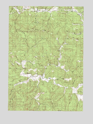
Harlan, OR USGS Topographic Map
Click on map above to begin viewing in our Map Viewer.

This topographic map contains these locations and features:
Feature Name Type Latitude Longitude GNIS ID View Map
Adams CreekStreamN44.5204°W123.6371°1137015View Map
Austin CreekStreamN44.6193°W123.6909°1134465View Map
Baker CreekStreamN44.5207°W123.6376°1134477View Map
BaldySummitN44.5646°W123.7037°1134466View Map
Barber Post Office (historical)Post OfficeN44.5562°W123.7276°1164880View Map
Beaver CreekStreamN44.5965°W123.6254°1134464View Map
Beaverdam CreekStreamN44.5129°W123.6304°1130894View Map
Bevens CreekStreamN44.5568°W123.7382°1134467View Map
Big Elk CampgroundLocaleN44.5440°W123.7232°1159340View Map
Big Elk Guard StationBuildingN44.5440°W123.7206°1117619View Map
Big Elk ValleyValleyN44.5401°W123.7090°1134469View Map
Bradish LakeLakeN44.6082°W123.7054°1130888View Map
Branch CreekStreamN44.5304°W123.7396°1135514View Map
Chapel of the ValleyChurchN44.5392°W123.6803°1134470View Map
Chinquapin PointCapeN44.5385°W123.6565°1118921View Map
Chinquapin RidgeRidgeN44.5410°W123.6304°1134473View Map
Cline CreekStreamN44.6176°W123.6829°1134475View Map
Cline HillSummitN44.6123°W123.6546°1136944View Map
Cline Hill SummitGapN44.6198°W123.6443°1163929View Map
Cougar CreekStreamN44.5207°W123.6429°1130893View Map
Coyote CreekStreamN44.5365°W123.6762°1130892View Map
Crawford CanyonValleyN44.5296°W123.6421°1134474View Map
Eddyville DivisionCivilN44.5784°W123.7228°1938008View Map
Ellmaker CreekStreamN44.6154°W123.6304°1134462View Map
Ellmaker State WaysideParkN44.6146°W123.6318°1130882View Map
Feagles CreekStreamN44.5410°W123.6971°1142054View Map
Goat RidgeRidgeN44.5851°W123.6359°1134463View Map
Grant CreekStreamN44.5396°W123.7134°1142943View Map
Grant RidgeRidgeN44.5010°W123.7187°1155944View Map
HarlanPopulated PlaceN44.5398°W123.6932°1121601View Map
Harlan CemeteryCemeteryN44.5389°W123.6868°1130895View Map
Harlan Post Office (historical)Post OfficeN44.5398°W123.6932°1165371View Map
Johnson CreekStreamN44.5532°W123.6682°1144343View Map
Lake CreekStreamN44.5557°W123.6837°1122891View Map
Leverage CreekStreamN44.5490°W123.6387°1134472View Map
Little CreekStreamN44.5523°W123.6896°1134468View Map
Little Wolf CreekStreamN44.5582°W123.7218°1130891View Map
Miller CreekStreamN44.6185°W123.7004°1130887View Map
Oglesby CreekStreamN44.6212°W123.7251°1124941View Map
Perry CreekStreamN44.6221°W123.7401°1130885View Map
Peterson CreekStreamN44.5482°W123.6498°1130890View Map
Rail CreekStreamN44.5276°W123.6559°1134478View Map
Salmon CreekStreamN44.6160°W123.7346°1126510View Map
Savage CreekStreamN44.5246°W123.7407°1149087View Map
Spout CreekStreamN44.5393°W123.6951°1127402View Map
Strom Boulder RidgeRidgeN44.5962°W123.6984°1134476View Map
Sugarbowl CreekStreamN44.5254°W123.6415°1150546View Map
Taylor RidgeRidgeN44.5601°W123.6293°1134471View Map
Wakefield CreekStreamN44.6187°W123.7040°1128579View Map
West Fork Feagles CreekStreamN44.5148°W123.7048°1134750View Map
Whiskey CreekStreamN44.6221°W123.7429°1130886View Map
Wolf CreekStreamN44.5565°W123.7298°1129270View Map

Note: Coordinates in the location and feature list above are referenced to NAD83 datum.


Copyright (C) 2008-2025 Ryan Niemi / Sunset Dynamics ... All Rights Reserved