TopoQuest Logo
Do you find TopoQuest useful?
Help keep TopoQuest running and adding new maps/features by donating!
Bitcoin:  19c7KJd3qBynnjoSw5npx9KScwjBe4ifkT
Litecoin:  LXs6TkuXGGXo1vDsWCkWVdjQX94eUKd6ui
Home View Maps Find Maps Find Places Resources & Links


Evansville, Minnesota Topographic Map

USGS Map Title: Evansville, MN
USGS Map MRC: 46095A6
DRG (GeoTIFF) Download: o46095a6.tif


Neighboring USGS Topographic Map Quads:


  Stalker Lake, MN  
46095B7
 

  Eagle Lake, MN  
46095B6
 

  Inspiration Peak, MN  
46095B5
 

  Ashby, MN  
46095A7
 

  Evansville, MN  
46095A6
 

  Millerville, MN  
46095A5
 

  Erdahl, MN  
45095H7
 

  Quam Lake, MN  
45095H6
 

  Brandon, MN  
45095H5


Map MRC Location:

N47°
W96°
N47°
W95°
H8 H7 H6 H5 H4 H3 H2 H1
G8 G7 G6 G5 G4 G3 G2 G1
F8 F7 F6 F5 F4 F3 F2 F1
E8 E7 E6 E5 E4 E3 E2 E1
D8 D7 D6 D5 D4 D3 D2 D1
C8 C7 C6 C5 C4 C3 C2 C1
B8 B7 B6 B5 B4 B3 B2 B1
A8 A7 A6 A5 A4 A3 A2 A1
N46°
W96°
N46°
W95°

Evansville, MN USGS 1:24K Topographic Map Preview:
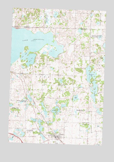
Evansville, MN USGS Topographic Map
Click on map above to begin viewing in our Map Viewer.

This topographic map contains these locations and features:
Feature Name Type Latitude Longitude GNIS ID View Map
Balgaard State Wildlife Management AreaParkN46.0302°W95.6623°639598View Map
Christina Lake CemeteryCemeteryN46.0635°W95.7063°2069674View Map
Christina Lake ChurchChurchN46.0638°W95.7064°641196View Map
Chuck West Memorial HeliportAirportN46.0100°W95.6814°660144View Map
City of EvansvilleCivilN46.0062°W95.6868°2394711View Map
Covenant ChurchChurchN46.0075°W95.6819°2069703View Map
Crestview Manor Health CareHospitalN46.0078°W95.6964°2069701View Map
Douglas County Waterfowl Production AreaParkN46.0224°W95.7384°2765273View Map
Eagle Lake State Wildlife Management AreaParkN46.1158°W95.7028°643034View Map
Elmer Airport (historical)AirportN46.0052°W95.6923°660145View Map
EvansvillePopulated PlaceN46.0041°W95.6828°643446View Map
Evansville (historical)LocaleN46.0075°W95.6861°2069699View Map
Evansville Fire DepartmentBuildingN46.0071°W95.6867°2666578View Map
Evansville Post OfficePost OfficeN46.0069°W95.6833°2069700View Map
Faith Lutheran ChurchChurchN46.0081°W95.6939°2069702View Map
Horseshoe LakeLakeN46.0281°W95.6891°645220View Map
Lake AnkaLakeN46.0809°W95.7320°639375View Map
Lake ChristinaLakeN46.0905°W95.7364°641197View Map
Lake InaLakeN46.0776°W95.7235°645394View Map
Lake SinaLakeN46.0434°W95.6623°652080View Map
Mahla LakesLakeN46.0072°W95.7392°647384View Map
MelbyPopulated PlaceN46.0638°W95.7359°647747View Map
Melby (historical)LocaleN46.0644°W95.7417°2069740View Map
Melby Post Office (historical)Post OfficeN46.0639°W95.7356°2069741View Map
Mound Grove Memorial ParkCemeteryN46.0019°W95.6880°2069673View Map
Stockhaven LakeLakeN46.0507°W95.6380°652646View Map
Stockhousen LakeLakeN46.0655°W95.6438°652648View Map
Thornberg State Wildlife Management AreaParkN46.0380°W95.7273°653174View Map
Township of LundCivilN46.0639°W95.7074°664837View Map

Note: Coordinates in the location and feature list above are referenced to NAD83 datum.


Copyright (C) 2008-2025 Ryan Niemi / Sunset Dynamics ... All Rights Reserved