TopoQuest Logo
Do you find TopoQuest useful?
Help keep TopoQuest running and adding new maps/features by donating!
Bitcoin:  19c7KJd3qBynnjoSw5npx9KScwjBe4ifkT
Litecoin:  LXs6TkuXGGXo1vDsWCkWVdjQX94eUKd6ui
Home View Maps Find Maps Find Places Resources & Links


Cascade, Missouri Topographic Map

USGS Map Title: Cascade, MO
USGS Map MRC: 37090C3
DRG (GeoTIFF) Download: o37090c3.tif


Neighboring USGS Topographic Map Quads:


  Rock Pile Mountain, MO  
37090D4
 

  Cherokee Pass, MO  
37090D3
 

  Marquand, MO  
37090D2
 

  Coldwater, MO  
37090C4
 

  Cascade, MO  
37090C3
 

  Allbright, MO  
37090C2
 

  Greenville, MO  
37090B4
 

  Lowndes, MO  
37090B3
 

  Gipsy, MO  
37090B2


Map MRC Location:

N38°
W91°
N38°
W90°
H8 H7 H6 H5 H4 H3 H2 H1
G8 G7 G6 G5 G4 G3 G2 G1
F8 F7 F6 F5 F4 F3 F2 F1
E8 E7 E6 E5 E4 E3 E2 E1
D8 D7 D6 D5 D4 D3 D2 D1
C8 C7 C6 C5 C4 C3 C2 C1
B8 B7 B6 B5 B4 B3 B2 B1
A8 A7 A6 A5 A4 A3 A2 A1
N37°
W91°
N37°
W90°

Cascade, MO USGS 1:24K Topographic Map Preview:
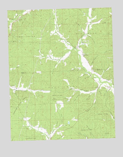
Cascade, MO USGS Topographic Map
Click on map above to begin viewing in our Map Viewer.

This topographic map contains these locations and features:
Feature Name Type Latitude Longitude GNIS ID View Map
Barrett CemeteryCemeteryN37.3375°W90.2929°743044View Map
Big Creek ChurchChurchN37.3420°W90.2876°743046View Map
Buck HollowValleyN37.2967°W90.2884°738458View Map
BuckhornPopulated PlaceN37.3381°W90.2896°714979View Map
Buckhorn ChurchChurchN37.3312°W90.2859°743048View Map
BurchPopulated PlaceN37.2684°W90.3546°740709View Map
Burr HollowValleyN37.3109°W90.2776°738463View Map
Cab Barrett HollowValleyN37.3495°W90.2834°738470View Map
Camp Number 31LocaleN37.2617°W90.3012°730463View Map
CascadePopulated PlaceN37.2995°W90.2693°715465View Map
Cascade Lookout TowerTowerN37.2892°W90.3237°743042View Map
Cascade Volunteer Fire DepartmentBuildingN37.2988°W90.2690°2621021View Map
Dixon-Sutton CemeteryCemeteryN37.3031°W90.3746°743041View Map
Doll Lake DamDamN37.3417°W90.2868°764451View Map
Dorris CemeteryCemeteryN37.3167°W90.2748°743050View Map
Dry Fork HollowStreamN37.3259°W90.3146°735964View Map
Dunaway HollowValleyN37.2956°W90.2954°738457View Map
East Fork Big CreekStreamN37.3345°W90.2907°749771View Map
Fairmont School (historical)SchoolN37.3742°W90.3454°736295View Map
Gimlet CreekStreamN37.3462°W90.2501°718465View Map
Gimlet MountainSummitN37.3606°W90.2559°738469View Map
Graham CemeteryCemeteryN37.3484°W90.2804°743047View Map
Graham HollowValleyN37.2512°W90.3301°738454View Map
GraphiteLocaleN37.2678°W90.2948°740097View Map
GraveltonPopulated PlaceN37.2984°W90.2540°718747View Map
Gravelton HollowValleyN37.3023°W90.2526°738462View Map
Graveyard HollowValleyN37.3501°W90.2812°738471View Map
Hammack HillSummitN37.3451°W90.3712°738473View Map
Hope HollowValleyN37.2937°W90.2773°738459View Map
Huffman-McKelvey CemeteryCemeteryN37.3306°W90.2857°743049View Map
Jett HollowValleyN37.2970°W90.2693°738461View Map
Joe HollowValleyN37.3567°W90.3162°738468View Map
Johnson HollowValleyN37.3062°W90.2671°738465View Map
Lewis HollowValleyN37.2989°W90.3701°738456View Map
Little CreekStreamN37.3033°W90.2625°721198View Map
McKelvey DamReservoirN37.3409°W90.2855°764452View Map
Middle Fork Big CreekStreamN37.3348°W90.2907°751032View Map
Mount Hope ChurchChurchN37.2570°W90.3312°743039View Map
Mount Hope School (historical)SchoolN37.2551°W90.3293°722768View Map
Oakdale Church (historical)ChurchN37.2976°W90.2907°723658View Map
Old Mount Pisgah CemeteryCemeteryN37.3648°W90.3643°743045View Map
Panther HollowValleyN37.3714°W90.3623°753514View Map
Porter HollowValleyN37.2626°W90.3140°738455View Map
Puch HollowValleyN37.3134°W90.2809°738464View Map
Saline HollowValleyN37.3678°W90.2787°753515View Map
Sugar HollowValleyN37.3128°W90.2793°738472View Map
Thirtythree HollowValleyN37.2934°W90.2729°738460View Map
TwelvemilePopulated PlaceN37.3662°W90.3632°715829View Map
West Fork Big CreekStreamN37.3356°W90.2971°728555View Map
White CemeteryCemeteryN37.3003°W90.3657°743040View Map
White Patch HollowValleyN37.3720°W90.2779°738467View Map
Wildcat CreekStreamN37.3176°W90.2846°738466View Map
Williams Lake Section 20ReservoirN37.2634°W90.3101°763758View Map
Williams Lake Section 20 DamDamN37.2634°W90.3101°763757View Map
Zion ChurchChurchN37.3062°W90.2576°743043View Map

Note: Coordinates in the location and feature list above are referenced to NAD83 datum.


Copyright (C) 2008-2025 Ryan Niemi / Sunset Dynamics ... All Rights Reserved