TopoQuest Logo
Do you find TopoQuest useful?
Help keep TopoQuest running and adding new maps/features by donating!
Bitcoin:  19c7KJd3qBynnjoSw5npx9KScwjBe4ifkT
Litecoin:  LXs6TkuXGGXo1vDsWCkWVdjQX94eUKd6ui
Home View Maps Find Maps Find Places Resources & Links


Chapel Mountain, Arizona Topographic Map

USGS Map Title: Chapel Mountain, AZ
USGS Map MRC: 35111E7
DRG (GeoTIFF) Download: o35111e7.tif


Neighboring USGS Topographic Map Quads:


  Dog Knobs, AZ  
35111F8
 

  Lockwood Canyon, AZ  
35111F7
 

  Additional Hill, AZ  
35111F6
 

  Ebert Mountain, AZ  
35111E8
 

  Chapel Mountain, AZ  
35111E7
 

  S P Mountain, AZ  
35111E6
 

  Moritz Ridge, AZ  
35111D8
 

  Kendrick Peak, AZ  
35111D7
 

  White Horse Hills, AZ  
35111D6


Map MRC Location:

N36°
W112°
N36°
W111°
H8 H7 H6 H5 H4 H3 H2 H1
G8 G7 G6 G5 G4 G3 G2 G1
F8 F7 F6 F5 F4 F3 F2 F1
E8 E7 E6 E5 E4 E3 E2 E1
D8 D7 D6 D5 D4 D3 D2 D1
C8 C7 C6 C5 C4 C3 C2 C1
B8 B7 B6 B5 B4 B3 B2 B1
A8 A7 A6 A5 A4 A3 A2 A1
N35°
W112°
N35°
W111°

Chapel Mountain, AZ USGS 1:24K Topographic Map Preview:
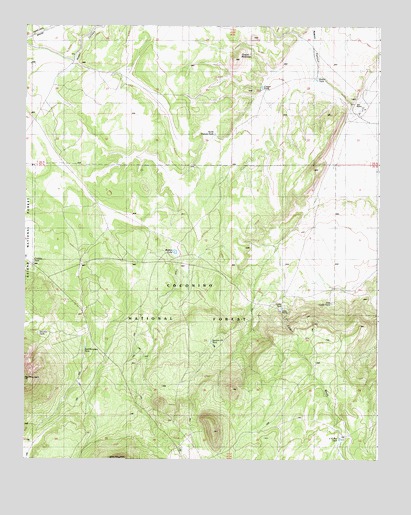
Chapel Mountain, AZ USGS Topographic Map
Click on map above to begin viewing in our Map Viewer.

This topographic map contains these locations and features:
Feature Name Type Latitude Longitude GNIS ID View Map
Babbitt LakeLakeN35.5599°W111.8221°25864View Map
Basin WellWellN35.5283°W111.7632°2088806View Map
Cadillac TankReservoirN35.5583°W111.8729°37692View Map
Cedar RanchLocaleN35.5428°W111.7849°27431View Map
Cedar TankReservoirN35.5437°W111.7844°20708View Map
Cedar Tank (historical)ReservoirN35.5439°W111.7674°20707View Map
Chapel MountainSummitN35.6150°W111.8013°27503View Map
Chapel TankReservoirN35.6074°W111.7917°27504View Map
Cinder TankReservoirN35.5222°W111.8196°2088807View Map
CO Bar TankReservoirN35.5060°W111.7632°27142View Map
Driftwood TankReservoirN35.6214°W111.8324°2088808View Map
East Cedar TankReservoirN35.5452°W111.7668°28742View Map
Limestone Number Two WellWellN35.5831°W111.8010°2088804View Map
Limestone WellWellN35.5694°W111.7860°2088805View Map
North Pasture TankReservoirN35.5937°W111.8084°32387View Map
Porkchop TankReservoirN35.5338°W111.8093°38064View Map
Rabbit TankReservoirN35.6095°W111.7724°33307View Map
Red Mountain TankReservoirN35.5322°W111.8537°33490View Map
Slate WellWellN35.6025°W111.8529°2088809View Map
Stevens TankReservoirN35.5365°W111.8704°41905View Map
Tub RanchLocaleN35.6025°W111.7540°35487View Map

Note: Coordinates in the location and feature list above are referenced to NAD83 datum.


Copyright (C) 2008-2025 Ryan Niemi / Sunset Dynamics ... All Rights Reserved