TopoQuest Logo
Do you find TopoQuest useful?
Help keep TopoQuest running and adding new maps/features by donating!
Bitcoin:  19c7KJd3qBynnjoSw5npx9KScwjBe4ifkT
Litecoin:  LXs6TkuXGGXo1vDsWCkWVdjQX94eUKd6ui
Home View Maps Find Maps Find Places Resources & Links


Cherryville, North Carolina Topographic Map

USGS Map Title: Cherryville, NC
USGS Map MRC: 35081D4
DRG (GeoTIFF) Download: o35081d4.tif


Neighboring USGS Topographic Map Quads:


  Casar, NC  
35081E5
 

  Banoak, NC  
35081E4
 

  Reepsville, NC  
35081E3
 

  Lawndale, NC  
35081D5
 

  Cherryville, NC  
35081D4
 

  Lincolnton West, NC  
35081D3
 

  Shelby, NC  
35081C5
 

  Waco, NC  
35081C4
 

  Bessemer City, NC  
35081C3


Map MRC Location:

N36°
W82°
N36°
W81°
H8 H7 H6 H5 H4 H3 H2 H1
G8 G7 G6 G5 G4 G3 G2 G1
F8 F7 F6 F5 F4 F3 F2 F1
E8 E7 E6 E5 E4 E3 E2 E1
D8 D7 D6 D5 D4 D3 D2 D1
C8 C7 C6 C5 C4 C3 C2 C1
B8 B7 B6 B5 B4 B3 B2 B1
A8 A7 A6 A5 A4 A3 A2 A1
N35°
W82°
N35°
W81°

Cherryville, NC USGS 1:24K Topographic Map Preview:
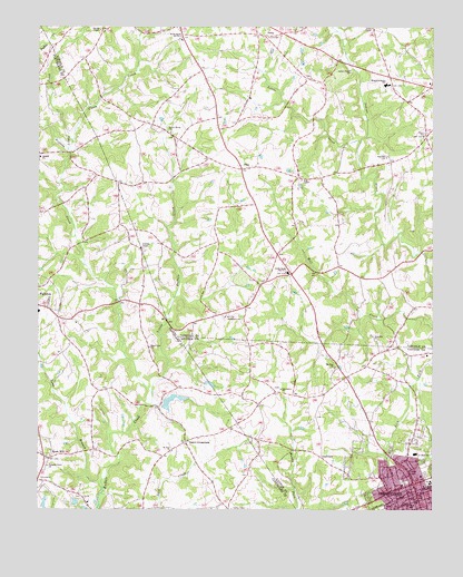
Cherryville, NC USGS Topographic Map
Click on map above to begin viewing in our Map Viewer.

This topographic map contains these locations and features:
Feature Name Type Latitude Longitude GNIS ID View Map
Baker CrossroadsPopulated PlaceN35.3926°W81.4526°980447View Map
Bakers Bridge (historical)BridgeN35.4007°W81.4673°1802788View Map
Beam Dairy FarmLocaleN35.4261°W81.3811°2680749View Map
Beam MillPopulated PlaceN35.3901°W81.4970°980683View Map
Beams Mill (historical)LocaleN35.3990°W81.4798°1001523View Map
Bess ChapelChurchN35.4607°W81.4165°981052View Map
Bethlehem ChurchChurchN35.4251°W81.4406°1000731View Map
Bingham Bridge (historical)Populated PlaceN35.4435°W81.4868°1001708View Map
Cedar LakeReservoirN35.4018°W81.4515°998934View Map
Cedar Lake DamDamN35.4018°W81.4515°998935View Map
CherryvillePopulated PlaceN35.3787°W81.3790°1019622View Map
Cherryville City ParkParkN35.3854°W81.3779°1001612View Map
Cherryville Fire DepartmentBuildingN35.3839°W81.3758°2638594View Map
Cherryville Junior Senior High SchoolSchoolN35.3896°W81.3801°1001613View Map
Cherryville Post OfficePost OfficeN35.3794°W81.3815°2773957View Map
Cherryville Rescue SquadBuildingN35.3775°W81.3799°2720364View Map
City of CherryvilleCivilN35.3844°W81.3782°2404040View Map
DellviewPopulated PlaceN35.3887°W81.4098°1019946View Map
Dixon Ford (historical)LocaleN35.4674°W81.4906°1001538View Map
DoraPopulated PlaceN35.4979°W81.4287°1020004View Map
Double Chimney School (historical)SchoolN35.4279°W81.4348°1001627View Map
Elliott Bridge (historical)LocaleN35.3896°W81.4851°1001544View Map
Fairview ChurchChurchN35.4662°W81.3895°984916View Map
Fallston Elementary SchoolSchoolN35.4262°W81.4995°1001548View Map
FlayPopulated PlaceN35.4632°W81.4359°985203View Map
Friendly ChapelChurchN35.4429°W81.4673°985413View Map
Glenn CreekStreamN35.4707°W81.4890°985732View Map
Half Halt FarmsLocaleN35.4050°W81.4061°2680741View Map
Hidden ValleyPopulated PlaceN35.3949°W81.3768°1005555View Map
Hughs Pond Volunteer Fire DepartmentBuildingN35.4108°W81.3998°2638306View Map
Indian Creek ChurchChurchN35.4890°W81.4012°987356View Map
Kadesh ChurchChurchN35.4662°W81.4993°987864View Map
Laughing Crow AirparkAirportN35.4517°W81.4591°2770354View Map
Little Buffalo CreekStreamN35.4054°W81.4637°988557View Map
Little CreekStreamN35.4704°W81.3979°988588View Map
Little CreekStreamN35.4685°W81.4904°988602View Map
Long BranchStreamN35.3821°W81.4795°988904View Map
Mount Zion ChurchChurchN35.4118°W81.4056°990644View Map
North Brook (historical)Populated PlaceN35.4804°W81.4804°1001788View Map
North Brook ChurchChurchN35.4726°W81.4581°991198View Map
North Brook Elementary SchoolSchoolN35.4968°W81.4548°1024843View Map
North Brook School Number 1SchoolN35.4365°W81.4206°1023677View Map
North Brook Volunteer Fire DepartmentBuildingN35.4973°W81.4556°2639097View Map
Oak Grove ChurchChurchN35.4065°W81.4229°991372View Map
OrleansPopulated PlaceN35.4699°W81.4026°1001674View Map
Panhandle School (historical)SchoolN35.4032°W81.4215°1001676View Map
Pine Grove Golf ClubLocaleN35.3776°W81.4854°1001577View Map
Plain View ChurchChurchN35.4171°W81.4645°992439View Map
Pleasant Grove ChurchChurchN35.3865°W81.4965°992474View Map
River Taw FarmsLocaleN35.4067°W81.4592°2680743View Map
Saint Paul ChurchChurchN35.3901°W81.4568°994072View Map
South ParkParkN35.3751°W81.3776°1001683View Map
Sweezy Bridge (historical)LocaleN35.4543°W81.4926°1001588View Map
Town of DellviewCivilN35.3866°W81.4127°2406373View Map
Township of North BrookCivilN35.4937°W81.4481°1026890View Map
Unity ChapelChurchN35.4999°W81.3943°996526View Map
West Lincoln Junior High SchoolSchoolN35.4876°W81.3976°1001691View Map
West Lincolnton SchoolSchoolN35.4854°W81.3895°997026View Map
West SchoolSchoolN35.3762°W81.3820°997047View Map
Wilson (historical)Populated PlaceN35.3896°W81.4745°1001595View Map
Wilsonville (historical)Populated PlaceN35.4387°W81.3798°1001796View Map
Wright Bridge (historical)LocaleN35.4282°W81.4743°1001598View Map
Zion ChurchChurchN35.4721°W81.3776°997767View Map
Zion Hill ChurchChurchN35.4199°W81.3934°997799View Map

Note: Coordinates in the location and feature list above are referenced to NAD83 datum.


Copyright (C) 2008-2024 Ryan Niemi / Sunset Dynamics ... All Rights Reserved