TopoQuest Logo
Do you find TopoQuest useful?
Help keep TopoQuest running and adding new maps/features by donating!
Bitcoin:  19c7KJd3qBynnjoSw5npx9KScwjBe4ifkT
Litecoin:  LXs6TkuXGGXo1vDsWCkWVdjQX94eUKd6ui
Home View Maps Find Maps Find Places Resources & Links


China, Alabama Topographic Map

USGS Map Title: China, AL
USGS Map MRC: 31087E1
DRG (GeoTIFF) Download: o31087e1.tif


Neighboring USGS Topographic Map Quads:


  Beatrice, AL  
31087F2
 

  Skinnerton, AL  
31087F1
 

  Bethel, AL  
31086F8
 

  Burnt Corn, AL  
31087E2
 

  China, AL  
31087E1
 

  Lyeffion, AL  
31086E8
 

  Repton, AL  
31087D2
 

  Belleville, AL  
31087D1
 

  Evergreen, AL  
31086D8


Map MRC Location:

N32°
W88°
N32°
W87°
H8 H7 H6 H5 H4 H3 H2 H1
G8 G7 G6 G5 G4 G3 G2 G1
F8 F7 F6 F5 F4 F3 F2 F1
E8 E7 E6 E5 E4 E3 E2 E1
D8 D7 D6 D5 D4 D3 D2 D1
C8 C7 C6 C5 C4 C3 C2 C1
B8 B7 B6 B5 B4 B3 B2 B1
A8 A7 A6 A5 A4 A3 A2 A1
N31°
W88°
N31°
W87°

China, AL USGS 1:24K Topographic Map Preview:
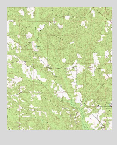
China, AL USGS Topographic Map
Click on map above to begin viewing in our Map Viewer.

This topographic map contains these locations and features:
Feature Name Type Latitude Longitude GNIS ID View Map
Blackmons PondReservoirN31.5847°W87.0901°114447View Map
Bookers MillPopulated PlaceN31.5268°W87.0322°156095View Map
Centernary Methodist ChurchChurchN31.5643°W87.0436°115876View Map
ChinaPopulated PlaceN31.5235°W87.0178°116054View Map
Eggville (historical)LocaleN31.5766°W87.0575°138462View Map
FairnelsonPopulated PlaceN31.5638°W87.0766°118126View Map
FowlerPopulated PlaceN31.5893°W87.0972°156375View Map
Holly Grove ChurchChurchN31.5027°W87.0097°120273View Map
Kaiser CemeteryCemeteryN31.6107°W87.0016°149641View Map
Little Brushy CreekStreamN31.5185°W87.0361°151647View Map
Lyeffion DivisionCivilN31.5970°W87.0069°161607View Map
Lyeffion Elementary SchoolSchoolN31.5249°W87.0161°133141View Map
Martin CemeteryCemeteryN31.5952°W87.1014°149644View Map
New Haven CemeteryCemeteryN31.6096°W87.0741°1805534View Map
New Haven Church of ChristChurchN31.6102°W87.0755°123758View Map
Pleasant Grove ChurchChurchN31.5274°W87.0372°124947View Map
Purnell Methodist ChurchChurchN31.5699°W87.1064°125369View Map
Spring CreekStreamN31.5652°W87.0650°127227View Map
Weston ChurchChurchN31.5207°W87.0253°149674View Map
Witherington CemeteryCemeteryN31.5215°W87.0072°129140View Map
Witheringtons PondReservoirN31.5252°W87.0028°129141View Map

Note: Coordinates in the location and feature list above are referenced to NAD83 datum.


Copyright (C) 2008-2025 Ryan Niemi / Sunset Dynamics ... All Rights Reserved