TopoQuest Logo
Do you find TopoQuest useful?
Help keep TopoQuest running and adding new maps/features by donating!
Bitcoin:  19c7KJd3qBynnjoSw5npx9KScwjBe4ifkT
Litecoin:  LXs6TkuXGGXo1vDsWCkWVdjQX94eUKd6ui
Home View Maps Find Maps Find Places Resources & Links


Evergreen, Alabama Topographic Map

USGS Map Title: Evergreen, AL
USGS Map MRC: 31086D8
DRG (GeoTIFF) Download: o31086d8.tif


Neighboring USGS Topographic Map Quads:


  China, AL  
31087E1
 

  Lyeffion, AL  
31086E8
 

  Garland, AL  
31086E7
 

  Belleville, AL  
31087D1
 

  Evergreen, AL  
31086D8
 

  Old Town, AL  
31086D7
 

  Castleberry, AL  
31087C1
 

  Nymph, AL  
31086C8
 

  Brooklyn, AL  
31086C7


Map MRC Location:

N32°
W87°
N32°
W86°
H8 H7 H6 H5 H4 H3 H2 H1
G8 G7 G6 G5 G4 G3 G2 G1
F8 F7 F6 F5 F4 F3 F2 F1
E8 E7 E6 E5 E4 E3 E2 E1
D8 D7 D6 D5 D4 D3 D2 D1
C8 C7 C6 C5 C4 C3 C2 C1
B8 B7 B6 B5 B4 B3 B2 B1
A8 A7 A6 A5 A4 A3 A2 A1
N31°
W87°
N31°
W86°

Evergreen, AL USGS 1:24K Topographic Map Preview:
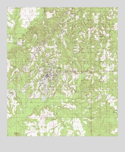
Evergreen, AL USGS Topographic Map
Click on map above to begin viewing in our Map Viewer.

This topographic map contains these locations and features:
Feature Name Type Latitude Longitude GNIS ID View Map
Abundant Life Assembly ChurchChurchN31.4360°W86.9432°2580340View Map
Alabama State Troopers Troop IBuildingN31.4507°W86.9605°2751873View Map
Antioch Missionary Baptist ChurchChurchN31.4391°W86.8769°133082View Map
Bethel Baptist ChurchChurchN31.4321°W86.9486°133092View Map
Bower Memorial Baptist ChurchChurchN31.4227°W86.9589°147416View Map
Brown Beasley CemeteryCemeteryN31.4746°W86.8877°149625View Map
BrownvillePopulated PlaceN31.4685°W86.9005°115025View Map
Brownville ChurchChurchN31.4677°W86.8966°133100View Map
Brownville ChurchChurchN31.4704°W86.8972°133124View Map
Call to Life Apostolic ChurchChurchN31.4301°W86.9464°2580341View Map
CentervillePopulated PlaceN31.4002°W86.8789°133102View Map
City of EvergreenCivilN31.4379°W86.9584°2403584View Map
Conecuh Baptist Association ChurchChurchN31.4377°W86.9600°2580339View Map
Conecuh CountyCivilN31.4293°W86.9937°161543View Map
Conecuh County CourthouseBuildingN31.4352°W86.9544°133106View Map
Conecuh County Sheriff's OfficeBuildingN31.4360°W86.9542°2751897View Map
Conecuh Rescue and FireBuildingN31.4679°W86.9438°2691311View Map
EvergreenPopulated PlaceN31.4335°W86.9569°118078View Map
Evergreen Elementary SchoolSchoolN31.4357°W86.9508°147419View Map
Evergreen Golf ClubLocaleN31.4352°W86.8861°133111View Map
Evergreen High SchoolSchoolN31.4343°W86.9439°133112View Map
Evergreen Medical CenterHospitalN31.4308°W86.9405°147420View Map
Evergreen Police DepartmentBuildingN31.4342°W86.9536°2751710View Map
Evergreen Post OfficePost OfficeN31.4353°W86.9554°168157View Map
Evergreen Sewage LagoonReservoirN31.4035°W86.9566°129805View Map
Evergreen Sewage Lagoon DamDamN31.4035°W86.9566°129806View Map
Evergreen Volunteer Fire DepartmentBuildingN31.4379°W86.9613°2691240View Map
Exit 96CrossingN31.4579°W86.9655°155648View Map
Fairview Baptist ChurchChurchN31.4166°W86.9972°147422View Map
Fairview Church of ChristChurchN31.4157°W86.9900°147423View Map
First Assembly of God ChurchChurchN31.4357°W86.9472°147424View Map
First Baptist ChurchChurchN31.4352°W86.9522°133113View Map
First United Methodist ChurchChurchN31.4324°W86.9550°147421View Map
Little Zion ChurchChurchN31.4146°W86.8869°133138View Map
Marshall High SchoolSchoolN31.4232°W86.9516°147427View Map
Mill CreekStreamN31.3988°W86.9805°133144View Map
Moody LakeReservoirN31.4317°W86.9331°129822View Map
Moody Lake DamDamN31.4302°W86.9316°129823View Map
Morgans DamDamN31.4402°W86.9633°129833View Map
Morgans PondReservoirN31.4417°W86.9642°129832View Map
Mount Zion African Methodist Episcopal ChurchChurchN31.4342°W86.9476°2580343View Map
Olive Branch CemeteryCemeteryN31.4927°W86.9280°1805519View Map
Olive Branch ChurchChurchN31.4932°W86.9280°133165View Map
OwassaPopulated PlaceN31.4932°W86.9316°155183View Map
Owassa - Brownville Volunteer Fire DepartmentBuildingN31.4743°W86.8972°2691328View Map
RabbPopulated PlaceN31.4391°W86.8805°133173View Map
Rabb CemeteryCemeteryN31.4418°W86.8791°149657View Map
Reid State Technical CollegeSchoolN31.4613°W86.9641°149659View Map
Saint Pauls United Methodist ChurchChurchN31.4336°W86.9482°150863View Map
Sandy CreekStreamN31.4054°W86.9583°133183View Map
Southside Elementary SchoolSchoolN31.4266°W86.9497°147432View Map
Sparta AcademySchoolN31.4460°W86.9469°147433View Map
Spence CemeteryCemeteryN31.4585°W86.8947°149671View Map
Unity in Christ Outreach ChurchChurchN31.4323°W86.9520°2580342View Map
WEGN-AM (Evergreen)TowerN31.4416°W86.9355°160936View Map
Westside ChurchChurchN31.4668°W86.9819°149673View Map
WTII-FM (Evergreen)TowerN31.4416°W86.9355°161135View Map

Note: Coordinates in the location and feature list above are referenced to NAD83 datum.


Copyright (C) 2008-2024 Ryan Niemi / Sunset Dynamics ... All Rights Reserved