TopoQuest Logo
Do you find TopoQuest useful?
Help keep TopoQuest running and adding new maps/features by donating!
Bitcoin:  19c7KJd3qBynnjoSw5npx9KScwjBe4ifkT
Litecoin:  LXs6TkuXGGXo1vDsWCkWVdjQX94eUKd6ui
Home View Maps Find Maps Find Places Resources & Links


Enos Mountain, Montana Topographic Map

USGS Map Title: Enos Mountain, MT
USGS Map MRC: 45110E1
DRG (GeoTIFF) Download: o45110e1.tif


Neighboring USGS Topographic Map Quads:


  Springdale, MT  
45110F2
 

  McLeod, MT  
45110F1
 

  Ross Canyon, MT  
45109F8
 

  McLeod Basin, MT  
45110E2
 

  Enos Mountain, MT  
45110E1
 

  Sliderock Mountain, MT  
45109E8
 

  Chrome Mountain, MT  
45110D2
 

  Picket Pin Mountain, MT  
45110D1
 

  Meyer Mountain, MT  
45109D8


Map MRC Location:

N46°
W111°
N46°
W110°
H8 H7 H6 H5 H4 H3 H2 H1
G8 G7 G6 G5 G4 G3 G2 G1
F8 F7 F6 F5 F4 F3 F2 F1
E8 E7 E6 E5 E4 E3 E2 E1
D8 D7 D6 D5 D4 D3 D2 D1
C8 C7 C6 C5 C4 C3 C2 C1
B8 B7 B6 B5 B4 B3 B2 B1
A8 A7 A6 A5 A4 A3 A2 A1
N45°
W111°
N45°
W110°

Enos Mountain, MT USGS 1:24K Topographic Map Preview:
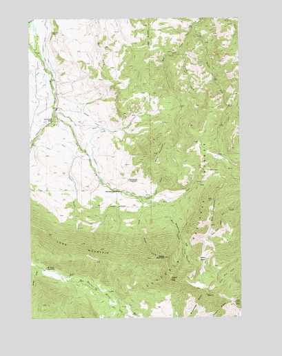
Enos Mountain, MT USGS Topographic Map
Click on map above to begin viewing in our Map Viewer.

This topographic map contains these locations and features:
Feature Name Type Latitude Longitude GNIS ID View Map
03S13E04AABD01 WellWellN45.6097°W110.1199°810497View Map
03S13E04ABAD01 WellWellN45.6094°W110.1213°810495View Map
03S13E14CCCA01 WellWellN45.5691°W110.0927°810189View Map
03S13E15BABA01 SpringSpringN45.5811°W110.1094°810259View Map
04S12E25CBBD01 WellWellN45.5769°W110.0994°810232View Map
04S13E04ABAA01 WellWellN45.5233°W110.1232°809953View Map
04S13E12BABB01 SpringSpringN45.5077°W110.0699°809853View Map
04S13E12BCBA01 WellWellN45.5035°W110.0730°809834View Map
04S13E12BCBA02 WellWellN45.5035°W110.0730°809835View Map
04S13E12BCBA03 WellWellN45.5033°W110.0730°809829View Map
04S13E12BCBA04 WellWellN45.5033°W110.0730°809830View Map
04S13E12BCBA05 WellWellN45.5033°W110.0730°809831View Map
04S13E12BCBA06 WellWellN45.5033°W110.0730°809832View Map
04S13E12BCBA07 WellWellN45.5033°W110.0730°809833View Map
04S13E12BCCD01 SpringSpringN45.5010°W110.0744°809814View Map
04S13E12BDCC01 SpringSpringN45.5013°W110.0707°809817View Map
Boone MountainSummitN45.5252°W110.0460°780227View Map
Clover BasinBasinN45.5244°W110.0235°781413View Map
Corral CreekStreamN45.6119°W110.0352°781690View Map
Craft DitchCanalN45.5716°W110.1169°781833View Map
Dry Fork CreekStreamN45.5044°W110.0791°782604View Map
East Boulder School (historical)SchoolN45.5819°W110.1124°782783View Map
East Sheep CreekStreamN45.5472°W110.0499°782954View Map
Elk CreekStreamN45.5858°W110.1105°783052View Map
Elk MountainSummitN45.5491°W110.0177°783097View Map
Enos CreekStreamN45.5880°W110.1107°783215View Map
Enos MountainSummitN45.5685°W110.0502°783216View Map
Farnsworth HomesteadLocaleN45.5577°W110.0671°783311View Map
Horse CreekStreamN45.5716°W110.0963°785027View Map
Lewis GulchValleyN45.5049°W110.1066°786076View Map
Long MountainRidgeN45.5310°W110.0955°786533View Map
Lost Cabin CreekStreamN45.5497°W110.0607°786572View Map
McKinsey HomesteadLocaleN45.5210°W110.1160°787086View Map
Middle Fork Upper Deer CreekStreamN45.6213°W110.0282°787311View Map
Morning Star PeakSummitN45.5163°W110.0427°791391View Map
Seasongood HomesteadLocaleN45.5530°W110.0719°790173View Map
Skookum Joe CanyonValleyN45.5422°W110.0416°790604View Map
Stillwater Mining Company / Medcor East Boulder MineBuildingN45.5043°W110.0834°2637907View Map
West Sheep CreekStreamN45.5485°W110.0594°793126View Map
Woolsey DitchCanalN45.5727°W110.0891°793543View Map
Wright GulchValleyN45.5210°W110.1207°793557View Map

Note: Coordinates in the location and feature list above are referenced to NAD83 datum.


Copyright (C) 2008-2025 Ryan Niemi / Sunset Dynamics ... All Rights Reserved