TopoQuest Logo
Do you find TopoQuest useful?
Help keep TopoQuest running and adding new maps/features by donating!
Bitcoin:  19c7KJd3qBynnjoSw5npx9KScwjBe4ifkT
Litecoin:  LXs6TkuXGGXo1vDsWCkWVdjQX94eUKd6ui
Home View Maps Find Maps Find Places Resources & Links


Riverside, Utah Topographic Map

USGS Map Title: Riverside, UT
USGS Map MRC: 41112G2
DRG (GeoTIFF) Download: o41112g2.tif


Neighboring USGS Topographic Map Quads:


  Limekiln Knoll, UT  
41112H3
 

  Portage, UT  
41112H2
 

  Clarkston, UT  
41112H1
 

  Blind Springs, UT  
41112G3
 

  Riverside, UT  
41112G2
 

  Cutler Dam, UT  
41112G1
 

  Thatcher Mountain, UT  
41112F3
 

  Tremonton, UT  
41112F2
 

  Honeyville, UT  
41112F1


Map MRC Location:

N42°
W113°
N42°
W112°
H8 H7 H6 H5 H4 H3 H2 H1
G8 G7 G6 G5 G4 G3 G2 G1
F8 F7 F6 F5 F4 F3 F2 F1
E8 E7 E6 E5 E4 E3 E2 E1
D8 D7 D6 D5 D4 D3 D2 D1
C8 C7 C6 C5 C4 C3 C2 C1
B8 B7 B6 B5 B4 B3 B2 B1
A8 A7 A6 A5 A4 A3 A2 A1
N41°
W113°
N41°
W112°

Riverside, UT USGS 1:24K Topographic Map Preview:
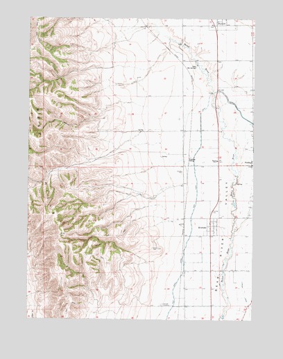
Riverside, UT USGS Topographic Map
Click on map above to begin viewing in our Map Viewer.

This topographic map contains these locations and features:
Feature Name Type Latitude Longitude GNIS ID View Map
Belmont ChurchChurchN41.8160°W112.1455°1425414View Map
Butler CanyonValleyN41.8399°W112.1922°1426220View Map
Fielding CemeteryCemeteryN41.8210°W112.1297°1437260View Map
Fielding SidingLocaleN41.8158°W112.1611°1427918View Map
Garland CemeteryCemeteryN41.7562°W112.1762°1428147View Map
KMXL-FM (Logan)TowerN41.7852°W112.2319°1455820View Map
Landmark Letters BranchParkN41.7599°W112.2025°1455364View Map
Magpie CanyonValleyN41.7724°W112.1772°1455380View Map
Marlow CanyonValleyN41.8544°W112.2091°1430111View Map
Plymouth Fire DepartmentBuildingN41.8743°W112.1465°2627296View Map
RiversidePopulated PlaceN41.7888°W112.1488°1431861View Map
Riverside CemeteryCemeteryN41.7887°W112.1422°1436236View Map
Riverside Census Designated PlaceCensusN41.8106°W112.1402°2409189View Map
Riverside Post OfficePost OfficeN41.7897°W112.1498°2769041View Map
Toponce CanyonValleyN41.8283°W112.1852°1433599View Map
Town of PlymouthCivilN41.8734°W112.1454°2412492View Map
Uddy Hot SpringsSpringN41.8549°W112.1575°1433769View Map
West CanalCanalN41.7663°W112.1669°1447115View Map

Note: Coordinates in the location and feature list above are referenced to NAD83 datum.


Copyright (C) 2008-2025 Ryan Niemi / Sunset Dynamics ... All Rights Reserved