TopoQuest Logo
Do you find TopoQuest useful?
Help keep TopoQuest running and adding new maps/features by donating!
Bitcoin:  19c7KJd3qBynnjoSw5npx9KScwjBe4ifkT
Litecoin:  LXs6TkuXGGXo1vDsWCkWVdjQX94eUKd6ui
Home View Maps Find Maps Find Places Resources & Links


Clayton, Indiana Topographic Map

USGS Map Title: Clayton, IN
USGS Map MRC: 39086F5
DRG (GeoTIFF) Download: o39086f5.tif


Neighboring USGS Topographic Map Quads:


  North Salem, IN  
39086G6
 

  Danville, IN  
39086G5
 

  Brownsburg, IN  
39086G4
 

  Coatesville, IN  
39086F6
 

  Clayton, IN  
39086F5
 

  Plainfield, IN  
39086F4
 

  Eminence, IN  
39086E6
 

  Hall, IN  
39086E5
 

  Mooresville West, IN  
39086E4


Map MRC Location:

N40°
W87°
N40°
W86°
H8 H7 H6 H5 H4 H3 H2 H1
G8 G7 G6 G5 G4 G3 G2 G1
F8 F7 F6 F5 F4 F3 F2 F1
E8 E7 E6 E5 E4 E3 E2 E1
D8 D7 D6 D5 D4 D3 D2 D1
C8 C7 C6 C5 C4 C3 C2 C1
B8 B7 B6 B5 B4 B3 B2 B1
A8 A7 A6 A5 A4 A3 A2 A1
N39°
W87°
N39°
W86°

Clayton, IN USGS 1:24K Topographic Map Preview:
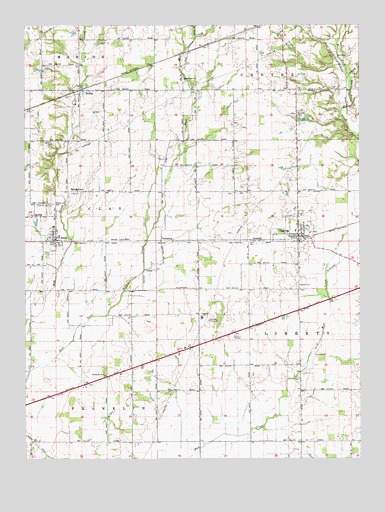
Clayton, IN USGS Topographic Map
Click on map above to begin viewing in our Map Viewer.

This topographic map contains these locations and features:
Feature Name Type Latitude Longitude GNIS ID View Map
AmoPopulated PlaceN39.6881°W86.6136°430143View Map
Amo CemeteryCemeteryN39.6852°W86.6141°2093770View Map
Amo Elementary SchoolSchoolN39.6923°W86.6144°447026View Map
Beck LakeReservoirN39.7227°W86.5206°447772View Map
Beck Lake DamDamN39.7217°W86.5183°447771View Map
Bethel Lutheran CemeteryCemeteryN39.6646°W86.5797°2093771View Map
Breneman FarmsLocaleN39.6861°W86.5436°2629014View Map
Buescher FarmsLocaleN39.6781°W86.5539°2629012View Map
Cascade SchoolSchoolN39.6659°W86.5586°432208View Map
Christie East CemeteryCemeteryN39.7242°W86.5232°2093551View Map
Christie West CemeteryCemeteryN39.7241°W86.5236°2093552View Map
ClaytonPopulated PlaceN39.6892°W86.5225°432598View Map
Clayton CemeteryCemeteryN39.6749°W86.5235°432600View Map
Clayton Police DepartmentBuildingN39.6900°W86.5234°2758191View Map
Cooper AirportAirportN39.6439°W86.5049°449104View Map
Cox's Plant FarmBuildingN39.6686°W86.5244°2629011View Map
Coyote Creek FarmsLocaleN39.6622°W86.5517°2629015View Map
Danlea FarmsLocaleN39.6278°W86.5069°2629013View Map
Fire Department of Liberty TownshipBuildingN39.6888°W86.5210°2625655View Map
Gary Alex FarmLocaleN39.6317°W86.5633°2629010View Map
HadleyPopulated PlaceN39.7314°W86.6028°435585View Map
Hadley Friends CemeteryCemeteryN39.7294°W86.6083°2093773View Map
Hillside CemeteryCemeteryN39.7245°W86.5233°436223View Map
Jones CemeteryCemeteryN39.6478°W86.5244°2093837View Map
Marcidale AirportAirportN39.6853°W86.6021°2676997View Map
McCormack CemeteryCemeteryN39.6900°W86.5472°2093850View Map
Mill Creek CemeteryCemeteryN39.7340°W86.5649°2093665View Map
Mill Creek ChurchChurchN39.7345°W86.5653°439165View Map
Mill Creek East Elementary SchoolSchoolN39.6909°W86.5242°447027View Map
Mill Creek Fire Department Station 51BuildingN39.6874°W86.6052°2625506View Map
NashPopulated PlaceN39.7495°W86.5381°446676View Map
New Mill Creek Cemetery (historical)CemeteryN39.7242°W86.5458°2093669View Map
PecksburgPopulated PlaceN39.6881°W86.5742°449707View Map
Snoddy CemeteryCemeteryN39.6316°W86.5889°2093823View Map
Spring Friends CemeteryCemeteryN39.6984°W86.6203°440600View Map
SpringtownPopulated PlaceN39.7023°W86.6061°444017View Map
Springtown Methodist CemeteryCemeteryN39.7016°W86.6071°2093775View Map
SummitPopulated PlaceN39.6881°W86.5367°444391View Map
Sunny Slope FarmLocaleN39.7247°W86.6058°2628453View Map
Town of AmoCivilN39.6888°W86.6125°2397430View Map
Town of ClaytonCivilN39.6883°W86.5231°2396652View Map
Township of ClayCivilN39.6949°W86.6176°453210View Map
Township of FranklinCivilN39.6370°W86.6207°453304View Map
Township of LibertyCivilN39.6617°W86.5016°453555View Map

Note: Coordinates in the location and feature list above are referenced to NAD83 datum.


Copyright (C) 2008-2024 Ryan Niemi / Sunset Dynamics ... All Rights Reserved