TopoQuest Logo
Do you find TopoQuest useful?
Help keep TopoQuest running and adding new maps/features by donating!
Bitcoin:  19c7KJd3qBynnjoSw5npx9KScwjBe4ifkT
Litecoin:  LXs6TkuXGGXo1vDsWCkWVdjQX94eUKd6ui
Home View Maps Find Maps Find Places Resources & Links


Clearview, Oklahoma Topographic Map

USGS Map Title: Clearview, OK
USGS Map MRC: 35096D2
DRG (GeoTIFF) Download: o35096d2.tif


Neighboring USGS Topographic Map Quads:


  Mason, OK  
35096E3
 

  Okfuskee, OK  
35096E2
 

  Okmulgee Lake, OK  
35096E1
 

  Okemah, OK  
35096D3
 

  Clearview, OK  
35096D2
 

  Pharoah, OK  
35096D1
 

  Okemah SE, OK  
35096C3
 

  Weleetka, OK  
35096C2
 

  Dustin, OK  
35096C1


Map MRC Location:

N36°
W97°
N36°
W96°
H8 H7 H6 H5 H4 H3 H2 H1
G8 G7 G6 G5 G4 G3 G2 G1
F8 F7 F6 F5 F4 F3 F2 F1
E8 E7 E6 E5 E4 E3 E2 E1
D8 D7 D6 D5 D4 D3 D2 D1
C8 C7 C6 C5 C4 C3 C2 C1
B8 B7 B6 B5 B4 B3 B2 B1
A8 A7 A6 A5 A4 A3 A2 A1
N35°
W97°
N35°
W96°

Clearview, OK USGS 1:24K Topographic Map Preview:
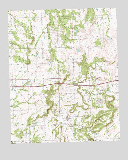
Clearview, OK USGS Topographic Map
Click on map above to begin viewing in our Map Viewer.

This topographic map contains these locations and features:
Feature Name Type Latitude Longitude GNIS ID View Map
ClearviewPopulated PlaceN35.3970°W96.1864°1091444View Map
Clearview CemeteryCemeteryN35.4020°W96.1931°1091445View Map
Clearview Oil FieldOilfieldN35.4018°W96.2025°1091447View Map
Creek ChapelChurchN35.3909°W96.2228°1091811View Map
Deaner Oil FieldOilfieldN35.4429°W96.1503°1091983View Map
East Okemah Oil FieldOilfieldN35.4568°W96.2144°1092424View Map
French CemeteryCemeteryN35.4064°W96.1933°2710144View Map
North Clearview Oil FieldOilfieldN35.4137°W96.2097°1095933View Map
Northwest Clearview Oil and Gas FieldOilfieldN35.4298°W96.2319°1096046View Map
Oknoname 107026 DamDamN35.3851°W96.1786°1753403View Map
Oknoname 107026 ReservoirReservoirN35.3851°W96.1786°1753404View Map
Oknoname 107027 DamDamN35.3934°W96.2203°1753405View Map
Oknoname 107027 ReservoirReservoirN35.3934°W96.2203°1753406View Map
Oknoname 107028 DamDamN35.4184°W96.1436°1753407View Map
Oknoname 107028 ReservoirReservoirN35.4184°W96.1436°1753408View Map
Salt Creek ChurchChurchN35.3776°W96.1778°1097700View Map
Southeast Blakely Oil FieldOilfieldN35.4518°W96.1761°1098287View Map
Springfield ChurchChurchN35.3776°W96.2289°1098455View Map
Town of ClearviewCivilN35.3971°W96.1908°2413212View Map
Township of LincolnCivilN35.4195°W96.1558°1824900View Map

Note: Coordinates in the location and feature list above are referenced to NAD83 datum.


Copyright (C) 2008-2024 Ryan Niemi / Sunset Dynamics ... All Rights Reserved