TopoQuest Logo
Do you find TopoQuest useful?
Help keep TopoQuest running and adding new maps/features by donating!
Bitcoin:  19c7KJd3qBynnjoSw5npx9KScwjBe4ifkT
Litecoin:  LXs6TkuXGGXo1vDsWCkWVdjQX94eUKd6ui
Home View Maps Find Maps Find Places Resources & Links


Coloma, California Topographic Map

USGS Map Title: Coloma, CA
USGS Map MRC: 38120G8
DRG (GeoTIFF) Download: o38120g8.tif


Neighboring USGS Topographic Map Quads:


  Auburn, CA  
38121H1
 

  Greenwood, CA  
38120H8
 

  Georgetown, CA  
38120H7
 

  Pilot Hill, CA  
38121G1
 

  Coloma, CA  
38120G8
 

  Garden Valley, CA  
38120G7
 

  Clarksville, CA  
38121F1
 

  Shingle Springs, CA  
38120F8
 

  Placerville, CA  
38120F7


Map MRC Location:

N39°
W121°
N39°
W120°
H8 H7 H6 H5 H4 H3 H2 H1
G8 G7 G6 G5 G4 G3 G2 G1
F8 F7 F6 F5 F4 F3 F2 F1
E8 E7 E6 E5 E4 E3 E2 E1
D8 D7 D6 D5 D4 D3 D2 D1
C8 C7 C6 C5 C4 C3 C2 C1
B8 B7 B6 B5 B4 B3 B2 B1
A8 A7 A6 A5 A4 A3 A2 A1
N38°
W121°
N38°
W120°

Coloma, CA USGS 1:24K Topographic Map Preview:
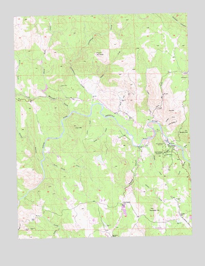
Coloma, CA USGS Topographic Map
Click on map above to begin viewing in our Map Viewer.

This topographic map contains these locations and features:
Feature Name Type Latitude Longitude GNIS ID View Map
Abrams 3462-002 DamDamN38.8499°W120.9811°1664389View Map
Akin AirportAirportN38.7544°W120.8992°1653824View Map
Bacchi 1461 DamDamN38.8266°W120.9261°1664325View Map
Bacchi Valley Industries AirportAirportN38.8174°W120.9224°1653706View Map
Beer Garden Picnic AreaParkN38.7999°W120.8908°1733818View Map
Black Rock CreekStreamN38.8324°W120.9805°257157View Map
Blue Tent CreekStreamN38.8299°W120.9780°219529View Map
Boulder MineMineN38.7549°W120.9958°219695View Map
Brush CreekStreamN38.8163°W120.9288°219924View Map
Burnt Shanty CreekStreamN38.7952°W120.9805°220235View Map
Chuck RavineValleyN38.7921°W120.8788°221097View Map
Clark CreekStreamN38.8180°W120.9474°221154View Map
Clark MountainSummitN38.8124°W120.9574°221161View Map
ColomaPopulated PlaceN38.7999°W120.8902°1655915View Map
Coloma Census Designated PlaceCensusN38.8026°W120.8946°2582981View Map
Coloma Post OfficePost OfficeN38.8002°W120.8904°1733824View Map
Coloma SchoolhouseSchoolN38.7993°W120.8885°1733825View Map
Coloma WineryLocaleN38.7941°W120.8908°1733826View Map
Delores MineMineN38.7557°W120.9894°222251View Map
Dutch CreekStreamN38.7991°W120.8816°259628View Map
El Dorado County Fire Protection District Station 27 Gold HillBuildingN38.7626°W120.8817°2624106View Map
El Dorado County Fire Protection District Station 74 Coloma / LotusBuildingN38.8010°W120.9075°2624514View Map
Emmanuel Episcopal ChurchChurchN38.7968°W120.8910°1733830View Map
Four CornersLocaleN38.7688°W120.9255°223741View Map
Gambler CreekStreamN38.8096°W120.8960°224027View Map
Gastaldi 1466 DamDamN38.7599°W120.8760°1664329View Map
Gold HillPopulated PlaceN38.7610°W120.8847°224271View Map
Gold Hill VineyardLocaleN38.7880°W120.8938°1733835View Map
Gold Trail Union SchoolSchoolN38.7671°W120.9247°1733838View Map
Granite CanyonValleyN38.8005°W120.9133°224401View Map
Granite CreekStreamN38.8005°W120.9133°224404View Map
Greenwood CreekStreamN38.8246°W120.9452°260882View Map
Hastings CreekStreamN38.8185°W120.9627°225001View Map
Indian CreekStreamN38.7910°W120.8769°261729View Map
Indian CreekStreamN38.8143°W120.9044°225860View Map
Jacobs CreekStreamN38.8171°W120.9352°226104View Map
Jacobs Creek 53-006 DamDamN38.7966°W120.9394°1663463View Map
James Marshall Monument GraveCemeteryN38.7967°W120.8941°1733843View Map
James W Marshall State Historical MonumentParkN38.7966°W120.8944°226134View Map
Johntown CreekStreamN38.8380°W120.8760°266867View Map
Kane HouseBuildingN38.8005°W120.8913°1733845View Map
Koloma (historical)Populated PlaceN38.7999°W120.8899°1733846View Map
Lichen CreekStreamN38.8302°W120.9461°227071View Map
Lilyama MineMineN38.8349°W120.9680°227101View Map
Little Gambler CreekStreamN38.8093°W120.8952°227262View Map
LotusPopulated PlaceN38.8016°W120.9086°1656142View Map
Lotus Post OfficePost OfficeN38.8081°W120.9026°1733849View Map
Marshall Gold Discovery State Historic ParkParkN38.8005°W120.8938°224267View Map
Marshall Gold Discovery State Historic Park MuseumBuildingN38.8005°W120.8922°1733850View Map
Marshalls CabinBuildingN38.7974°W120.8930°1733851View Map
Monroe Ridge TrailTrailN38.7999°W120.8974°1733853View Map
Monument Picnic AreaLocaleN38.7955°W120.8947°1733854View Map
Monument TrailTrailN38.7999°W120.8944°1733855View Map
Mount AraratSummitN38.8530°W120.9399°218334View Map
Murphy MountainSummitN38.8085°W120.8780°267050View Map
North Beach Picnic AreaLocaleN38.8060°W120.8949°1733858View Map
Norton RavineValleyN38.7924°W120.9833°229785View Map
Old Coloma TheatreBuildingN38.7952°W120.8908°1733862View Map
Papini HouseBuildingN38.7991°W120.8899°1733863View Map
Perry MountainSummitN38.8207°W120.8894°1656218View Map
Perry Mountain CreekStreamN38.8218°W120.9044°230539View Map
Pinehem CreekStreamN38.7566°W120.9716°217923View Map
Pioneer CemeteryCemeteryN38.7949°W120.8890°1733865View Map
Point Pleasant Bench Picnic AreaLocaleN38.8082°W120.8941°1733866View Map
Ponderosa Park Picnic AreaLocaleN38.8091°W120.9002°1733867View Map
Rescue Fire Protection District Station 81BuildingN38.7574°W120.9298°2624039View Map
Saint John's Catholic CemeteryCemeteryN38.7967°W120.8926°1733821View Map
Saint Johns Catholic ChurchChurchN38.7974°W120.8924°1733869View Map
Schubin 2460 DamDamN38.7632°W120.9244°1664370View Map
Shingle CreekStreamN38.8007°W120.9127°233009View Map
Springvale SchoolSchoolN38.7502°W120.9336°235289View Map
Straza 3462 DamDamN38.8366°W120.9777°1664388View Map
Sutter's Mill Primary SchoolSchoolN38.7694°W120.9274°1733875View Map
Sutters MillLocaleN38.8030°W120.8919°235854View Map
Thomas HouseBuildingN38.7982°W120.8916°1733879View Map
Thompson HillSummitN38.7652°W120.9058°236276View Map
Uniontown CemeteryCemeteryN38.7993°W120.9121°236854View Map
Veerkamp 1465 DamDamN38.7582°W120.8877°1664328View Map
Vineyard HouseBuildingN38.7941°W120.8902°1733880View Map
Williamson Number 1 464 DamDamN38.7549°W120.9377°1663900View Map

Note: Coordinates in the location and feature list above are referenced to NAD83 datum.


Copyright (C) 2008-2024 Ryan Niemi / Sunset Dynamics ... All Rights Reserved