TopoQuest Logo
Do you find TopoQuest useful?
Help keep TopoQuest running and adding new maps/features by donating!
Bitcoin:  19c7KJd3qBynnjoSw5npx9KScwjBe4ifkT
Litecoin:  LXs6TkuXGGXo1vDsWCkWVdjQX94eUKd6ui
Home View Maps Find Maps Find Places Resources & Links


Lake, Mississippi Topographic Map

USGS Map Title: Lake, MS
USGS Map MRC: 32089C3
DRG (GeoTIFF) Download: o32089c3.tif


Neighboring USGS Topographic Map Quads:


  Harperville, MS  
32089D4
 

  Conehatta, MS  
32089D3
 

  Decatur NW, MS  
32089D2
 

  Forest, MS  
32089C4
 

  Lake, MS  
32089C3
 

  Newton, MS  
32089C2
 

  Pineville, MS  
32089B4
 

  Clear Springs, MS  
32089B3
 

  Montrose North, MS  
32089B2


Map MRC Location:

N33°
W90°
N33°
W89°
H8 H7 H6 H5 H4 H3 H2 H1
G8 G7 G6 G5 G4 G3 G2 G1
F8 F7 F6 F5 F4 F3 F2 F1
E8 E7 E6 E5 E4 E3 E2 E1
D8 D7 D6 D5 D4 D3 D2 D1
C8 C7 C6 C5 C4 C3 C2 C1
B8 B7 B6 B5 B4 B3 B2 B1
A8 A7 A6 A5 A4 A3 A2 A1
N32°
W90°
N32°
W89°

Lake, MS USGS 1:24K Topographic Map Preview:
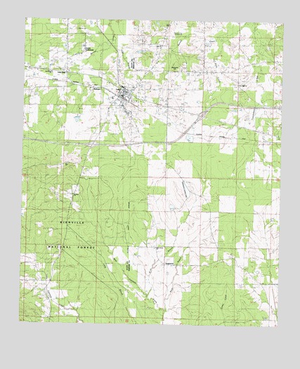
Lake, MS USGS Topographic Map
Click on map above to begin viewing in our Map Viewer.

This topographic map contains these locations and features:
Feature Name Type Latitude Longitude GNIS ID View Map
Bald HillSummitN32.3163°W89.3534°692443View Map
Ball HillPopulated PlaceN32.3154°W89.3559°707284View Map
Barnett CreekStreamN32.3693°W89.2801°692463View Map
BartlettPopulated PlaceN32.2585°W89.3167°692466View Map
Buck BranchStreamN32.2590°W89.3092°692740View Map
BuckleytownPopulated PlaceN32.3038°W89.3609°692749View Map
Dennis CemeteryCemeteryN32.3710°W89.3495°704954View Map
Dennis SettlementPopulated PlaceN32.3610°W89.3492°693085View Map
Diamond HillSummitN32.3543°W89.3037°693089View Map
Earl Davis Pond DamDamN32.3351°W89.3484°695440View Map
Eureka CemeteryCemeteryN32.2532°W89.2548°705461View Map
Eureka ChurchChurchN32.2526°W89.2542°693187View Map
First Baptist ChurchChurchN32.3449°W89.3267°704961View Map
Green Grove ChurchChurchN32.2815°W89.3101°705464View Map
Green Grove SchoolSchoolN32.2813°W89.3109°693354View Map
Interchange 100CrossingN32.3363°W89.2890°691392View Map
Interchange 96CrossingN32.3238°W89.3415°691391View Map
LakePopulated PlaceN32.3432°W89.3287°693679View Map
Lake Attendance CenterSchoolN32.3474°W89.3267°707291View Map
Lake ChurchChurchN32.3649°W89.3115°693439View Map
Lake Elementary SchoolSchoolN32.3368°W89.3228°707292View Map
Lake Holiness ChurchChurchN32.3485°W89.3206°705465View Map
Lake Post OfficePost OfficeN32.3420°W89.3302°2768866View Map
Little ItalyPopulated PlaceN32.3532°W89.3542°704986View Map
MuskegonPopulated PlaceN32.3482°W89.3523°694137View Map
Patrons Union (historical)Populated PlaceN32.3690°W89.3056°705477View Map
Patrons Union CampgroundLocaleN32.3674°W89.2992°694328View Map
Pine Ridge ChurchChurchN32.3493°W89.2728°694389View Map
Pine Ridge SchoolSchoolN32.3040°W89.3509°694390View Map
Polar BranchStreamN32.3668°W89.3331°694446View Map
Riley BranchStreamN32.2629°W89.3140°694560View Map
Rush School (historical)SchoolN32.3546°W89.2795°705481View Map
Saint Mark ChurchChurchN32.3035°W89.3498°704999View Map
Sand Ridge ChurchChurchN32.3426°W89.3737°694695View Map
Sivils CreekStreamN32.3693°W89.2809°694804View Map
Stovall Lake DamDamN32.2851°W89.2567°695432View Map
Tallahala School (historical)SchoolN32.2835°W89.2737°705486View Map
TanglewoodPopulated PlaceN32.2757°W89.3048°694938View Map
Town of LakeCivilN32.3407°W89.3295°2405968View Map

Note: Coordinates in the location and feature list above are referenced to NAD83 datum.


Copyright (C) 2008-2025 Ryan Niemi / Sunset Dynamics ... All Rights Reserved