TopoQuest Logo
Do you find TopoQuest useful?
Help keep TopoQuest running and adding new maps/features by donating!
Bitcoin:  19c7KJd3qBynnjoSw5npx9KScwjBe4ifkT
Litecoin:  LXs6TkuXGGXo1vDsWCkWVdjQX94eUKd6ui
Home View Maps Find Maps Find Places Resources & Links


Andersonville, Virginia Topographic Map

USGS Map Title: Andersonville, VA
USGS Map MRC: 37078D5
DRG (GeoTIFF) Download: o37078d5.tif


Neighboring USGS Topographic Map Quads:


  Saint Joy, VA  
37078E6
 

  Buckingham, VA  
37078E5
 

  Dillwyn, VA  
37078E4
 

  Holiday Lake, VA  
37078D6
 

  Andersonville, VA  
37078D5
 

  Willis Mountain, VA  
37078D4
 

  Pamplin, VA  
37078C6
 

  Prospect, VA  
37078C5
 

  Farmville, VA  
37078C4


Map MRC Location:

N38°
W79°
N38°
W78°
H8 H7 H6 H5 H4 H3 H2 H1
G8 G7 G6 G5 G4 G3 G2 G1
F8 F7 F6 F5 F4 F3 F2 F1
E8 E7 E6 E5 E4 E3 E2 E1
D8 D7 D6 D5 D4 D3 D2 D1
C8 C7 C6 C5 C4 C3 C2 C1
B8 B7 B6 B5 B4 B3 B2 B1
A8 A7 A6 A5 A4 A3 A2 A1
N37°
W79°
N37°
W78°

Andersonville, VA USGS 1:24K Topographic Map Preview:
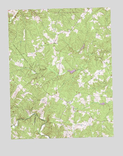
Andersonville, VA USGS Topographic Map
Click on map above to begin viewing in our Map Viewer.

This topographic map contains these locations and features:
Feature Name Type Latitude Longitude GNIS ID View Map
AndersonvillePopulated PlaceN37.4674°W78.5689°1477073View Map
AreanumPopulated PlaceN37.4476°W78.5097°1477079View Map
Beasley CreekStreamN37.3982°W78.5972°1462915View Map
Bethel CemeteryCemeteryN37.4596°W78.5906°1501494View Map
Bethel ChurchChurchN37.4596°W78.5906°1463182View Map
Brickyard BranchStreamN37.4410°W78.5375°1463805View Map
Chestnut GrovePopulated PlaceN37.4201°W78.6061°1501512View Map
Chestnut Grove ChurchChurchN37.4188°W78.6072°1464815View Map
Concord ChurchChurchN37.3901°W78.5119°1465161View Map
Cut Banks FordCrossingN37.3982°W78.5947°1497255View Map
District 3CivilN37.4256°W78.5033°2390683View Map
EnonvillePopulated PlaceN37.4999°W78.5233°1477308View Map
First Liberty ChurchChurchN37.4676°W78.5228°1466586View Map
Jenkins CreekStreamN37.3951°W78.6039°1468672View Map
Lee Experimental ForestForestN37.4963°W78.5547°1469264View Map
Mount Carmel Church (historical)ChurchN37.4257°W78.5864°1501562View Map
New StoreLocaleN37.4090°W78.5544°1471498View Map
Sams CreekStreamN37.4999°W78.6089°1473985View Map
Second Liberty ChurchChurchN37.4790°W78.5467°1474143View Map
Willis River Number 1a DamDamN37.4401°W78.5447°1489269View Map
Willis River Number 1b DamDamN37.4618°W78.5331°1489270View Map
Willis River Number 6a DamDamN37.4068°W78.5114°1489276View Map
Woods MountainSummitN37.3946°W78.5789°1493832View Map

Note: Coordinates in the location and feature list above are referenced to NAD83 datum.


Copyright (C) 2008-2025 Ryan Niemi / Sunset Dynamics ... All Rights Reserved