TopoQuest Logo
Do you find TopoQuest useful?
Help keep TopoQuest running and adding new maps/features by donating!
Bitcoin:  19c7KJd3qBynnjoSw5npx9KScwjBe4ifkT
Litecoin:  LXs6TkuXGGXo1vDsWCkWVdjQX94eUKd6ui
Home View Maps Find Maps Find Places Resources & Links


Buckingham, Virginia Topographic Map

USGS Map Title: Buckingham, VA
USGS Map MRC: 37078E5
DRG (GeoTIFF) Download: o37078e5.tif


Neighboring USGS Topographic Map Quads:


  Howardsville, VA  
37078F6
 

  Glenmore, VA  
37078F5
 

  Diana Mills, VA  
37078F4
 

  Saint Joy, VA  
37078E6
 

  Buckingham, VA  
37078E5
 

  Dillwyn, VA  
37078E4
 

  Holiday Lake, VA  
37078D6
 

  Andersonville, VA  
37078D5
 

  Willis Mountain, VA  
37078D4


Map MRC Location:

N38°
W79°
N38°
W78°
H8 H7 H6 H5 H4 H3 H2 H1
G8 G7 G6 G5 G4 G3 G2 G1
F8 F7 F6 F5 F4 F3 F2 F1
E8 E7 E6 E5 E4 E3 E2 E1
D8 D7 D6 D5 D4 D3 D2 D1
C8 C7 C6 C5 C4 C3 C2 C1
B8 B7 B6 B5 B4 B3 B2 B1
A8 A7 A6 A5 A4 A3 A2 A1
N37°
W79°
N37°
W78°

Buckingham, VA USGS 1:24K Topographic Map Preview:
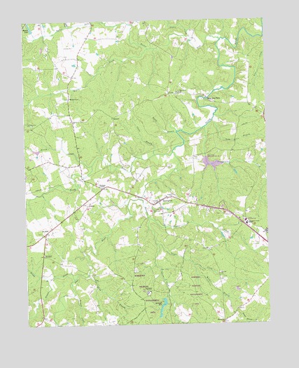
Buckingham, VA USGS Topographic Map
Click on map above to begin viewing in our Map Viewer.

This topographic map contains these locations and features:
Feature Name Type Latitude Longitude GNIS ID View Map
AlcomaPopulated PlaceN37.5488°W78.5922°1492454View Map
Beard BranchStreamN37.5782°W78.5456°1462905View Map
Bradshaw PondReservoirN37.6072°W78.5984°1463746View Map
Bryant CreekStreamN37.5429°W78.5611°1463961View Map
BuckinghamPopulated PlaceN37.5501°W78.5556°1498458View Map
Buckingham Community CemeteryCemeteryN37.5524°W78.5471°1501501View Map
Buckingham CountyCivilN37.5722°W78.5287°1501502View Map
Buckingham County High SchoolSchoolN37.5413°W78.5108°1464011View Map
Buckingham County Middle SchoolSchoolN37.5363°W78.5027°1501506View Map
Buckingham County Sheriff's OfficeBuildingN37.5509°W78.5566°2767081View Map
Buckingham Courthouse Census Designated PlaceCensusN37.5541°W78.5514°2584817View Map
Buckingham Courthouse Historic DistrictParkN37.5515°W78.5539°1501503View Map
Buckingham Post OfficePost OfficeN37.5496°W78.5557°1501508View Map
Buckingham Primary SchoolSchoolN37.5517°W78.5512°1501504View Map
Buckingham TabernacleChurchN37.5124°W78.5622°1464012View Map
Buckingham TabernacleChurchN37.5282°W78.6156°1464013View Map
Carter DamDamN37.6218°W78.6197°1489296View Map
Cooper CreekStreamN37.5326°W78.5575°1465221View Map
Crews BranchStreamN37.5690°W78.5572°1465430View Map
Dentons CornerPopulated PlaceN37.5557°W78.5845°1477258View Map
District 4CivilN37.5469°W78.5346°2390685View Map
Eastview Airport (historical)AirportN37.6143°W78.6036°1498605View Map
Enon CemeteryCemeteryN37.5065°W78.5169°1501525View Map
Enon ChurchChurchN37.5054°W78.5161°1466314View Map
Fork Union CemeteryCemeteryN37.5468°W78.5575°1501529View Map
Fork Union ChurchChurchN37.5463°W78.5583°1466785View Map
Forsip CreekStreamN37.5651°W78.5900°1466790View Map
Frisby BranchStreamN37.5188°W78.6122°1466898View Map
Grease CreekStreamN37.5182°W78.6003°1467414View Map
Horsepen CreekStreamN37.5515°W78.5647°1468299View Map
Horsepen Creek DamDamN37.5099°W78.5528°1489282View Map
Horsepen LakeReservoirN37.5093°W78.5539°1468237View Map
Horsepen State Wildlife Management AreaParkN37.5065°W78.5539°1501545View Map
KatrinePopulated PlaceN37.5849°W78.5781°1477455View Map
Licky BranchStreamN37.5196°W78.5931°1469422View Map
Little CreekStreamN37.6221°W78.6008°1469522View Map
Long BranchStreamN37.5832°W78.5272°1469779View Map
Lucas DamDamN37.5718°W78.6147°1489295View Map
Mount RushPopulated PlaceN37.5376°W78.6145°1477562View Map
Mount VincoPopulated PlaceN37.5924°W78.6014°1493322View Map
Mulberry Grove CemeteryCemeteryN37.5829°W78.6214°1501568View Map
Mulberry Grove ChurchChurchN37.5829°W78.6211°1471249View Map
New Mount VincoPopulated PlaceN37.5865°W78.6011°1501570View Map
North RiverStreamN37.5701°W78.5481°1471639View Map
Oak Hill ChurchChurchN37.5201°W78.5247°1471754View Map
Old Mount VincoPopulated PlaceN37.6096°W78.5967°1501576View Map
Pitman CreekStreamN37.5124°W78.5997°1472447View Map
Ripley CreekStreamN37.6124°W78.5595°1473236View Map
Slate River AirparkAirportN37.5451°W78.5871°2787190View Map
Slate River ChurchChurchN37.5946°W78.5442°1474675View Map
Slate River MillsLocaleN37.5910°W78.5294°1474676View Map
Slate River Number Two DamDamN37.5685°W78.5314°1489281View Map
Slate River School (historical)SchoolN37.5893°W78.5678°1501600View Map
Stadon CreekStreamN37.6154°W78.5375°1475047View Map
Trinity CemeteryCemeteryN37.5532°W78.5492°1501609View Map
Trinity ChurchChurchN37.5524°W78.5489°1475869View Map
Troublesome CreekStreamN37.5804°W78.5311°1475892View Map
Walton ForkStreamN37.6157°W78.5225°1476295View Map
Walton LakeReservoirN37.6224°W78.6210°1476296View Map
Warner BranchStreamN37.5238°W78.5381°1476341View Map
Wheatland AirportAirportN37.5576°W78.6211°1498607View Map

Note: Coordinates in the location and feature list above are referenced to NAD83 datum.


Copyright (C) 2008-2025 Ryan Niemi / Sunset Dynamics ... All Rights Reserved