TopoQuest Logo
Do you find TopoQuest useful?
Help keep TopoQuest running and adding new maps/features by donating!
Bitcoin:  19c7KJd3qBynnjoSw5npx9KScwjBe4ifkT
Litecoin:  LXs6TkuXGGXo1vDsWCkWVdjQX94eUKd6ui
Home View Maps Find Maps Find Places Resources & Links


Dillwyn, Virginia Topographic Map

USGS Map Title: Dillwyn, VA
USGS Map MRC: 37078E4
DRG (GeoTIFF) Download: o37078e4.tif


Neighboring USGS Topographic Map Quads:


  Glenmore, VA  
37078F5
 

  Diana Mills, VA  
37078F4
 

  Arvonia, VA  
37078F3
 

  Buckingham, VA  
37078E5
 

  Dillwyn, VA  
37078E4
 

  Gold Hill, VA  
37078E3
 

  Andersonville, VA  
37078D5
 

  Willis Mountain, VA  
37078D4
 

  Hillcrest, VA  
37078D3


Map MRC Location:

N38°
W79°
N38°
W78°
H8 H7 H6 H5 H4 H3 H2 H1
G8 G7 G6 G5 G4 G3 G2 G1
F8 F7 F6 F5 F4 F3 F2 F1
E8 E7 E6 E5 E4 E3 E2 E1
D8 D7 D6 D5 D4 D3 D2 D1
C8 C7 C6 C5 C4 C3 C2 C1
B8 B7 B6 B5 B4 B3 B2 B1
A8 A7 A6 A5 A4 A3 A2 A1
N37°
W79°
N37°
W78°

Dillwyn, VA USGS 1:24K Topographic Map Preview:
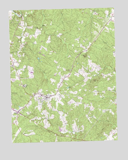
Dillwyn, VA USGS Topographic Map
Click on map above to begin viewing in our Map Viewer.

This topographic map contains these locations and features:
Feature Name Type Latitude Longitude GNIS ID View Map
Allen CemeteryCemeteryN37.5988°W78.4081°1462403View Map
AllenslevelPopulated PlaceN37.5618°W78.4894°1492460View Map
AlphaPopulated PlaceN37.5829°W78.4172°1492464View Map
Ayers CemeteryCemeteryN37.5871°W78.4908°1462632View Map
Bethlehem CemeteryCemeteryN37.5737°W78.4969°1501495View Map
Bethlehem ChurchChurchN37.5738°W78.4967°1463238View Map
Branch CemeteryCemeteryN37.5826°W78.4897°1463752View Map
Buckingham Correctional CenterBuildingN37.5665°W78.4752°2741356View Map
Buckingham County Volunteer Rescue Squad Station 19BuildingN37.5370°W78.4784°2086359View Map
Buffards MountainSummitN37.5810°W78.4106°1492671View Map
County CemeteryCemeteryN37.6176°W78.3764°1501516View Map
County ChurchChurchN37.6176°W78.3753°1465297View Map
Deep Bottom School (historical)SchoolN37.6099°W78.3875°1501518View Map
DillwynPopulated PlaceN37.5429°W78.4572°1492868View Map
Dillwyn Correctional CenterBuildingN37.5757°W78.4704°2741360View Map
Dillwyn Elementary SchoolSchoolN37.5662°W78.4750°1501521View Map
Dillwyn LakeReservoirN37.5510°W78.4323°1465807View Map
Dillwyn Post OfficePost OfficeN37.5459°W78.4657°1501522View Map
Dillwyn Primary SchoolSchoolN37.5444°W78.4720°1501523View Map
Dillwyn Volunteer Fire DepartmentBuildingN37.5408°W78.4762°2086354View Map
District 2CivilN37.5334°W78.4081°2390681View Map
Eldridge MillPopulated PlaceN37.6099°W78.4608°1492908View Map
Ellis SchoolSchoolN37.5546°W78.4847°1466252View Map
Flat CreekStreamN37.6218°W78.4908°1466650View Map
Gold Mine BranchStreamN37.5846°W78.4692°1467188View Map
Gold Mine CemeteryCemeteryN37.5082°W78.4856°1501536View Map
Gold Mine ChurchChurchN37.5082°W78.4861°1467189View Map
Hanes ChapelChurchN37.6082°W78.4672°1467704View Map
Johnson StationLocaleN37.6238°W78.3997°1468804View Map
Kennedys DamDamN37.5818°W78.4664°1489286View Map
Kennedys PondReservoirN37.5818°W78.4664°1489287View Map
Lick BranchStreamN37.6015°W78.4850°1469387View Map
Mount Olive ChurchChurchN37.5435°W78.4750°1470970View Map
Mourning Valley CemeteryCemeteryN37.6121°W78.4883°1501566View Map
Mourning Valley ChurchChurchN37.6129°W78.4878°1471207View Map
Mourning Valley School (historical)SchoolN37.6068°W78.4925°1501567View Map
Newton CemeteryCemeteryN37.5504°W78.4275°1501572View Map
Peyton CreekStreamN37.5904°W78.4822°1472245View Map
Rocky Mount CemeteryCemeteryN37.5674°W78.4281°1501589View Map
Rocky Mount ChurchChurchN37.5676°W78.4289°1473470View Map
RosneyPopulated PlaceN37.5093°W78.4253°1493507View Map
Rosney CreekStreamN37.5099°W78.4417°1473556View Map
Shepherd CemeteryCemeteryN37.5551°W78.4417°1501596View Map
Sprouses CornerPopulated PlaceN37.5293°W78.4919°1493647View Map
The RidgeRidgeN37.5074°W78.3944°1475606View Map
Thomas CemeteryCemeteryN37.5663°W78.4169°1501606View Map
Thomas-Oliver School (historical)SchoolN37.5640°W78.4072°1501607View Map
Tower BranchStreamN37.5682°W78.3894°1475800View Map
Tower HillSummitN37.5571°W78.3978°1475802View Map
Town of DillwynCivilN37.5411°W78.4613°2390148View Map
Virginia State Police Division 3 Area 19 OfficeBuildingN37.5307°W78.4965°2767149View Map
Wade CemeteryCemeteryN37.5754°W78.4219°1476210View Map
Ward CemeteryCemeteryN37.5218°W78.4722°1476310View Map
Whitlock CemeteryCemeteryN37.5876°W78.3864°1476687View Map
Willis River Number 5e DamDamN37.5101°W78.4414°1489273View Map
Woodson High SchoolSchoolN37.5529°W78.4839°1476975View Map

Note: Coordinates in the location and feature list above are referenced to NAD83 datum.


Copyright (C) 2008-2024 Ryan Niemi / Sunset Dynamics ... All Rights Reserved