TopoQuest Logo
Do you find TopoQuest useful?
Help keep TopoQuest running and adding new maps/features by donating!
Bitcoin:  19c7KJd3qBynnjoSw5npx9KScwjBe4ifkT
Litecoin:  LXs6TkuXGGXo1vDsWCkWVdjQX94eUKd6ui
Home View Maps Find Maps Find Places Resources & Links


Saint Joy, Virginia Topographic Map

USGS Map Title: Saint Joy, VA
USGS Map MRC: 37078E6
DRG (GeoTIFF) Download: o37078e6.tif


Neighboring USGS Topographic Map Quads:


  Shipman, VA  
37078F7
 

  Howardsville, VA  
37078F6
 

  Glenmore, VA  
37078F5
 

  Gladstone, VA  
37078E7
 

  Saint Joy, VA  
37078E6
 

  Buckingham, VA  
37078E5
 

  Vera, VA  
37078D7
 

  Holiday Lake, VA  
37078D6
 

  Andersonville, VA  
37078D5


Map MRC Location:

N38°
W79°
N38°
W78°
H8 H7 H6 H5 H4 H3 H2 H1
G8 G7 G6 G5 G4 G3 G2 G1
F8 F7 F6 F5 F4 F3 F2 F1
E8 E7 E6 E5 E4 E3 E2 E1
D8 D7 D6 D5 D4 D3 D2 D1
C8 C7 C6 C5 C4 C3 C2 C1
B8 B7 B6 B5 B4 B3 B2 B1
A8 A7 A6 A5 A4 A3 A2 A1
N37°
W79°
N37°
W78°

Saint Joy, VA USGS 1:24K Topographic Map Preview:
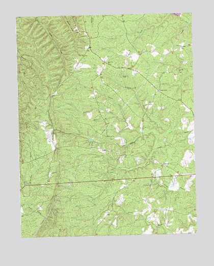
Saint Joy, VA USGS Topographic Map
Click on map above to begin viewing in our Map Viewer.

This topographic map contains these locations and features:
Feature Name Type Latitude Longitude GNIS ID View Map
Antioch ChurchChurchN37.5443°W78.6742°1462510View Map
Austin CreekStreamN37.5554°W78.6497°1462624View Map
Bagby ChurchChurchN37.5790°W78.7256°1462671View Map
Commonwealth of VirginiaCivilN37.5109°W78.6664°1779803View Map
District 5CivilN37.5881°W78.6770°2390687View Map
District 5, James River (historical)CivilN37.5918°W78.6750°1927357View Map
Dolittle CreekStreamN37.5574°W78.6620°1465880View Map
Gladstone ChurchChurchN37.5479°W78.6897°1467125View Map
Goodloe LakeReservoirN37.5096°W78.6803°1467225View Map
Horse BranchStreamN37.5660°W78.6789°1468256View Map
Maple Grove ChurchChurchN37.6021°W78.7008°1470073View Map
Mathews CreekStreamN37.5579°W78.6420°1470183View Map
Meadow CreekStreamN37.5554°W78.6497°1470309View Map
Mount Tabor ChurchChurchN37.5971°W78.6842°1471078View Map
Ragland LakeReservoirN37.5900°W78.6752°1472941View Map
Saint JoyPopulated PlaceN37.5388°W78.6470°1477711View Map
Saint Joy CemeteryCemeteryN37.5351°W78.6497°1501590View Map
Saint Joy School (historical)SchoolN37.5215°W78.6592°1501591View Map
Sawmill CreekStreamN37.5643°W78.6739°1474074View Map
Union Grove ChurchChurchN37.6057°W78.6322°1476067View Map
Union Grove School (historical)SchoolN37.6057°W78.6333°1501612View Map
Union Hill ChurchChurchN37.5915°W78.6342°1476079View Map
Woods CornerPopulated PlaceN37.5813°W78.6489°1477896View Map

Note: Coordinates in the location and feature list above are referenced to NAD83 datum.


Copyright (C) 2008-2024 Ryan Niemi / Sunset Dynamics ... All Rights Reserved