TopoQuest Logo
Do you find TopoQuest useful?
Help keep TopoQuest running and adding new maps/features by donating!
Bitcoin:  19c7KJd3qBynnjoSw5npx9KScwjBe4ifkT
Litecoin:  LXs6TkuXGGXo1vDsWCkWVdjQX94eUKd6ui
Home View Maps Find Maps Find Places Resources & Links


Conway, Mississippi Topographic Map

USGS Map Title: Conway, MS
USGS Map MRC: 32089G5
DRG (GeoTIFF) Download: o32089g5.tif


Neighboring USGS Topographic Map Quads:


  Joseph, MS  
32089H6
 

  Singleton, MS  
32089H5
 

  Zama, MS  
32089H4
 

  Thomastown, MS  
32089G6
 

  Conway, MS  
32089G5
 

  Renfroe, MS  
32089G4
 

  Ofahoma, MS  
32089F6
 

  Carthage, MS  
32089F5
 

  McAfee, MS  
32089F4


Map MRC Location:

N33°
W90°
N33°
W89°
H8 H7 H6 H5 H4 H3 H2 H1
G8 G7 G6 G5 G4 G3 G2 G1
F8 F7 F6 F5 F4 F3 F2 F1
E8 E7 E6 E5 E4 E3 E2 E1
D8 D7 D6 D5 D4 D3 D2 D1
C8 C7 C6 C5 C4 C3 C2 C1
B8 B7 B6 B5 B4 B3 B2 B1
A8 A7 A6 A5 A4 A3 A2 A1
N32°
W90°
N32°
W89°

Conway, MS USGS 1:24K Topographic Map Preview:
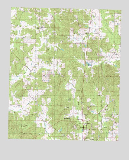
Conway, MS USGS Topographic Map
Click on map above to begin viewing in our Map Viewer.

This topographic map contains these locations and features:
Feature Name Type Latitude Longitude GNIS ID View Map
Bell BranchStreamN32.8546°W89.5137°666770View Map
Bethel CemeteryCemeteryN32.8107°W89.5640°707063View Map
Bethel ChurchChurchN32.8099°W89.5642°666922View Map
Bilbro Lake DamDamN32.7568°W89.5651°681627View Map
Carthage Fire DepaermentBuildingN32.7503°W89.5391°2665660View Map
Carthage-Leake County AirportAirportN32.7580°W89.5293°680353View Map
Center Hill ChurchChurchN32.8554°W89.5923°691098View Map
Center Hill ChurchChurchN32.8607°W89.5876°691099View Map
ConwayPopulated PlaceN32.8562°W89.5901°668773View Map
Damascus ChurchChurchN32.8318°W89.5034°707081View Map
HopocaPopulated PlaceN32.8343°W89.5065°691942View Map
Indian Agency Lake DamDamN32.7885°W89.5501°681652View Map
Leake CountyCivilN32.7535°W89.5240°695763View Map
McDonald Ponds DamDamN32.7618°W89.5417°681632View Map
Mount Bethel Church (historical)ChurchN32.7990°W89.5231°691152View Map
Mount Olive ChurchChurchN32.7974°W89.6026°674139View Map
Mount Zion CemeteryCemeteryN32.7746°W89.5384°707127View Map
Mount Zion ChurchChurchN32.7746°W89.5378°674366View Map
New Providence CemeteryCemeteryN32.7949°W89.6109°707130View Map
New Providence ChurchChurchN32.7932°W89.6115°674821View Map
Pleasant Grove CemeteryCemeteryN32.8507°W89.5395°707138View Map
Pleasant Grove ChurchChurchN32.8515°W89.5401°676018View Map
R and R Processing Plant Lagoon DamDamN32.8235°W89.5334°681679View Map
RedwaterPopulated PlaceN32.7668°W89.5367°676553View Map
Redwater Census Designated PlaceCensusN32.7835°W89.5559°2403467View Map
Scott CemeteryCemeteryN32.8324°W89.5034°677471View Map
Supervisor District 2CivilN32.8417°W89.5485°711949View Map
Zion Hill CemeteryCemeteryN32.7815°W89.5340°707183View Map
Zion Hill ChurchChurchN32.7812°W89.5337°680026View Map

Note: Coordinates in the location and feature list above are referenced to NAD83 datum.


Copyright (C) 2008-2025 Ryan Niemi / Sunset Dynamics ... All Rights Reserved