TopoQuest Logo
Do you find TopoQuest useful?
Help keep TopoQuest running and adding new maps/features by donating!
Bitcoin:  19c7KJd3qBynnjoSw5npx9KScwjBe4ifkT
Litecoin:  LXs6TkuXGGXo1vDsWCkWVdjQX94eUKd6ui
Home View Maps Find Maps Find Places Resources & Links


Joseph, Mississippi Topographic Map

USGS Map Title: Joseph, MS
USGS Map MRC: 32089H6
DRG (GeoTIFF) Download: o32089h6.tif


Neighboring USGS Topographic Map Quads:


  Durant, MS  
33089A7
 

  McAdams, MS  
33089A6
 

  Kosciusko, MS  
33089A5
 

  Newport, MS  
32089H7
 

  Joseph, MS  
32089H6
 

  Singleton, MS  
32089H5
 

  Camden, MS  
32089G7
 

  Thomastown, MS  
32089G6
 

  Conway, MS  
32089G5


Map MRC Location:

N33°
W90°
N33°
W89°
H8 H7 H6 H5 H4 H3 H2 H1
G8 G7 G6 G5 G4 G3 G2 G1
F8 F7 F6 F5 F4 F3 F2 F1
E8 E7 E6 E5 E4 E3 E2 E1
D8 D7 D6 D5 D4 D3 D2 D1
C8 C7 C6 C5 C4 C3 C2 C1
B8 B7 B6 B5 B4 B3 B2 B1
A8 A7 A6 A5 A4 A3 A2 A1
N32°
W90°
N32°
W89°

Joseph, MS USGS 1:24K Topographic Map Preview:
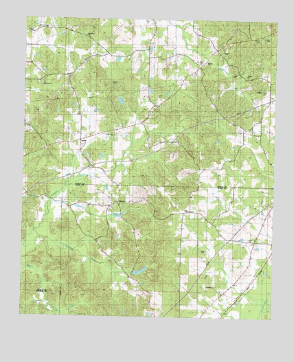
Joseph, MS USGS Topographic Map
Click on map above to begin viewing in our Map Viewer.

This topographic map contains these locations and features:
Feature Name Type Latitude Longitude GNIS ID View Map
BolatushaPopulated PlaceN32.9229°W89.7023°691717View Map
Cedar Grove Baptist ChurchChurchN32.9515°W89.7054°668199View Map
Cow Barn School (historical)SchoolN32.9246°W89.7398°710864View Map
Ellington CemeteryCemeteryN32.9946°W89.7462°669731View Map
Fisher CreekStreamN32.9226°W89.7356°669994View Map
Galilee ChurchChurchN32.9193°W89.6667°670297View Map
Hallbrook Lake DamDamN32.9635°W89.7101°681763View Map
Harmon CemeteryCemeteryN32.9721°W89.7409°670920View Map
Hill Springs CemeteryCemeteryN32.9962°W89.7170°710894View Map
Hill Springs ChurchChurchN32.9932°W89.7195°671212View Map
Hinds CreekStreamN32.8799°W89.7362°671233View Map
Jenkins CemeteryCemeteryN32.9679°W89.6842°671832View Map
Jones Lake DamDamN32.9418°W89.7117°681751View Map
JosephPopulated PlaceN32.9757°W89.7279°672034View Map
Joseph School (historical)SchoolN32.9801°W89.6890°710904View Map
Landrum CreekStreamN32.9049°W89.7490°672295View Map
Malett CemeteryCemeteryN32.9826°W89.6637°673096View Map
Malett School (historical)SchoolN32.9818°W89.6962°710920View Map
Merchant CreekStreamN32.8796°W89.6254°673480View Map
Morgan School (historical)SchoolN32.9618°W89.7223°710931View Map
Nash CemeteryCemeteryN32.9076°W89.6378°674510View Map
Palestine ChurchChurchN32.9821°W89.6595°675398View Map
Russell CemeteryCemeteryN32.9732°W89.7065°676966View Map
Rutherford (historical)Populated PlaceN32.9424°W89.7473°710990View Map
Samarra CemeteryCemeteryN32.9865°W89.6506°677311View Map
Shelley CemeteryCemeteryN32.9715°W89.6331°677642View Map
Shelley CemeteryCemeteryN32.9765°W89.6390°677643View Map
Skeen CemeteryCemeteryN32.9704°W89.6295°677861View Map
Thomastown ChurchChurchN32.8874°W89.6542°678688View Map
Tom Bell Pond DamDamN32.8751°W89.7034°681717View Map
Wright CemeteryCemeteryN32.9032°W89.6606°679891View Map
ZemulyPopulated PlaceN32.9493°W89.7217°679980View Map
Zemuly ChurchChurchN32.9487°W89.7223°710187View Map
Zemuly School (historical)SchoolN32.9485°W89.7223°710188View Map

Note: Coordinates in the location and feature list above are referenced to NAD83 datum.


Copyright (C) 2008-2024 Ryan Niemi / Sunset Dynamics ... All Rights Reserved