TopoQuest Logo
Do you find TopoQuest useful?
Help keep TopoQuest running and adding new maps/features by donating!
Bitcoin:  19c7KJd3qBynnjoSw5npx9KScwjBe4ifkT
Litecoin:  LXs6TkuXGGXo1vDsWCkWVdjQX94eUKd6ui
Home View Maps Find Maps Find Places Resources & Links


Crawfordsville, Arkansas Topographic Map

USGS Map Title: Crawfordsville, AR
USGS Map MRC: 35090B3
DRG (GeoTIFF) Download: o35090b3.tif


Neighboring USGS Topographic Map Quads:


  Earle, AR  
35090C4
 

  Heafer, AR  
35090C3
 

  Jericho, AR  
35090C2
 

  Jeanette, AR  
35090B4
 

  Crawfordsville, AR  
35090B3
 

  West Memphis, AR  
35090B2
 

  Chatfield, AR  
35090A4
 

  Edmondson, AR  
35090A3
 

  Fletcher Lake, AR  
35090A2


Map MRC Location:

N36°
W91°
N36°
W90°
H8 H7 H6 H5 H4 H3 H2 H1
G8 G7 G6 G5 G4 G3 G2 G1
F8 F7 F6 F5 F4 F3 F2 F1
E8 E7 E6 E5 E4 E3 E2 E1
D8 D7 D6 D5 D4 D3 D2 D1
C8 C7 C6 C5 C4 C3 C2 C1
B8 B7 B6 B5 B4 B3 B2 B1
A8 A7 A6 A5 A4 A3 A2 A1
N35°
W91°
N35°
W90°

Crawfordsville, AR USGS 1:24K Topographic Map Preview:
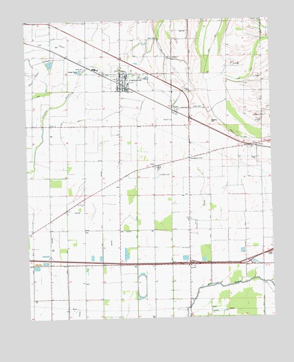
Crawfordsville, AR USGS Topographic Map
Click on map above to begin viewing in our Map Viewer.

This topographic map contains these locations and features:
Feature Name Type Latitude Longitude GNIS ID View Map
Alligator BayouStreamN35.1734°W90.3748°70431View Map
Bethel CemeteryCemeteryN35.2298°W90.3445°67741View Map
Burning Bush ChurchChurchN35.1326°W90.2920°47202View Map
Corinthian CemeteryCemeteryN35.2345°W90.3006°48056View Map
Corinthian ChurchChurchN35.2345°W90.3009°48057View Map
CrawfordsvillePopulated PlaceN35.2251°W90.3251°57604View Map
Crawfordsville Elementary SchoolSchoolN35.2297°W90.3402°67754View Map
Crawfordsville High SchoolSchoolN35.2295°W90.3389°67755View Map
Crawfordsville Volunteer Fire StationBuildingN35.2264°W90.3262°2116324View Map
Crittenden CountyCivilN35.2079°W90.3089°69162View Map
Crittenden County LandfillLocaleN35.1369°W90.2589°2726751View Map
Cunningham CornerPopulated PlaceN35.1918°W90.2918°67798View Map
Ditch Number 10CanalN35.1545°W90.2640°82032View Map
Ditch Number 10CanalN35.2490°W90.2912°82041View Map
Ditch Number 11CanalN35.1570°W90.2818°82048View Map
Ditch Number 12CanalN35.1390°W90.2684°82059View Map
Ditch Number 14CanalN35.1376°W90.3018°82085View Map
Ditch Number 15CanalN35.1370°W90.3195°82092View Map
Ditch Number 16CanalN35.1356°W90.3368°82100View Map
Ditch Number 18CanalN35.1851°W90.3362°82113View Map
Ditch Number 18CanalN35.1354°W90.3554°82119View Map
Ditch Number 19CanalN35.1798°W90.3551°82123View Map
Ditch Number 5CanalN35.2259°W90.2609°82291View Map
Ditch Number 5CanalN35.2493°W90.3457°82292View Map
Ditch Number 9CanalN35.2481°W90.2740°82416View Map
Ebenezer ChurchChurchN35.2084°W90.3012°48806View Map
EbonyPopulated PlaceN35.1976°W90.2615°76851View Map
Ebony SchoolSchoolN35.1918°W90.2576°48809View Map
Garant BayouStreamN35.1529°W90.2820°49333View Map
Interchange 271CrossingN35.1479°W90.2926°59025View Map
Interchange 273CrossingN35.1484°W90.2623°59026View Map
Jackson ChapelChurchN35.1762°W90.2526°50562View Map
JuliusPopulated PlaceN35.1893°W90.3073°58003View Map
LehiPopulated PlaceN35.1473°W90.2926°58052View Map
Lehi SchoolSchoolN35.1412°W90.2920°51059View Map
Mays CemeteryCemeteryN35.2454°W90.2922°51770View Map
McNeil SchoolSchoolN35.2323°W90.3462°51875View Map
Mount Olive Church (historical)ChurchN35.1879°W90.2812°70240View Map
Mount Zion ChurchChurchN35.2079°W90.2554°52479View Map
New Lehi ChurchChurchN35.1573°W90.2929°52709View Map
Raspberry CemeteryCemeteryN35.2074°W90.2805°53900View Map
Reynold Grove ChurchChurchN35.1548°W90.2554°53995View Map
Roberta Island SchoolSchoolN35.2073°W90.2543°54068View Map
Saint Johns CemeteryCemeteryN35.2273°W90.3344°54359View Map
Saint Johns ChurchChurchN35.2270°W90.3348°54366View Map
Saint Stephens CemeteryCemeteryN35.1876°W90.3031°54476View Map
Shiloh CemeteryCemeteryN35.2068°W90.3626°54776View Map
Shiloh ChurchChurchN35.2068°W90.3626°54795View Map
Solomon's Temple ChurchChurchN35.2206°W90.3012°55001View Map
Solomons Temple School (historical)SchoolN35.2206°W90.3004°1730610View Map
Town of CrawfordsvilleCivilN35.2266°W90.3244°2406334View Map
Township of JacksonCivilN35.2062°W90.3345°68748View Map
Trexler CemeteryCemeteryN35.2426°W90.3079°55645View Map
VincentPopulated PlaceN35.2123°W90.3009°58805View Map
Vincent CemeteryCemeteryN35.2200°W90.2910°77000View Map

Note: Coordinates in the location and feature list above are referenced to NAD83 datum.


Copyright (C) 2008-2025 Ryan Niemi / Sunset Dynamics ... All Rights Reserved