TopoQuest Logo
Do you find TopoQuest useful?
Help keep TopoQuest running and adding new maps/features by donating!
Bitcoin:  19c7KJd3qBynnjoSw5npx9KScwjBe4ifkT
Litecoin:  LXs6TkuXGGXo1vDsWCkWVdjQX94eUKd6ui
Home View Maps Find Maps Find Places Resources & Links


Anniston, Missouri Topographic Map

USGS Map Title: Anniston, MO
USGS Map MRC: 36089G3
DRG (GeoTIFF) Download: o36089g3.tif


Neighboring USGS Topographic Map Quads:


  Bertrand, MO  
36089H4
 

  Charleston, MO  
36089H3
 

  Wyatt, MO  
36089H2
 

  East Prairie, MO  
36089G4
 

  Anniston, MO  
36089G3
 

  Wickliffe SW, MO  
36089G2
 

  Henderson Mound, MO  
36089F4
 

  Bayouville, MO  
36089F3
 

  Wolf Island, MO  
36089F2


Map MRC Location:

N37°
W90°
N37°
W89°
H8 H7 H6 H5 H4 H3 H2 H1
G8 G7 G6 G5 G4 G3 G2 G1
F8 F7 F6 F5 F4 F3 F2 F1
E8 E7 E6 E5 E4 E3 E2 E1
D8 D7 D6 D5 D4 D3 D2 D1
C8 C7 C6 C5 C4 C3 C2 C1
B8 B7 B6 B5 B4 B3 B2 B1
A8 A7 A6 A5 A4 A3 A2 A1
N36°
W90°
N36°
W89°

Anniston, MO USGS 1:24K Topographic Map Preview:
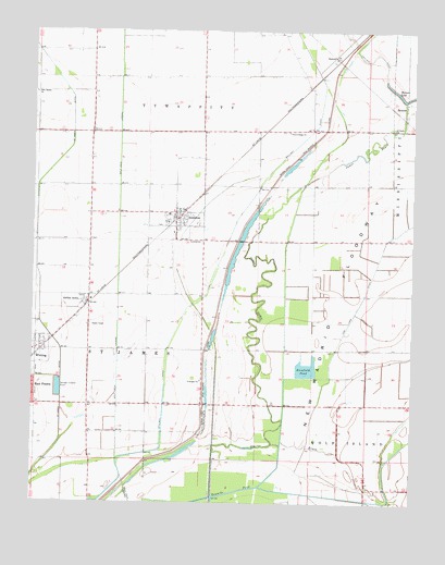
Anniston, MO USGS Topographic Map
Click on map above to begin viewing in our Map Viewer.

This topographic map contains these locations and features:
Feature Name Type Latitude Longitude GNIS ID View Map
Airline AcresPopulated PlaceN36.8034°W89.3581°713175View Map
AnnistonPopulated PlaceN36.8259°W89.3279°713304View Map
Anniston Fire DepartmentBuildingN36.8249°W89.3269°2621027View Map
Anniston Police DepartmentBuildingN36.8243°W89.3307°2752174View Map
Anniston Post OfficePost OfficeN36.8243°W89.3280°2782791View Map
Black BayouGutN36.7651°W89.2970°714283View Map
Calhoun Cemetery (historical)CemeteryN36.7673°W89.3192°747752View Map
Concord Church (historical)ChurchN36.8626°W89.3195°747746View Map
Concord SchoolSchoolN36.8698°W89.3195°747749View Map
Fish Lake DitchCanalN36.8695°W89.2626°717945View Map
Fox School (historical)SchoolN36.8695°W89.3562°747745View Map
Gravel Ridge ChurchChurchN36.8484°W89.2909°718742View Map
HensonPopulated PlaceN36.8562°W89.2526°740924View Map
Henson LakeLakeN36.8591°W89.2563°735644View Map
Henson School (historical)SchoolN36.8564°W89.2523°747750View Map
Howletts (historical)LocaleN36.8595°W89.2856°740282View Map
James BayouStreamN36.7657°W89.2957°720242View Map
KYMO-AM (East Prairie)TowerN36.7951°W89.3548°759198View Map
Mississippi CountyCivilN36.8281°W89.2912°758521View Map
Mississippi County AirportAirportN36.8387°W89.3578°758635View Map
New Bethel ChurchChurchN36.8584°W89.3745°723182View Map
PulltightPopulated PlaceN36.7826°W89.3192°730314View Map
Pulltight ChurchChurchN36.7823°W89.3192°735811View Map
Ricefield PondReservoirN36.7856°W89.2848°765586View Map
Ricefield Pond DamDamN36.7834°W89.2884°765585View Map
Saint James DitchCanalN36.7764°W89.3656°725755View Map
Saint Pauls ChurchChurchN36.8492°W89.2565°725879View Map
SamosPopulated PlaceN36.8681°W89.2765°741236View Map
Town of AnnistonCivilN36.8243°W89.3267°2397433View Map
Travel Rest School (historical)SchoolN36.8189°W89.3009°747751View Map
Vater (historical)LocaleN36.8187°W89.3362°747748View Map
WhitingPopulated PlaceN36.7889°W89.3740°728795View Map
Wolf Hole LateralCanalN36.8748°W89.3465°729060View Map
Wolf Hole LateralCanalN36.8242°W89.3467°729061View Map
Woolridge SchoolSchoolN36.8198°W89.3559°747747View Map

Note: Coordinates in the location and feature list above are referenced to NAD83 datum.


Copyright (C) 2008-2024 Ryan Niemi / Sunset Dynamics ... All Rights Reserved