TopoQuest Logo
Do you find TopoQuest useful?
Help keep TopoQuest running and adding new maps/features by donating!
Bitcoin:  19c7KJd3qBynnjoSw5npx9KScwjBe4ifkT
Litecoin:  LXs6TkuXGGXo1vDsWCkWVdjQX94eUKd6ui
Home View Maps Find Maps Find Places Resources & Links


Bertrand, Missouri Topographic Map

USGS Map Title: Bertrand, MO
USGS Map MRC: 36089H4
DRG (GeoTIFF) Download: o36089h4.tif


Neighboring USGS Topographic Map Quads:


  Morley, MO  
37089A5
 

  Thebes SW, MO  
37089A4
 

  Cache, IL  
37089A3
 

  Sikeston North, MO  
36089H5
 

  Bertrand, MO  
36089H4
 

  Charleston, MO  
36089H3
 

  Sikeston South, MO  
36089G5
 

  East Prairie, MO  
36089G4
 

  Anniston, MO  
36089G3


Map MRC Location:

N37°
W90°
N37°
W89°
H8 H7 H6 H5 H4 H3 H2 H1
G8 G7 G6 G5 G4 G3 G2 G1
F8 F7 F6 F5 F4 F3 F2 F1
E8 E7 E6 E5 E4 E3 E2 E1
D8 D7 D6 D5 D4 D3 D2 D1
C8 C7 C6 C5 C4 C3 C2 C1
B8 B7 B6 B5 B4 B3 B2 B1
A8 A7 A6 A5 A4 A3 A2 A1
N36°
W90°
N36°
W89°

Bertrand, MO USGS 1:24K Topographic Map Preview:
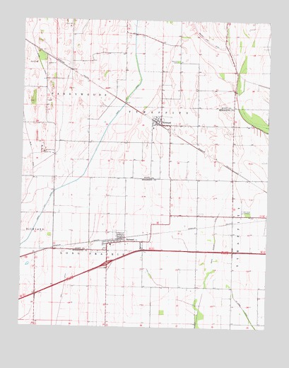
Bertrand, MO USGS Topographic Map
Click on map above to begin viewing in our Map Viewer.

This topographic map contains these locations and features:
Feature Name Type Latitude Longitude GNIS ID View Map
Austin SwitchLocaleN36.9687°W89.4531°740071View Map
Bement SchoolSchoolN36.8773°W89.4929°747726View Map
BertrandPopulated PlaceN36.9095°W89.4526°714002View Map
Bertrand Fire DepartmentBuildingN36.9096°W89.4454°2621228View Map
Bertrand Post OfficePost OfficeN36.9094°W89.4537°2782950View Map
BuckeyePopulated PlaceN36.9045°W89.4926°739879View Map
City of BertrandCivilN36.9085°W89.4498°2394153View Map
DiehlstadtPopulated PlaceN36.9584°W89.4309°716891View Map
Diehlstadt School (historical)SchoolN36.9789°W89.4212°747727View Map
Lemons School (historical)SchoolN36.9948°W89.4415°730425View Map
Maynard CemeteryCemeteryN36.9837°W89.4217°722015View Map
Muddy DitchCanalN36.9873°W89.4945°723041View Map
Never Spur (historical)Populated PlaceN36.9131°W89.4340°739880View Map
North Cut DitchCanalN36.9864°W89.4437°723439View Map
Oak Grove CemeteryCemeteryN36.9228°W89.3859°735758View Map
PorterPopulated PlaceN36.9803°W89.4776°739878View Map
Russell School (historical)SchoolN36.9245°W89.3923°747728View Map
Sand Pit Spur (historical)LocaleN36.9850°W89.4876°740292View Map
Township of Long PrairieCivilN36.8767°W89.4560°767024View Map
Village of DiehlstadtCivilN36.9593°W89.4323°2398722View Map

Note: Coordinates in the location and feature list above are referenced to NAD83 datum.


Copyright (C) 2008-2025 Ryan Niemi / Sunset Dynamics ... All Rights Reserved