TopoQuest Logo
Do you find TopoQuest useful?
Help keep TopoQuest running and adding new maps/features by donating!
Bitcoin:  19c7KJd3qBynnjoSw5npx9KScwjBe4ifkT
Litecoin:  LXs6TkuXGGXo1vDsWCkWVdjQX94eUKd6ui
Home View Maps Find Maps Find Places Resources & Links


Henderson Mound, Missouri Topographic Map

USGS Map Title: Henderson Mound, MO
USGS Map MRC: 36089F4
DRG (GeoTIFF) Download: o36089f4.tif


Neighboring USGS Topographic Map Quads:


  Sikeston South, MO  
36089G5
 

  East Prairie, MO  
36089G4
 

  Anniston, MO  
36089G3
 

  Kewanee, MO  
36089F5
 

  Henderson Mound, MO  
36089F4
 

  Bayouville, MO  
36089F3
 

  New Madrid, MO  
36089E5
 

  Hubbard Lake, MO  
36089E4
 

  Bondurant, KY  
36089E3


Map MRC Location:

N37°
W90°
N37°
W89°
H8 H7 H6 H5 H4 H3 H2 H1
G8 G7 G6 G5 G4 G3 G2 G1
F8 F7 F6 F5 F4 F3 F2 F1
E8 E7 E6 E5 E4 E3 E2 E1
D8 D7 D6 D5 D4 D3 D2 D1
C8 C7 C6 C5 C4 C3 C2 C1
B8 B7 B6 B5 B4 B3 B2 B1
A8 A7 A6 A5 A4 A3 A2 A1
N36°
W90°
N36°
W89°

Henderson Mound, MO USGS 1:24K Topographic Map Preview:
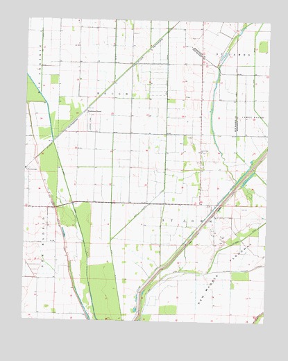
Henderson Mound, MO USGS Topographic Map
Click on map above to begin viewing in our Map Viewer.

This topographic map contains these locations and features:
Feature Name Type Latitude Longitude GNIS ID View Map
Barnes CemeteryCemeteryN36.6605°W89.3964°713666View Map
Barnes RidgeRidgeN36.6792°W89.4012°730296View Map
Barnes Ridge ChurchChurchN36.6953°W89.4095°713677View Map
Barnes Ridge SchoolSchoolN36.6689°W89.4015°746828View Map
Black BayouStreamN36.6839°W89.3904°739567View Map
Coal Oil DitchCanalN36.6617°W89.4295°716037View Map
Cole CemeteryCemeteryN36.6723°W89.3884°716095View Map
Ditch Number 10CanalN36.7484°W89.4548°755055View Map
Henderson MoundLocaleN36.7117°W89.4687°731579View Map
Henderson Mounds E B G AirportAirportN36.7097°W89.4637°758664View Map
Huff SchoolSchoolN36.7176°W89.4681°746826View Map
Peck and Imhoff (historical)LocaleN36.7381°W89.4370°740414View Map
Pioneer (historical)LocaleN36.7034°W89.4801°740413View Map
SelkirkPopulated PlaceN36.7239°W89.4548°740081View Map
Township of HoughCivilN36.7169°W89.4555°767062View Map
Walnut Grove SchoolSchoolN36.7137°W89.4090°746827View Map

Note: Coordinates in the location and feature list above are referenced to NAD83 datum.


Copyright (C) 2008-2024 Ryan Niemi / Sunset Dynamics ... All Rights Reserved