TopoQuest Logo
Do you find TopoQuest useful?
Help keep TopoQuest running and adding new maps/features by donating!
Bitcoin:  19c7KJd3qBynnjoSw5npx9KScwjBe4ifkT
Litecoin:  LXs6TkuXGGXo1vDsWCkWVdjQX94eUKd6ui
Home View Maps Find Maps Find Places Resources & Links


East Prairie, Missouri Topographic Map

USGS Map Title: East Prairie, MO
USGS Map MRC: 36089G4
DRG (GeoTIFF) Download: o36089g4.tif


Neighboring USGS Topographic Map Quads:


  Sikeston North, MO  
36089H5
 

  Bertrand, MO  
36089H4
 

  Charleston, MO  
36089H3
 

  Sikeston South, MO  
36089G5
 

  East Prairie, MO  
36089G4
 

  Anniston, MO  
36089G3
 

  Kewanee, MO  
36089F5
 

  Henderson Mound, MO  
36089F4
 

  Bayouville, MO  
36089F3


Map MRC Location:

N37°
W90°
N37°
W89°
H8 H7 H6 H5 H4 H3 H2 H1
G8 G7 G6 G5 G4 G3 G2 G1
F8 F7 F6 F5 F4 F3 F2 F1
E8 E7 E6 E5 E4 E3 E2 E1
D8 D7 D6 D5 D4 D3 D2 D1
C8 C7 C6 C5 C4 C3 C2 C1
B8 B7 B6 B5 B4 B3 B2 B1
A8 A7 A6 A5 A4 A3 A2 A1
N36°
W90°
N36°
W89°

East Prairie, MO USGS 1:24K Topographic Map Preview:
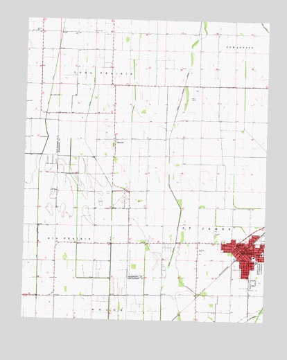
East Prairie, MO USGS Topographic Map
Click on map above to begin viewing in our Map Viewer.

This topographic map contains these locations and features:
Feature Name Type Latitude Longitude GNIS ID View Map
Armour CemeteryCemeteryN36.8703°W89.4609°713386View Map
Armour SchoolSchoolN36.8692°W89.4595°747736View Map
Ash DitchCanalN36.8101°W89.4929°713417View Map
Bement ChurchChurchN36.8701°W89.4956°713940View Map
Bridges ChurchChurchN36.8689°W89.4012°747742View Map
Bridges SchoolSchoolN36.8692°W89.4001°747741View Map
Cades School (historical)SchoolN36.7823°W89.4809°747739View Map
City of East PrairieCivilN36.7790°W89.3842°2394606View Map
DefieldLocaleN36.7603°W89.4098°740359View Map
DogwoodPopulated PlaceN36.8253°W89.4537°739985View Map
Dogwood CemeteryCemeteryN36.8231°W89.4547°2702461View Map
Dogwood ChurchChurchN36.8245°W89.4540°747738View Map
Dogwood School (historical)SchoolN36.8326°W89.4545°747737View Map
Doyle SchoolSchoolN36.7820°W89.3892°717038View Map
East PrairiePopulated PlaceN36.7798°W89.3856°717337View Map
East Prairie Fire DepartmentBuildingN36.7809°W89.3880°2621078View Map
East Prairie Police DepartmentBuildingN36.7811°W89.3870°2752328View Map
East Prairie Post OfficePost OfficeN36.7795°W89.3872°2782962View Map
Harriman SchoolSchoolN36.7712°W89.4004°747744View Map
Lower Dogwood SchoolSchoolN36.7964°W89.4370°747743View Map
Maple Slough DitchCanalN36.8098°W89.4248°721842View Map
Martin SchoolSchoolN36.7781°W89.3765°721935View Map
Miller Church (historical)ChurchN36.8262°W89.3992°1669617View Map
Miller School (historical)SchoolN36.8262°W89.3992°766190View Map
Township of Saint JamesCivilN36.7882°W89.3761°767027View Map
Union Grove Church (historical)ChurchN36.7606°W89.4556°730291View Map
Webb SchoolSchoolN36.7770°W89.3804°728463View Map
Yellow Dog SchoolSchoolN36.7598°W89.4540°747740View Map

Note: Coordinates in the location and feature list above are referenced to NAD83 datum.


Copyright (C) 2008-2025 Ryan Niemi / Sunset Dynamics ... All Rights Reserved