TopoQuest Logo
Do you find TopoQuest useful?
Help keep TopoQuest running and adding new maps/features by donating!
Bitcoin:  19c7KJd3qBynnjoSw5npx9KScwjBe4ifkT
Litecoin:  LXs6TkuXGGXo1vDsWCkWVdjQX94eUKd6ui
Home View Maps Find Maps Find Places Resources & Links


Anoka, Indiana Topographic Map

USGS Map Title: Anoka, IN
USGS Map MRC: 40086F3
DRG (GeoTIFF) Download: o40086f3.tif


Neighboring USGS Topographic Map Quads:


  Lucerne, IN  
40086G4
 

  Logansport, IN  
40086G3
 

  Twelve Mile, IN  
40086G2
 

  Clymers, IN  
40086F4
 

  Anoka, IN  
40086F3
 

  Onward, IN  
40086F2
 

  Deer Creek, IN  
40086E4
 

  Young America, IN  
40086E3
 

  Galveston, IN  
40086E2


Map MRC Location:

N41°
W87°
N41°
W86°
H8 H7 H6 H5 H4 H3 H2 H1
G8 G7 G6 G5 G4 G3 G2 G1
F8 F7 F6 F5 F4 F3 F2 F1
E8 E7 E6 E5 E4 E3 E2 E1
D8 D7 D6 D5 D4 D3 D2 D1
C8 C7 C6 C5 C4 C3 C2 C1
B8 B7 B6 B5 B4 B3 B2 B1
A8 A7 A6 A5 A4 A3 A2 A1
N40°
W87°
N40°
W86°

Anoka, IN USGS 1:24K Topographic Map Preview:
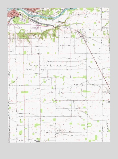
Anoka, IN USGS Topographic Map
Click on map above to begin viewing in our Map Viewer.

This topographic map contains these locations and features:
Feature Name Type Latitude Longitude GNIS ID View Map
AnokaPopulated PlaceN40.7220°W86.2825°430184View Map
Ansberry Bird DitchCanalN40.6428°W86.3239°430185View Map
Biddle IslandIslandN40.7498°W86.3647°431007View Map
Blue Ball ChurchChurchN40.6642°W86.3167°431215View Map
Bohn DitchCanalN40.6714°W86.2853°431301View Map
Bruner CemeteryCemeteryN40.6636°W86.2954°431664View Map
Cornell DitchCanalN40.6461°W86.3703°432984View Map
Cromley DitchCanalN40.7306°W86.2514°433145View Map
DeaconPopulated PlaceN40.6339°W86.3172°433385View Map
Eighteenth Street BridgeBridgeN40.7428°W86.3464°434049View Map
Emmanuel ChurchChurchN40.7250°W86.3461°434173View Map
Fairview ParkParkN40.7403°W86.3736°434347View Map
Helvie DitchCanalN40.7028°W86.2722°436000View Map
Jefferson SchoolSchoolN40.7456°W86.3697°436968View Map
Kienly IslandIslandN40.7403°W86.3225°437289View Map
Lewis Cass Junior-Senior High SchoolSchoolN40.6628°W86.2514°432216View Map
Logansport City Fire Department Station 4BuildingN40.7462°W86.3664°2625535View Map
Logansport Community High SchoolSchoolN40.7495°W86.3331°446547View Map
Martin DitchCanalN40.6831°W86.3269°438665View Map
Miller CemeteryCemeteryN40.6406°W86.3222°439184View Map
Minnow CreekStreamN40.7392°W86.3197°439272View Map
Morgan HillSummitN40.7264°W86.3447°439433View Map
Potawatomi PointPopulated PlaceN40.7478°W86.3083°441499View Map
Poundstone CornerPopulated PlaceN40.6267°W86.3361°441514View Map
Ramer CemeteryCemeteryN40.6786°W86.2845°441752View Map
Saint Pauls ChurchChurchN40.7078°W86.3361°442768View Map
Salem ChurchChurchN40.6345°W86.2986°442896View Map
Shaff CemeteryCemeteryN40.7320°W86.2583°443259View Map
Taber CemeteryCemeteryN40.7319°W86.3408°444534View Map
Tolen DitchCanalN40.6256°W86.3317°444800View Map
Township of WashingtonCivilN40.6980°W86.3295°453986View Map
Turnpaugh FieldAirportN40.6489°W86.2938°2676963View Map
Union ChurchChurchN40.6781°W86.2844°445097View Map
Venard CemeteryCemeteryN40.6717°W86.2522°445243View Map
Walton CemeteryCemeteryN40.6717°W86.2544°445454View Map
West CemeteryCemeteryN40.6706°W86.3125°445728View Map
Woodlawn SchoolSchoolN40.7489°W86.3497°446298View Map

Note: Coordinates in the location and feature list above are referenced to NAD83 datum.


Copyright (C) 2008-2024 Ryan Niemi / Sunset Dynamics ... All Rights Reserved