TopoQuest Logo
Do you find TopoQuest useful?
Help keep TopoQuest running and adding new maps/features by donating!
Bitcoin:  19c7KJd3qBynnjoSw5npx9KScwjBe4ifkT
Litecoin:  LXs6TkuXGGXo1vDsWCkWVdjQX94eUKd6ui
Home View Maps Find Maps Find Places Resources & Links


Young America, Indiana Topographic Map

USGS Map Title: Young America, IN
USGS Map MRC: 40086E3
DRG (GeoTIFF) Download: o40086e3.tif


Neighboring USGS Topographic Map Quads:


  Clymers, IN  
40086F4
 

  Anoka, IN  
40086F3
 

  Onward, IN  
40086F2
 

  Deer Creek, IN  
40086E4
 

  Young America, IN  
40086E3
 

  Galveston, IN  
40086E2
 

  Burlington, IN  
40086D4
 

  Russiaville, IN  
40086D3
 

  Kokomo West, IN  
40086D2


Map MRC Location:

N41°
W87°
N41°
W86°
H8 H7 H6 H5 H4 H3 H2 H1
G8 G7 G6 G5 G4 G3 G2 G1
F8 F7 F6 F5 F4 F3 F2 F1
E8 E7 E6 E5 E4 E3 E2 E1
D8 D7 D6 D5 D4 D3 D2 D1
C8 C7 C6 C5 C4 C3 C2 C1
B8 B7 B6 B5 B4 B3 B2 B1
A8 A7 A6 A5 A4 A3 A2 A1
N40°
W87°
N40°
W86°

Young America, IN USGS 1:24K Topographic Map Preview:
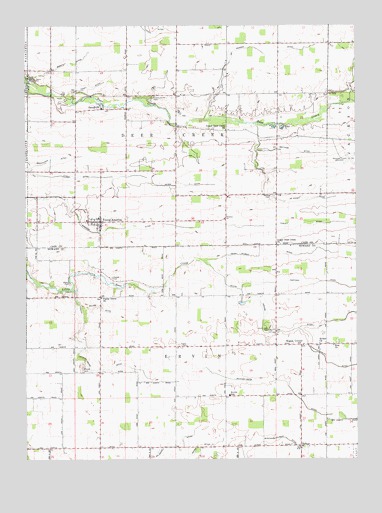
Young America, IN USGS Topographic Map
Click on map above to begin viewing in our Map Viewer.

This topographic map contains these locations and features:
Feature Name Type Latitude Longitude GNIS ID View Map
Bethel ChurchChurchN40.5334°W86.2639°430941View Map
Brown CemeteryCemeteryN40.5509°W86.3581°431604View Map
Brown DitchCanalN40.6128°W86.3631°431618View Map
Center ChurchChurchN40.6011°W86.3461°432324View Map
De Haven DitchCanalN40.5792°W86.2847°433381View Map
Ervin Elementary SchoolSchoolN40.5184°W86.2981°434234View Map
Galveston AirportAirportN40.5851°W86.2576°449178View Map
Geetings DitchCanalN40.5889°W86.2739°435002View Map
Gillam DitchCanalN40.5431°W86.3458°435075View Map
Harness CemeteryCemeteryN40.5761°W86.2822°435753View Map
Harness DitchCanalN40.5656°W86.3486°435756View Map
Hartman DitchCanalN40.5511°W86.2656°435831View Map
Henry Gilbert DitchCanalN40.5598°W86.2664°436035View Map
Hoover-Snider CemeteryCemeteryN40.6036°W86.3275°436430View Map
Hyman DitchCanalN40.5820°W86.3658°436672View Map
JudsonPopulated PlaceN40.5039°W86.2714°437138View Map
Kappa CemeteryCemeteryN40.5327°W86.3140°437165View Map
Kappa CornerPopulated PlaceN40.5328°W86.2708°437166View Map
Mathias Young DitchCanalN40.5242°W86.3014°438720View Map
McDowell DitchCanalN40.5045°W86.3181°438855View Map
Moore DitchCanalN40.5045°W86.3083°439396View Map
Mound CemeteryCemeteryN40.5265°W86.3536°439512View Map
Munson DitchCanalN40.6181°W86.2867°439884View Map
North Union CemeteryCemeteryN40.5371°W86.2822°440304View Map
Peter DitchCanalN40.5792°W86.3122°441050View Map
Pickett CemeteryCemeteryN40.5525°W86.3422°441102View Map
Poplar GrovePopulated PlaceN40.5556°W86.3472°446708View Map
Poplar Grove ChurchChurchN40.5464°W86.3467°441446View Map
Shankland DitchCanalN40.5873°W86.3572°443282View Map
Township of Deer CreekCivilN40.6054°W86.3171°453258View Map
Township of ErvinCivilN40.5171°W86.3088°453279View Map
Turley DitchCanalN40.5681°W86.2597°444987View Map
Upper Deer Creek ChurchChurchN40.5620°W86.2800°445162View Map
Upper Deer Creek ChurchChurchN40.5950°W86.2994°445163View Map
Young AmericaPopulated PlaceN40.5686°W86.3467°446410View Map
Young America Volunteer Fire DepartmentBuildingN40.5683°W86.3468°2625559View Map
Zion ChurchChurchN40.5328°W86.2589°446462View Map

Note: Coordinates in the location and feature list above are referenced to NAD83 datum.


Copyright (C) 2008-2025 Ryan Niemi / Sunset Dynamics ... All Rights Reserved