TopoQuest Logo
Do you find TopoQuest useful?
Help keep TopoQuest running and adding new maps/features by donating!
Bitcoin:  19c7KJd3qBynnjoSw5npx9KScwjBe4ifkT
Litecoin:  LXs6TkuXGGXo1vDsWCkWVdjQX94eUKd6ui
Home View Maps Find Maps Find Places Resources & Links


Deer Creek, Indiana Topographic Map

USGS Map Title: Deer Creek, IN
USGS Map MRC: 40086E4
DRG (GeoTIFF) Download: o40086e4.tif


Neighboring USGS Topographic Map Quads:


  Burrows, IN  
40086F5
 

  Clymers, IN  
40086F4
 

  Anoka, IN  
40086F3
 

  Flora, IN  
40086E5
 

  Deer Creek, IN  
40086E4
 

  Young America, IN  
40086E3
 

  Rossville, IN  
40086D5
 

  Burlington, IN  
40086D4
 

  Russiaville, IN  
40086D3


Map MRC Location:

N41°
W87°
N41°
W86°
H8 H7 H6 H5 H4 H3 H2 H1
G8 G7 G6 G5 G4 G3 G2 G1
F8 F7 F6 F5 F4 F3 F2 F1
E8 E7 E6 E5 E4 E3 E2 E1
D8 D7 D6 D5 D4 D3 D2 D1
C8 C7 C6 C5 C4 C3 C2 C1
B8 B7 B6 B5 B4 B3 B2 B1
A8 A7 A6 A5 A4 A3 A2 A1
N40°
W87°
N40°
W86°

Deer Creek, IN USGS 1:24K Topographic Map Preview:
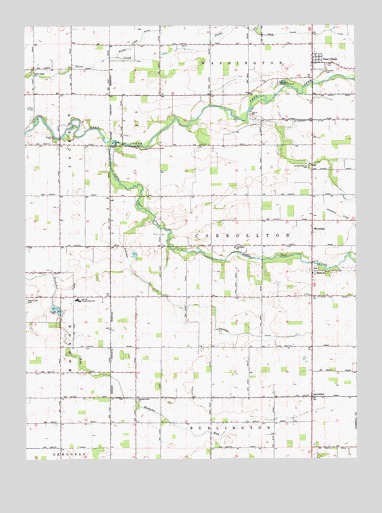
Deer Creek, IN USGS Topographic Map
Click on map above to begin viewing in our Map Viewer.

This topographic map contains these locations and features:
Feature Name Type Latitude Longitude GNIS ID View Map
Bachelor Run ChurchChurchN40.5175°W86.4583°430386View Map
Carroll County Emergency Medical ServicesBuildingN40.5472°W86.4799°2719269View Map
Carroll Junior-Senior High SchoolSchoolN40.5461°W86.4806°432175View Map
CarrolltonPopulated PlaceN40.5178°W86.3919°432178View Map
Deer CreekPopulated PlaceN40.6142°W86.3911°449647View Map
Deer Creek Conservation ClubLocaleN40.6084°W86.4039°452303View Map
Deer Creek United Brethren CemeteryCemeteryN40.5842°W86.3930°445143View Map
Hopewell CemeteryCemeteryN40.6120°W86.3872°436453View Map
Little Deer CreekStreamN40.5917°W86.4656°438037View Map
Maple Lawn CemeteryCemeteryN40.5461°W86.4997°438571View Map
McCloskey DitchCanalN40.5931°W86.3803°438798View Map
Paint Creek ChurchChurchN40.6117°W86.4969°440830View Map
Price Plank DitchStreamN40.6231°W86.4128°441595View Map
Ridenour DitchCanalN40.5439°W86.4311°441986View Map
SharonPopulated PlaceN40.5536°W86.3914°443292View Map
Township of CarrolltonCivilN40.5615°W86.4212°453160View Map
WheelingPopulated PlaceN40.5661°W86.3917°445896View Map
Zartman DitchCanalN40.5709°W86.3833°446426View Map

Note: Coordinates in the location and feature list above are referenced to NAD83 datum.


Copyright (C) 2008-2025 Ryan Niemi / Sunset Dynamics ... All Rights Reserved