TopoQuest Logo
Do you find TopoQuest useful?
Help keep TopoQuest running and adding new maps/features by donating!
Bitcoin:  19c7KJd3qBynnjoSw5npx9KScwjBe4ifkT
Litecoin:  LXs6TkuXGGXo1vDsWCkWVdjQX94eUKd6ui
Home View Maps Find Maps Find Places Resources & Links


Clymers, Indiana Topographic Map

USGS Map Title: Clymers, IN
USGS Map MRC: 40086F4
DRG (GeoTIFF) Download: o40086f4.tif


Neighboring USGS Topographic Map Quads:


  Burnettsville, IN  
40086G5
 

  Lucerne, IN  
40086G4
 

  Logansport, IN  
40086G3
 

  Burrows, IN  
40086F5
 

  Clymers, IN  
40086F4
 

  Anoka, IN  
40086F3
 

  Flora, IN  
40086E5
 

  Deer Creek, IN  
40086E4
 

  Young America, IN  
40086E3


Map MRC Location:

N41°
W87°
N41°
W86°
H8 H7 H6 H5 H4 H3 H2 H1
G8 G7 G6 G5 G4 G3 G2 G1
F8 F7 F6 F5 F4 F3 F2 F1
E8 E7 E6 E5 E4 E3 E2 E1
D8 D7 D6 D5 D4 D3 D2 D1
C8 C7 C6 C5 C4 C3 C2 C1
B8 B7 B6 B5 B4 B3 B2 B1
A8 A7 A6 A5 A4 A3 A2 A1
N40°
W87°
N40°
W86°

Clymers, IN USGS 1:24K Topographic Map Preview:
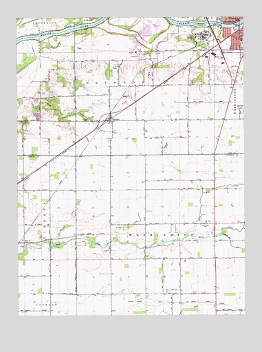
Clymers, IN USGS Topographic Map
Click on map above to begin viewing in our Map Viewer.

This topographic map contains these locations and features:
Feature Name Type Latitude Longitude GNIS ID View Map
Climbers Township Volunteer Fire DepartmentBuildingN40.6730°W86.4824°2626518View Map
ClymersPopulated PlaceN40.7075°W86.4489°432697View Map
Clymers CemeteryCemeteryN40.7070°W86.4603°432698View Map
Clymers Fire DepartmentBuildingN40.7063°W86.4478°2701435View Map
Cronin DitchCanalN40.7009°W86.4636°433150View Map
Fairview Park SchoolSchoolN40.7403°W86.3764°434350View Map
Fitzers DitchCanalN40.7342°W86.4889°434536View Map
Goose CreekStreamN40.7459°W86.3808°435190View Map
Grants RunStreamN40.7414°W86.4892°435331View Map
Gukien Cohee DitchCanalN40.6306°W86.4311°435554View Map
Homburg DitchCanalN40.6884°W86.4161°436363View Map
Joyce Airport (historical)AirportN40.6353°W86.4142°449143View Map
Little Rock CreekStreamN40.6581°W86.4067°438134View Map
Logansport QuarryMineN40.7425°W86.4289°2649538View Map
Logansport State HospitalHospitalN40.7405°W86.3995°2718869View Map
Logansport State HospitalBuildingN40.7408°W86.3997°438286View Map
Logansport/Cass County AirportAirportN40.7092°W86.3762°449250View Map
Martin DitchCanalN40.7023°W86.4481°438669View Map
Porter CemeteryCemeteryN40.7066°W86.4964°441462View Map
Rock Creek CemeteryCemeteryN40.6631°W86.3964°442196View Map
Ryan Appleton DitchCanalN40.6628°W86.4722°442429View Map
Saint Johns CemeteryCemeteryN40.7351°W86.4238°442575View Map
Saint Pisgah ChurchChurchN40.6636°W86.3967°442826View Map
Sebastian IslandIslandN40.7470°W86.3983°443185View Map
Shideler CemeteryCemeteryN40.7218°W86.4048°443374View Map
Slusser DitchCanalN40.6617°W86.4400°443634View Map
Township of ClintonCivilN40.7192°W86.4523°453229View Map
Township of WashingtonCivilN40.6486°W86.4207°453985View Map
Washington SchoolSchoolN40.7489°W86.3778°445518View Map
Widow CreekStreamN40.6592°W86.3872°446005View Map
Woodville CemeteryCemeteryN40.6552°W86.4963°446321View Map

Note: Coordinates in the location and feature list above are referenced to NAD83 datum.


Copyright (C) 2008-2024 Ryan Niemi / Sunset Dynamics ... All Rights Reserved