TopoQuest Logo
Do you find TopoQuest useful?
Help keep TopoQuest running and adding new maps/features by donating!
Bitcoin:  19c7KJd3qBynnjoSw5npx9KScwjBe4ifkT
Litecoin:  LXs6TkuXGGXo1vDsWCkWVdjQX94eUKd6ui
Home View Maps Find Maps Find Places Resources & Links


Antone, Oregon Topographic Map

USGS Map Title: Antone, OR
USGS Map MRC: 44119D7
DRG (GeoTIFF) Download: o44119d7.tif


Neighboring USGS Topographic Map Quads:


  Frog Hollow, OR  
44119E8
 

  Tubb Spring, OR  
44119E7
 

  Picture Gorge West, OR  
44119E6
 

  Derr Meadows, OR  
44119D8
 

  Antone, OR  
44119D7
 

  Day Basin, OR  
44119D6
 

  Little Summit Prairie, OR  
44119C8
 

  Six Corners, OR  
44119C7
 

  Wolf Mountain, OR  
44119C6


Map MRC Location:

N45°
W120°
N45°
W119°
H8 H7 H6 H5 H4 H3 H2 H1
G8 G7 G6 G5 G4 G3 G2 G1
F8 F7 F6 F5 F4 F3 F2 F1
E8 E7 E6 E5 E4 E3 E2 E1
D8 D7 D6 D5 D4 D3 D2 D1
C8 C7 C6 C5 C4 C3 C2 C1
B8 B7 B6 B5 B4 B3 B2 B1
A8 A7 A6 A5 A4 A3 A2 A1
N44°
W120°
N44°
W119°

Antone, OR USGS 1:24K Topographic Map Preview:
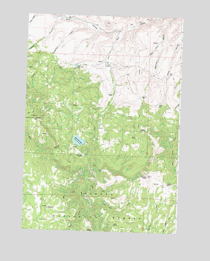
Antone, OR USGS Topographic Map
Click on map above to begin viewing in our Map Viewer.

This topographic map contains these locations and features:
Feature Name Type Latitude Longitude GNIS ID View Map
Andrews MineMineN44.4496°W119.7658°1137214View Map
Antone (historical)Populated PlaceN44.4715°W119.8100°1137265View Map
Antone Post Office (historical)Post OfficeN44.4715°W119.8100°1164845View Map
Antone Ranch AirportAirportN44.4925°W119.8485°2717346View Map
Balm CreekStreamN44.3985°W119.8283°1137485View Map
Bear CreekStreamN44.3888°W119.8236°1137684View Map
Buck PastureFlatN44.4415°W119.8469°1157825View Map
Cockleburr CreekStreamN44.4954°W119.8283°1139882View Map
Cottonwood Recreation SiteLocaleN44.3876°W119.8550°1140170View Map
Cottonwood SpringSpringN44.3886°W119.8558°1158619View Map
Edmonson SpringSpringN44.4186°W119.8282°1141681View Map
Erickson DitchCanalN44.4499°W119.7886°1158618View Map
Erickson RanchLocaleN44.4540°W119.8061°1141888View Map
Fir Tree CreekStreamN44.3871°W119.8214°1142116View Map
First CreekStreamN44.4143°W119.8225°1142134View Map
Fred CreekStreamN44.4729°W119.8105°1142430View Map
Fred Creek LakeLakeN44.4708°W119.8348°1142431View Map
High CreekStreamN44.4468°W119.8100°1143564View Map
Hope GulchValleyN44.4863°W119.7661°1143725View Map
Joe CreekStreamN44.4482°W119.8080°1144290View Map
Leggins SpringSpringN44.4342°W119.7778°1144925View Map
Maley CreekStreamN44.4863°W119.8603°1145768View Map
Mary Waterman GraveCemeteryN44.4723°W119.8116°2507727View Map
Mascall CorrallsLocaleN44.3771°W119.7747°1145863View Map
Nelson PlaceLocaleN44.4918°W119.7505°1136569View Map
Philling-McFadden DitchCanalN44.4582°W119.8105°1157824View Map
Pine GulchValleyN44.4932°W119.7503°1147713View Map
Pine HollowValleyN44.4996°W119.8558°1147714View Map
Rock Creek LakeReservoirN44.4270°W119.8317°1148607View Map
Rock Creek Lake DamDamN44.4269°W119.8264°1155649View Map
Saddle SpringSpringN44.3753°W119.8225°1148914View Map
Second CreekStreamN44.4049°W119.8253°1149202View Map
Shingle CreekStreamN44.4974°W119.8464°1149399View Map
Spanish Gulch CemeteryCemeteryN44.4662°W119.7730°1158617View Map
Spanish PeakSummitN44.4071°W119.7753°1150102View Map
Tate SpringSpringN44.4300°W119.7887°1150903View Map
Ted Glover SpringSpringN44.4744°W119.8456°1157823View Map
Triplet SpringSpringN44.4030°W119.7598°1151421View Map
Vehrs SpringSpringN44.3791°W119.8013°1151745View Map
Waterman MineMineN44.4532°W119.7817°1151952View Map
West Branch Rock CreekStreamN44.4193°W119.8219°1152032View Map

Note: Coordinates in the location and feature list above are referenced to NAD83 datum.


Copyright (C) 2008-2024 Ryan Niemi / Sunset Dynamics ... All Rights Reserved