TopoQuest Logo
Do you find TopoQuest useful?
Help keep TopoQuest running and adding new maps/features by donating!
Bitcoin:  19c7KJd3qBynnjoSw5npx9KScwjBe4ifkT
Litecoin:  LXs6TkuXGGXo1vDsWCkWVdjQX94eUKd6ui
Home View Maps Find Maps Find Places Resources & Links


Lynnville, Indiana Topographic Map

USGS Map Title: Lynnville, IN
USGS Map MRC: 38087B3
DRG (GeoTIFF) Download: o38087b3.tif


Neighboring USGS Topographic Map Quads:


  Francisco, IN  
38087C4
 

  Oakland City, IN  
38087C3
 

  Augusta, IN  
38087C2
 

  Elberfeld, IN  
38087B4
 

  Lynnville, IN  
38087B3
 

  Folsomville, IN  
38087B2
 

  Daylight, IN  
38087A4
 

  Boonville, IN  
38087A3
 

  De Gonia Springs, IN  
38087A2


Map MRC Location:

N39°
W88°
N39°
W87°
H8 H7 H6 H5 H4 H3 H2 H1
G8 G7 G6 G5 G4 G3 G2 G1
F8 F7 F6 F5 F4 F3 F2 F1
E8 E7 E6 E5 E4 E3 E2 E1
D8 D7 D6 D5 D4 D3 D2 D1
C8 C7 C6 C5 C4 C3 C2 C1
B8 B7 B6 B5 B4 B3 B2 B1
A8 A7 A6 A5 A4 A3 A2 A1
N38°
W88°
N38°
W87°

Lynnville, IN USGS 1:24K Topographic Map Preview:
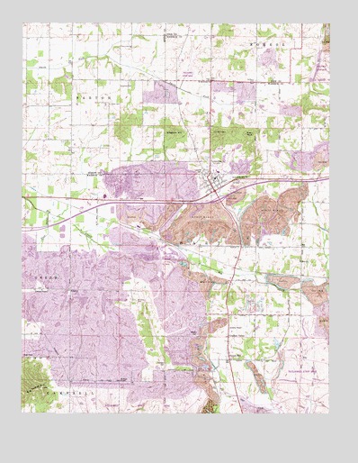
Lynnville, IN USGS Topographic Map
Click on map above to begin viewing in our Map Viewer.

This topographic map contains these locations and features:
Feature Name Type Latitude Longitude GNIS ID View Map
Barnetts ChapelChurchN38.1642°W87.3667°430515View Map
Big Ditney HillSummitN38.1328°W87.3661°431033View Map
Dyson KnobSummitN38.2145°W87.2842°433830View Map
EbyPopulated PlaceN38.1420°W87.2614°433988View Map
Eby Post Office (historical)Post OfficeN38.1434°W87.2620°452995View Map
Eden CemeteryCemeteryN38.2242°W87.3392°434005View Map
Fletcher ChapelChurchN38.1353°W87.3347°434590View Map
Graham ValleyPopulated PlaceN38.1495°W87.2906°435291View Map
Kilpatrick CemeteryCemeteryN38.2300°W87.3356°437303View Map
Liberty ChapelChurchN38.1525°W87.2903°437822View Map
Little CreekStreamN38.1812°W87.3486°438024View Map
LynnvillePopulated PlaceN38.1962°W87.2967°438435View Map
Lynnville CemeteryCemeteryN38.2009°W87.3022°438436View Map
Lynnville Elementary SchoolSchoolN38.2000°W87.2925°447525View Map
Lynnville MineMineN38.1845°W87.3272°438437View Map
Lynnville Post OfficePost OfficeN38.1983°W87.2978°2775775View Map
Lynnville Town MarshalBuildingN38.1978°W87.2978°2758252View Map
Lynnville Volunteer Fire DepartmentBuildingN38.1947°W87.3014°2626226View Map
Massey CemeteryCemeteryN38.1498°W87.3042°438701View Map
Morrison CemeteryCemeteryN38.1409°W87.3167°439456View Map
Mount Olive CemeteryCemeteryN38.1612°W87.3283°439612View Map
North Friendship ChurchChurchN38.2009°W87.2831°440260View Map
Plum BranchStreamN38.1892°W87.3645°441361View Map
Ringham HillSummitN38.2153°W87.3139°442051View Map
Saint Matthews ChurchChurchN38.2320°W87.2995°442724View Map
Saint Pauls CemeteryCemeteryN38.2317°W87.2806°442762View Map
StanleyPopulated PlaceN38.1645°W87.3550°444060View Map
Tecumseh Junior - Senior High SchoolSchoolN38.1947°W87.3414°447526View Map
Town of LynnvilleCivilN38.1989°W87.3140°2396730View Map
Township of HartCivilN38.1749°W87.2940°453401View Map
Turpin HillPopulated PlaceN38.1423°W87.2903°444995View Map
Zion ChurchChurchN38.1739°W87.2617°446451View Map

Note: Coordinates in the location and feature list above are referenced to NAD83 datum.


Copyright (C) 2008-2025 Ryan Niemi / Sunset Dynamics ... All Rights Reserved