TopoQuest Logo
Do you find TopoQuest useful?
Help keep TopoQuest running and adding new maps/features by donating!
Bitcoin:  19c7KJd3qBynnjoSw5npx9KScwjBe4ifkT
Litecoin:  LXs6TkuXGGXo1vDsWCkWVdjQX94eUKd6ui
Home View Maps Find Maps Find Places Resources & Links


Boonville, Indiana Topographic Map

USGS Map Title: Boonville, IN
USGS Map MRC: 38087A3
DRG (GeoTIFF) Download: o38087a3.tif


Neighboring USGS Topographic Map Quads:


  Elberfeld, IN  
38087B4
 

  Lynnville, IN  
38087B3
 

  Folsomville, IN  
38087B2
 

  Daylight, IN  
38087A4
 

  Boonville, IN  
38087A3
 

  De Gonia Springs, IN  
38087A2
 

  Newburgh, IN  
37087H4
 

  Yankeetown, IN  
37087H3
 

  Richland City, IN  
37087H2


Map MRC Location:

N39°
W88°
N39°
W87°
H8 H7 H6 H5 H4 H3 H2 H1
G8 G7 G6 G5 G4 G3 G2 G1
F8 F7 F6 F5 F4 F3 F2 F1
E8 E7 E6 E5 E4 E3 E2 E1
D8 D7 D6 D5 D4 D3 D2 D1
C8 C7 C6 C5 C4 C3 C2 C1
B8 B7 B6 B5 B4 B3 B2 B1
A8 A7 A6 A5 A4 A3 A2 A1
N38°
W88°
N38°
W87°

Boonville, IN USGS 1:24K Topographic Map Preview:
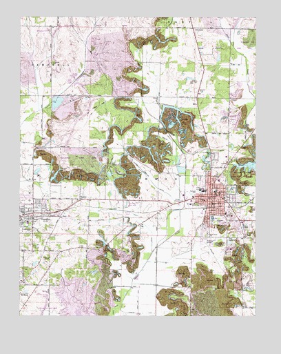
Boonville, IN USGS Topographic Map
Click on map above to begin viewing in our Map Viewer.

This topographic map contains these locations and features:
Feature Name Type Latitude Longitude GNIS ID View Map
Baker CemeteryCemeteryN38.0264°W87.3167°430421View Map
BoonvillePopulated PlaceN38.0492°W87.2742°431342View Map
Boonville AirportAirportN38.0418°W87.3199°449111View Map
Boonville Country ClubLocaleN38.1120°W87.2717°452287View Map
Boonville Fire DepartmentBuildingN38.0464°W87.2730°2625993View Map
Boonville High SchoolSchoolN38.0525°W87.2778°447523View Map
Boonville Junior High SchoolSchoolN38.0517°W87.2714°447522View Map
Boonville Police DepartmentBuildingN38.0489°W87.2741°2758174View Map
Breckenridge ParkParkN38.0470°W87.2814°431469View Map
Bullivant ParkParkN38.0520°W87.2811°431803View Map
Carter Traylor DitchCanalN38.0575°W87.3064°432189View Map
CenterPopulated PlaceN38.0487°W87.3431°432308View Map
ChandlerPopulated PlaceN38.0417°W87.3681°432395View Map
Chandler Elementary SchoolSchoolN38.0390°W87.3706°447524View Map
Chandler Police DepartmentBuildingN38.0467°W87.3636°2758472View Map
Chandler Volunteer Fire DepartmentBuildingN38.0431°W87.3727°2625896View Map
City Lake Number OneLakeN38.0409°W87.2730°432537View Map
City Lake Number TwoLakeN38.0307°W87.2636°432538View Map
City of BoonvilleCivilN38.0452°W87.2740°2394221View Map
Clarke SchoolSchoolN38.0523°W87.2717°432570View Map
Clutter Stone CemeteryCemeteryN38.0684°W87.2736°432696View Map
Crossroad CemeteryCemeteryN38.1067°W87.3578°433190View Map
Ellis CemeteryCemeteryN38.0289°W87.3433°434106View Map
Faith Free Will Baptist ChurchChurchN38.0448°W87.3611°2465791View Map
GreenbrierPopulated PlaceN38.1206°W87.2836°435425View Map
Greenwood CemeteryCemeteryN38.0356°W87.3689°435466View Map
Hines DitchCanalN38.0014°W87.3470°436235View Map
Houston MineMineN38.0937°W87.2789°436527View Map
Izaak Walton League BuildingBuildingN38.0637°W87.3239°436866View Map
JarrettsPopulated PlaceN38.1209°W87.3586°452124View Map
Kelly DitchCanalN38.0378°W87.3081°437224View Map
Maple Grove CemeteryCemeteryN38.0345°W87.2753°438548View Map
Mount Gilead ChurchChurchN38.0114°W87.2719°439565View Map
Oakdale Elementary SchoolSchoolN38.0428°W87.2658°451291View Map
Perigo CemeteryCemeteryN38.0184°W87.2742°441019View Map
Pursley DitchCanalN38.0014°W87.3106°441669View Map
Rolling AcresPopulated PlaceN38.0667°W87.2708°446751View Map
Rolling Hills Golf CourseLocaleN38.0095°W87.3745°452394View Map
Saint Clements SchoolSchoolN38.0517°W87.2697°442523View Map
Saint Marys Warrick HospitalHospitalN38.0419°W87.2627°2660430View Map
Scales Lake County ParkParkN38.0598°W87.2550°443055View Map
Shaw MineMineN38.0887°W87.2817°443319View Map
Thornburg CemeteryCemeteryN38.0331°W87.2558°444733View Map
Town of ChandlerCivilN38.0368°W87.3747°2396639View Map
Township of BoonCivilN38.0398°W87.2781°453124View Map
Warrick CountyCivilN38.0922°W87.2721°450335View Map
Washing Recirculating ReservoirReservoirN38.0892°W87.3554°447417View Map
Washing-Recirculating Reservoir DamDamN38.0900°W87.3583°447418View Map
WBNL-AM (Boonville)TowerN38.0662°W87.2742°448477View Map
WBNL-FM (Boonville)TowerN38.0662°W87.2742°448930View Map
Wesley CemeteryCemeteryN38.1059°W87.3142°445689View Map
Whittaker DitchCanalN38.0375°W87.3722°445993View Map
Williams SchoolSchoolN38.0484°W87.2772°446082View Map
WNIN-TV (Evansville)TowerN38.0242°W87.3620°447014View Map
WTVW-TV (Evansville)TowerN38.0242°W87.3620°447011View Map

Note: Coordinates in the location and feature list above are referenced to NAD83 datum.


Copyright (C) 2008-2025 Ryan Niemi / Sunset Dynamics ... All Rights Reserved