TopoQuest Logo
Do you find TopoQuest useful?
Help keep TopoQuest running and adding new maps/features by donating!
Bitcoin:  19c7KJd3qBynnjoSw5npx9KScwjBe4ifkT
Litecoin:  LXs6TkuXGGXo1vDsWCkWVdjQX94eUKd6ui
Home View Maps Find Maps Find Places Resources & Links


Sandy Hook, Mississippi Topographic Map

USGS Map Title: Sandy Hook, MS
USGS Map MRC: 31089A7
DRG (GeoTIFF) Download: o31089a7.tif


Neighboring USGS Topographic Map Quads:


  Sandy Hook NW, MS  
31089B8
 

  Columbia South, MS  
31089B7
 

  Pinebur, MS  
31089B6
 

  Dexter, MS  
31089A8
 

  Sandy Hook, MS  
31089A7
 

  Baxterville SW, MS  
31089A6
 

  State Line, LA  
30089H8
 

  Angie, LA  
30089H7
 

  Fords Creek, MS  
30089H6


Map MRC Location:

N32°
W90°
N32°
W89°
H8 H7 H6 H5 H4 H3 H2 H1
G8 G7 G6 G5 G4 G3 G2 G1
F8 F7 F6 F5 F4 F3 F2 F1
E8 E7 E6 E5 E4 E3 E2 E1
D8 D7 D6 D5 D4 D3 D2 D1
C8 C7 C6 C5 C4 C3 C2 C1
B8 B7 B6 B5 B4 B3 B2 B1
A8 A7 A6 A5 A4 A3 A2 A1
N31°
W90°
N31°
W89°

Sandy Hook, MS USGS 1:24K Topographic Map Preview:
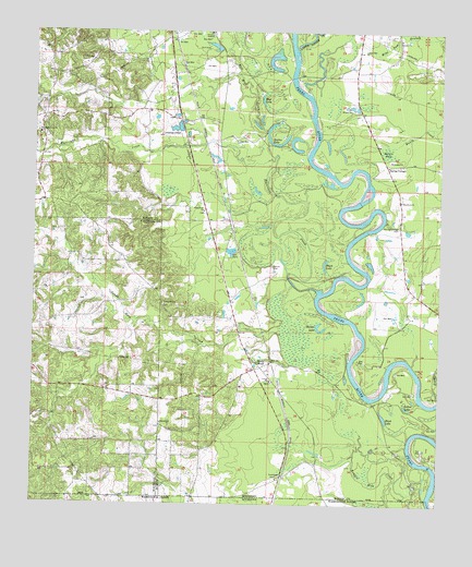
Sandy Hook, MS USGS Topographic Map
Click on map above to begin viewing in our Map Viewer.

This topographic map contains these locations and features:
Feature Name Type Latitude Longitude GNIS ID View Map
Allen BaySwampN31.1243°W89.7556°689648View Map
Ball Mill CreekStreamN31.0982°W89.8034°666491View Map
Black LakeLakeN31.0232°W89.7666°667229View Map
Black LakeLakeN31.0629°W89.7856°667230View Map
Blue LakeLakeN31.1070°W89.8051°667300View Map
Capp CemeteryCemeteryN31.1199°W89.7734°668054View Map
Columbia AcademySchoolN31.1249°W89.8212°668716View Map
Ford ChapelChurchN31.0080°W89.7981°670076View Map
Ford Chapel CemeteryCemeteryN31.0074°W89.7990°710536View Map
Fords Fort (historical)MilitaryN31.0131°W89.7853°1680708View Map
Fords School (historical)SchoolN31.0127°W89.7856°710537View Map
Fordsville (historical)Populated PlaceN31.0591°W89.7609°689672View Map
Fortenberry Lake DamDamN31.0968°W89.8301°680572View Map
Harper LakeLakeN31.0462°W89.7864°670958View Map
Hurricane CreekStreamN31.0560°W89.7873°671620View Map
Hurricane CreekPopulated PlaceN31.1021°W89.8723°689678View Map
Hurricane Creek CemeteryCemeteryN31.0974°W89.8717°710551View Map
Hurricane Creek ChurchChurchN31.0977°W89.8737°671632View Map
Hurricane Creek School (historical)SchoolN31.0974°W89.8726°710552View Map
Lower Little CreekStreamN31.1196°W89.7948°672919View Map
Macedonia ChurchChurchN31.0805°W89.7623°672997View Map
Mike Tom BranchStreamN31.1082°W89.7901°673560View Map
Old Spring Cottage Church (historical)ChurchN31.0743°W89.7626°689696View Map
Pearl River CemeteryCemeteryN31.0777°W89.8234°710567View Map
Pearl River ChurchChurchN31.0777°W89.8229°675541View Map
Rankin Mill CreekStreamN31.0019°W89.7531°538493View Map
Rawls BaySwampN31.0936°W89.7661°676491View Map
Rawls CreekStreamN31.0946°W89.7648°676495View Map
Saint PaulPopulated PlaceN31.0752°W89.8140°689698View Map
Sandy HookPopulated PlaceN31.0363°W89.8048°677389View Map
Sandy Hook Baptist ChurchChurchN31.0385°W89.8062°689702View Map
Sandy Hook CemeteryCemeteryN31.0380°W89.8059°710573View Map
Sandy Hook CemeteryCemeteryN31.0327°W89.8020°710574View Map
Sandy Hook CreekStreamN31.0457°W89.7981°677390View Map
Sandy Hook Post OfficePost OfficeN31.0324°W89.8004°2768576View Map
Sandy Hook School (historical)SchoolN31.0363°W89.8062°710575View Map
SauerPopulated PlaceN31.1016°W89.8301°689703View Map
SaxonPopulated PlaceN31.1232°W89.8342°689704View Map
Southwest Marion Fire DepartmentBuildingN31.1018°W89.8329°2667729View Map
Southwest Marion Fire Department Sandy HookBuildingN31.0379°W89.8020°2667687View Map
Spains LakeLakeN31.0953°W89.8002°678032View Map
Spring CottagePopulated PlaceN31.0896°W89.7665°692240View Map
Spring Cottage CemeteryCemeteryN31.0735°W89.7623°678079View Map
Spring Hill ChurchChurchN31.0527°W89.8345°678106View Map
Sunlight ChurchChurchN31.0216°W89.8356°678419View Map
Sweetwater CreekStreamN31.0738°W89.8015°689705View Map
T E Stogner CemeteryCemeteryN31.0724°W89.8681°709263View Map
Tolar Ponds DamDamN31.0652°W89.8151°680559View Map
TwinPopulated PlaceN31.0077°W89.7981°689708View Map
United ChurchChurchN31.0330°W89.8017°679126View Map
Warren CemeteryCemeteryN31.0630°W89.8017°679350View Map
West Sauer (historical)LocaleN31.1043°W89.8431°689712View Map
Willy Pittman Pond DamDamN31.0135°W89.8701°680544View Map
Yellow LakeLakeN31.0258°W89.7599°679946View Map

Note: Coordinates in the location and feature list above are referenced to NAD83 datum.


Copyright (C) 2008-2025 Ryan Niemi / Sunset Dynamics ... All Rights Reserved