TopoQuest Logo
Do you find TopoQuest useful?
Help keep TopoQuest running and adding new maps/features by donating!
Bitcoin:  19c7KJd3qBynnjoSw5npx9KScwjBe4ifkT
Litecoin:  LXs6TkuXGGXo1vDsWCkWVdjQX94eUKd6ui
Home View Maps Find Maps Find Places Resources & Links


Douglass, Kansas Topographic Map

USGS Map Title: Douglass, KS
USGS Map MRC: 37097E1
DRG (GeoTIFF) Download: o37097e1.tif


Neighboring USGS Topographic Map Quads:


  Andover, KS  
37097F2
 

  Santa Fe Lake, KS  
37097F1
 

  Augusta, KS  
37096F8
 

  Rose Hill, KS  
37097E2
 

  Douglass, KS  
37097E1
 

  Gordon, KS  
37096E8
 

  Mulvane, KS  
37097D2
 

  Udall, KS  
37097D1
 

  Wilmot, KS  
37096D8


Map MRC Location:

N38°
W98°
N38°
W97°
H8 H7 H6 H5 H4 H3 H2 H1
G8 G7 G6 G5 G4 G3 G2 G1
F8 F7 F6 F5 F4 F3 F2 F1
E8 E7 E6 E5 E4 E3 E2 E1
D8 D7 D6 D5 D4 D3 D2 D1
C8 C7 C6 C5 C4 C3 C2 C1
B8 B7 B6 B5 B4 B3 B2 B1
A8 A7 A6 A5 A4 A3 A2 A1
N37°
W98°
N37°
W97°

Douglass, KS USGS 1:24K Topographic Map Preview:
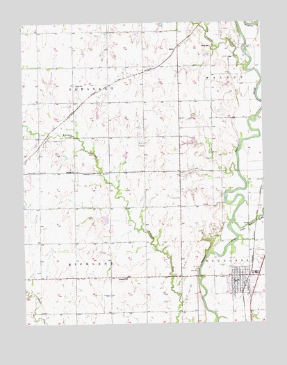
Douglass, KS USGS Topographic Map
Click on map above to begin viewing in our Map Viewer.

This topographic map contains these locations and features:
Feature Name Type Latitude Longitude GNIS ID View Map
Aral (historical)LocaleN37.5922°W97.0803°482057View Map
Butler AirparkAirportN37.5589°W97.0650°2651060View Map
Butler County Fire District 3 Station 2BuildingN37.5926°W97.0709°2111158View Map
Butler County Fire District 8 - DouglassBuildingN37.5193°W97.0159°2111163View Map
Church of ChristChurchN37.5188°W97.0197°2689721View Map
City of DouglassCivilN37.5178°W97.0103°2394553View Map
Douglas City HallBuildingN37.5167°W97.0160°2694377View Map
Douglas Elementary School (historical)SchoolN37.5136°W97.0114°481015View Map
Douglas United Methodist ChurchChurchN37.5182°W97.0131°2690040View Map
Douglas Wastewater Treatment FacilityLocaleN37.5016°W97.0160°2692080View Map
DouglassPopulated PlaceN37.5195°W97.0128°481864View Map
Douglass High SchoolSchoolN37.5206°W97.0049°481016View Map
Douglass Historical MuseumBuildingN37.5169°W97.0160°2694315View Map
Douglass Post OfficePost OfficeN37.5170°W97.0166°2693694View Map
Douglass Public LibraryBuildingN37.5167°W97.0166°2694828View Map
Douglass Senior CenterBuildingN37.5166°W97.0187°2692687View Map
Douglass United School District 396 Police DepartmentBuildingN37.5205°W97.0048°2503858View Map
Dunlap CemeteryCemeteryN37.5997°W97.0981°474374View Map
First Baptist ChurchChurchN37.5193°W97.0182°2689940View Map
First Christian ChurchChurchN37.5159°W97.0144°2689829View Map
Floral School (historical)SchoolN37.6150°W97.0270°474375View Map
Flying H Ranch AirportAirportN37.6242°W97.0965°481468View Map
Fourmile CreekStreamN37.6050°W97.0084°474234View Map
Friends CemeteryCemeteryN37.5626°W97.0898°474371View Map
Leonard C. Seal Elementary SchoolSchoolN37.5166°W97.0116°2497406View Map
Little Walnut RiverStreamN37.5431°W97.0164°474370View Map
Marvin Sisk Middle SchoolSchoolN37.5213°W97.0041°2497612View Map
Richland CemeteryCemeteryN37.5120°W97.0811°474368View Map
Richland School (historical)SchoolN37.5192°W97.0773°474369View Map
Rose Hill CemeteryCemeteryN37.5635°W97.1182°474373View Map
Rose Hill Friends ChurchChurchN37.5634°W97.0988°474372View Map
Rose Hill Wastewater Treatment FacilityLocaleN37.5883°W97.1224°2691973View Map
SalterPopulated PlaceN37.6139°W97.0448°484681View Map
Sunset 77 Mobile Home ParkPopulated PlaceN37.5242°W97.0004°2694169View Map
Township of PleasantCivilN37.6067°W97.0983°474233View Map
Township of RichlandCivilN37.5193°W97.0985°474367View Map

Note: Coordinates in the location and feature list above are referenced to NAD83 datum.


Copyright (C) 2008-2024 Ryan Niemi / Sunset Dynamics ... All Rights Reserved