TopoQuest Logo
Do you find TopoQuest useful?
Help keep TopoQuest running and adding new maps/features by donating!
Bitcoin:  19c7KJd3qBynnjoSw5npx9KScwjBe4ifkT
Litecoin:  LXs6TkuXGGXo1vDsWCkWVdjQX94eUKd6ui
Home View Maps Find Maps Find Places Resources & Links


Udall, Kansas Topographic Map

USGS Map Title: Udall, KS
USGS Map MRC: 37097D1
DRG (GeoTIFF) Download: o37097d1.tif


Neighboring USGS Topographic Map Quads:


  Rose Hill, KS  
37097E2
 

  Douglass, KS  
37097E1
 

  Gordon, KS  
37096E8
 

  Mulvane, KS  
37097D2
 

  Udall, KS  
37097D1
 

  Wilmot, KS  
37096D8
 

  Oxford, KS  
37097C2
 

  Akron, KS  
37097C1
 

  New Salem, KS  
37096C8


Map MRC Location:

N38°
W98°
N38°
W97°
H8 H7 H6 H5 H4 H3 H2 H1
G8 G7 G6 G5 G4 G3 G2 G1
F8 F7 F6 F5 F4 F3 F2 F1
E8 E7 E6 E5 E4 E3 E2 E1
D8 D7 D6 D5 D4 D3 D2 D1
C8 C7 C6 C5 C4 C3 C2 C1
B8 B7 B6 B5 B4 B3 B2 B1
A8 A7 A6 A5 A4 A3 A2 A1
N37°
W98°
N37°
W97°

Udall, KS USGS 1:24K Topographic Map Preview:
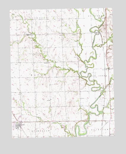
Udall, KS USGS Topographic Map
Click on map above to begin viewing in our Map Viewer.

This topographic map contains these locations and features:
Feature Name Type Latitude Longitude GNIS ID View Map
Brookshire CemeteryCemeteryN37.4526°W97.0430°470211View Map
Centennial School (historical)SchoolN37.4197°W97.1239°483407View Map
City of UdallCivilN37.3890°W97.1177°2397077View Map
Coon CreekStreamN37.4717°W97.0973°470210View Map
Countryview Baptist ChurchChurchN37.4039°W97.0984°2689741View Map
Cowley County Fire District 4 UdallBuildingN37.3867°W97.1164°2111235View Map
Eightmile CreekStreamN37.4470°W97.0359°470208View Map
First Baptist ChurchChurchN37.3883°W97.1157°2690737View Map
Fleming Feed and Grain Company Grain Elevator Number 3LocaleN37.3763°W97.0057°2695219View Map
Green Valley School (historical)SchoolN37.3756°W97.0653°483428View Map
Heritage Evangelical Free ChurchChurchN37.3881°W97.1189°2688694View Map
Maple CreekStreamN37.4928°W97.1112°470209View Map
Muddy CreekStreamN37.4620°W97.0248°470207View Map
Pilot Pointe Estates AirportAirportN37.4794°W97.0131°2675725View Map
Polecat CreekStreamN37.4295°W97.0223°470212View Map
Providence (historical)LocaleN37.4900°W97.0800°482061View Map
Providence Church (historical)ChurchN37.4478°W97.0978°483467View Map
Red Bud (historical)LocaleN37.4500°W97.0981°482116View Map
Red Bud CemeteryCemeteryN37.4413°W97.0969°470214View Map
Red Bud School (historical)SchoolN37.4486°W97.0798°470213View Map
RockPopulated PlaceN37.4403°W97.0064°470206View Map
Rock CreekStreamN37.4209°W97.0125°470205View Map
Rock Post OfficePost OfficeN37.4406°W97.0069°2693948View Map
Rock Station (historical)LocaleN37.4403°W97.0106°482117View Map
Sanford CreekStreamN37.3984°W97.0150°470204View Map
Spring CreekStreamN37.3992°W97.0148°470203View Map
Star Valley CemeteryCemeteryN37.4124°W97.0422°470216View Map
Star Valley School (historical)SchoolN37.4195°W97.0414°483480View Map
Township of MapleCivilN37.4331°W97.0967°470215View Map
UdallPopulated PlaceN37.3875°W97.1142°470218View Map
Udall Church of the NazareneChurchN37.3863°W97.1180°2690394View Map
Udall City HallBuildingN37.3877°W97.1170°2693112View Map
Udall Community Historical SocietyBuildingN37.3872°W97.1168°2694362View Map
Udall Elementary SchoolSchoolN37.3860°W97.1202°481065View Map
Udall Middle / High SchoolSchoolN37.3845°W97.1210°481066View Map
Udall Middle SchoolSchoolN37.3847°W97.1216°2497572View Map
Udall Police DepartmentBuildingN37.3872°W97.1170°2503779View Map
Udall Post OfficePost OfficeN37.3872°W97.1164°2693999View Map
Udall Public LibraryBuildingN37.3872°W97.1168°2694703View Map
Udall United Methodist ChurchChurchN37.3853°W97.1189°2689559View Map
Udall Wastewater PlantLocaleN37.3946°W97.1078°2691934View Map
Valley Center School (historical)SchoolN37.3756°W97.0161°483486View Map
Walnut Valley ChurchChurchN37.3759°W97.0150°470202View Map

Note: Coordinates in the location and feature list above are referenced to NAD83 datum.


Copyright (C) 2008-2024 Ryan Niemi / Sunset Dynamics ... All Rights Reserved