TopoQuest Logo
Do you find TopoQuest useful?
Help keep TopoQuest running and adding new maps/features by donating!
Bitcoin:  19c7KJd3qBynnjoSw5npx9KScwjBe4ifkT
Litecoin:  LXs6TkuXGGXo1vDsWCkWVdjQX94eUKd6ui
Home View Maps Find Maps Find Places Resources & Links


Mulvane, Kansas Topographic Map

USGS Map Title: Mulvane, KS
USGS Map MRC: 37097D2
DRG (GeoTIFF) Download: o37097d2.tif


Neighboring USGS Topographic Map Quads:


  Derby, KS  
37097E3
 

  Rose Hill, KS  
37097E2
 

  Douglass, KS  
37097E1
 

  Belle Plaine, KS  
37097D3
 

  Mulvane, KS  
37097D2
 

  Udall, KS  
37097D1
 

  Dalton, KS  
37097C3
 

  Oxford, KS  
37097C2
 

  Akron, KS  
37097C1


Map MRC Location:

N38°
W98°
N38°
W97°
H8 H7 H6 H5 H4 H3 H2 H1
G8 G7 G6 G5 G4 G3 G2 G1
F8 F7 F6 F5 F4 F3 F2 F1
E8 E7 E6 E5 E4 E3 E2 E1
D8 D7 D6 D5 D4 D3 D2 D1
C8 C7 C6 C5 C4 C3 C2 C1
B8 B7 B6 B5 B4 B3 B2 B1
A8 A7 A6 A5 A4 A3 A2 A1
N37°
W98°
N37°
W97°

Mulvane, KS USGS 1:24K Topographic Map Preview:
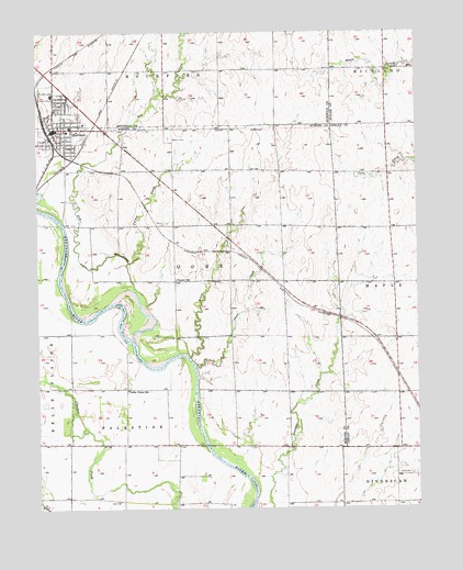
Mulvane, KS USGS Topographic Map
Click on map above to begin viewing in our Map Viewer.

This topographic map contains these locations and features:
Feature Name Type Latitude Longitude GNIS ID View Map
Antelope CreekStreamN37.4481°W97.1417°470230View Map
Assembly of God ChurchChurchN37.4740°W97.2418°2509979View Map
Belle Plaine Farms AirportAirportN37.3935°W97.2098°2651109View Map
Bitter CreekStreamN37.4145°W97.2003°470225View Map
Central SchoolSchoolN37.4353°W97.2050°470224View Map
Church of Christ of MulvaneChurchN37.4730°W97.2418°2510933View Map
City of MulvaneCivilN37.4756°W97.2376°2395137View Map
College Hill Church of ChristChurchN37.4772°W97.2390°2509723View Map
Dog CreekStreamN37.4184°W97.2181°470220View Map
First Baptist ChurchChurchN37.4848°W97.2436°2510302View Map
Grand Prairie School (historical)SchoolN37.4589°W97.1348°483423View Map
Island (historical)LocaleN37.4145°W97.1353°482397View Map
Littleton CemeteryCemeteryN37.4498°W97.2075°470227View Map
Living Word Christian ChurchChurchN37.4730°W97.2418°2510358View Map
Maria Court Assisted Living FacilityBuildingN37.4740°W97.2348°2510098View Map
MulvanePopulated PlaceN37.4745°W97.2439°470229View Map
Mulvane Academy Charter SchoolSchoolN37.4751°W97.2393°2497585View Map
Mulvane Brethren ChurchChurchN37.4726°W97.2406°2511045View Map
Mulvane CemeteryCemeteryN37.4730°W97.2069°470228View Map
Mulvane Christian ChurchChurchN37.4734°W97.2424°2510246View Map
Mulvane City OfficesBuildingN37.4758°W97.2451°2509967View Map
Mulvane Emergency ServicesBuildingN37.4753°W97.2305°2111657View Map
Mulvane First Church of the NazareneChurchN37.4806°W97.2455°2510377View Map
Mulvane Grade SchoolSchoolN37.4778°W97.2339°2497477View Map
Mulvane Historical MuseumBuildingN37.4743°W97.2458°2510921View Map
Mulvane Intermediate SchoolSchoolN37.4761°W97.2351°2497576View Map
Mulvane Middle SchoolSchoolN37.4838°W97.2455°2497538View Map
Mulvane Mobile Home ParkPopulated PlaceN37.4690°W97.2236°2510635View Map
Mulvane Municipal Power PlantLocaleN37.4725°W97.2467°2692442View Map
Mulvane Police DepartmentBuildingN37.4762°W97.2453°2504042View Map
Mulvane Post OfficePost OfficeN37.4745°W97.2405°2509621View Map
Mulvane Public LibraryBuildingN37.4745°W97.2437°2510284View Map
Mulvane Recreation CenterBuildingN37.4756°W97.2361°2510096View Map
Mulvane Senior Citizens CenterBuildingN37.4756°W97.2361°2510097View Map
Mulvane Sports ComplexBuildingN37.4886°W97.2286°2509836View Map
Mulvane United Methodist ChurchChurchN37.4746°W97.2412°2510364View Map
Our Savior Lutheran ChurchChurchN37.4797°W97.2355°2509768View Map
Prairie Schooner Mobile Home Court Water TankReserveN37.4729°W97.2195°2509609View Map
Rogers AirportAirportN37.4025°W97.1944°481281View Map
Saint Michaels Catholic ChurchChurchN37.4751°W97.2381°2509796View Map
Sedgwick County Rural Water District 3 Water TowerTowerN37.4655°W97.1869°2509610View Map
Short CreekStreamN37.4128°W97.1987°470226View Map
Township of GoreCivilN37.4241°W97.1887°470223View Map
Turner CreekStreamN37.4395°W97.2212°470219View Map
Udall CemeteryCemeteryN37.3840°W97.1264°470231View Map
Valley Home SchoolSchoolN37.4061°W97.2212°470221View Map
W.D. Munson Primary SchoolSchoolN37.4854°W97.2454°2497547View Map

Note: Coordinates in the location and feature list above are referenced to NAD83 datum.


Copyright (C) 2008-2024 Ryan Niemi / Sunset Dynamics ... All Rights Reserved