TopoQuest Logo
Do you find TopoQuest useful?
Help keep TopoQuest running and adding new maps/features by donating!
Bitcoin:  19c7KJd3qBynnjoSw5npx9KScwjBe4ifkT
Litecoin:  LXs6TkuXGGXo1vDsWCkWVdjQX94eUKd6ui
Home View Maps Find Maps Find Places Resources & Links


Rose Hill, Kansas Topographic Map

USGS Map Title: Rose Hill, KS
USGS Map MRC: 37097E2
DRG (GeoTIFF) Download: o37097e2.tif


Neighboring USGS Topographic Map Quads:


  Wichita East, KS  
37097F3
 

  Andover, KS  
37097F2
 

  Santa Fe Lake, KS  
37097F1
 

  Derby, KS  
37097E3
 

  Rose Hill, KS  
37097E2
 

  Douglass, KS  
37097E1
 

  Belle Plaine, KS  
37097D3
 

  Mulvane, KS  
37097D2
 

  Udall, KS  
37097D1


Map MRC Location:

N38°
W98°
N38°
W97°
H8 H7 H6 H5 H4 H3 H2 H1
G8 G7 G6 G5 G4 G3 G2 G1
F8 F7 F6 F5 F4 F3 F2 F1
E8 E7 E6 E5 E4 E3 E2 E1
D8 D7 D6 D5 D4 D3 D2 D1
C8 C7 C6 C5 C4 C3 C2 C1
B8 B7 B6 B5 B4 B3 B2 B1
A8 A7 A6 A5 A4 A3 A2 A1
N37°
W98°
N37°
W97°

Rose Hill, KS USGS 1:24K Topographic Map Preview:
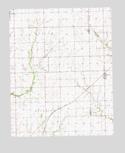
Rose Hill, KS USGS Topographic Map
Click on map above to begin viewing in our Map Viewer.

This topographic map contains these locations and features:
Feature Name Type Latitude Longitude GNIS ID View Map
Branson CemeteryCemeteryN37.6071°W97.2072°474365View Map
Butler Community College - Rose Hill CampusSchoolN37.5498°W97.1338°2720294View Map
Butler County Fire District 3 Station 1BuildingN37.5720°W97.1359°2111157View Map
Church of ChristChurchN37.5592°W97.1335°2689700View Map
City of Rose HillCivilN37.5712°W97.1354°2396429View Map
Cook AirfieldAirportN37.5659°W97.1724°474362View Map
Derby City HallBuildingN37.5485°W97.2486°2510077View Map
Derby Fire and Rescue Department Station 2BuildingN37.5605°W97.2448°2111256View Map
Derby High SchoolSchoolN37.5537°W97.2418°481050View Map
Derby High SchoolSchoolN37.5537°W97.2418°2497490View Map
Derby Public LibraryBuildingN37.5491°W97.2487°2510073View Map
Derby Senior CenterBuildingN37.5491°W97.2487°2510072View Map
Eastridge CemeteryCemeteryN37.5903°W97.2073°474363View Map
Farber SubstationLocaleN37.5331°W97.2392°2509528View Map
Hamilton Field (historical)AirportN37.5609°W97.2345°474360View Map
Harper Rural Water District 5 Water TowerTowerN37.5632°W97.1922°2509616View Map
Hidden Lake Golf CourseLocaleN37.5810°W97.2032°2510065View Map
Hillcrest CemeteryCemeteryN37.5199°W97.2203°2673395View Map
Iowaville (historical)LocaleN37.5770°W97.1828°482580View Map
Longbranch Mobile Home ParkPopulated PlaceN37.6080°W97.2251°2509853View Map
Mulvane High SchoolSchoolN37.5017°W97.2405°481064View Map
Olson AerodromeAirportN37.5231°W97.2026°481423View Map
Park Hill Elementary SchoolSchoolN37.5294°W97.2473°2497432View Map
Perrine Mobile Home ParkPopulated PlaceN37.5642°W97.2023°2510151View Map
Rose HillPopulated PlaceN37.5584°W97.1350°474361View Map
Rose Hill Bible ChurchChurchN37.5786°W97.1319°484350View Map
Rose Hill Christian ChurchChurchN37.5619°W97.1344°2690653View Map
Rose Hill City HallBuildingN37.5772°W97.1365°2693014View Map
Rose Hill First Baptist ChurchChurchN37.5757°W97.1348°2688756View Map
Rose Hill High SchoolSchoolN37.5505°W97.1331°2497512View Map
Rose Hill Intermediate SchoolSchoolN37.5554°W97.1329°2497468View Map
Rose Hill Middle SchoolSchoolN37.5547°W97.1294°2497593View Map
Rose Hill Police DepartmentBuildingN37.5772°W97.1364°2503806View Map
Rose Hill Post OfficePost OfficeN37.5635°W97.1355°2509619View Map
Rose Hill Primary SchoolSchoolN37.5547°W97.1338°2497324View Map
Rose Hill Public LibraryBuildingN37.5612°W97.1348°2694672View Map
Rose Hill United Methodist ChurchChurchN37.5408°W97.1372°2690648View Map
Rose Hill Victory Fellowship ChurchChurchN37.5561°W97.1314°2688757View Map
Saint Mary Elementary SchoolSchoolN37.5644°W97.2339°474334View Map
Sedgwick County Fire District 1 Station 36BuildingN37.5768°W97.2439°2111854View Map
Sedgwick County Water Tower 3TowerN37.5189°W97.1698°2509605View Map
Sterling House of Derby Assisted Living FacilityBuildingN37.5492°W97.2455°2510746View Map
Stonegate Mobile Home ParkPopulated PlaceN37.6124°W97.2088°2509727View Map
Stonegate Park Mobile Home Park Wastewater Treatment FacilityLocaleN37.6108°W97.2092°2510945View Map
Tanglewood Elementary SchoolSchoolN37.5515°W97.2493°2497573View Map
Township of GypsumCivilN37.6055°W97.2071°474213View Map
Township of RockfordCivilN37.5210°W97.2129°474358View Map
Union CemeteryCemeteryN37.5270°W97.1536°474366View Map
Vankirk AirportAirportN37.6120°W97.1639°2651054View Map
Vintage Place of Derby Assisted Living FacilityBuildingN37.5497°W97.2466°2510744View Map

Note: Coordinates in the location and feature list above are referenced to NAD83 datum.


Copyright (C) 2008-2025 Ryan Niemi / Sunset Dynamics ... All Rights Reserved