TopoQuest Logo
Do you find TopoQuest useful?
Help keep TopoQuest running and adding new maps/features by donating!
Bitcoin:  19c7KJd3qBynnjoSw5npx9KScwjBe4ifkT
Litecoin:  LXs6TkuXGGXo1vDsWCkWVdjQX94eUKd6ui
Home View Maps Find Maps Find Places Resources & Links


Durhamville, Tennessee Topographic Map

USGS Map Title: Durhamville, TN
USGS Map MRC: 35089F4
DRG (GeoTIFF) Download: o35089f4.tif


Neighboring USGS Topographic Map Quads:


  Ripley North, TN  
35089G5
 

  Gates, TN  
35089G4
 

  Chestnut Bluff, TN  
35089G3
 

  Ripley South, TN  
35089F5
 

  Durhamville, TN  
35089F4
 

  Tibbs, TN  
35089F3
 

  Gift, TN  
35089E5
 

  Turnpike, TN  
35089E4
 

  Brownsville, TN  
35089E3


Map MRC Location:

N36°
W90°
N36°
W89°
H8 H7 H6 H5 H4 H3 H2 H1
G8 G7 G6 G5 G4 G3 G2 G1
F8 F7 F6 F5 F4 F3 F2 F1
E8 E7 E6 E5 E4 E3 E2 E1
D8 D7 D6 D5 D4 D3 D2 D1
C8 C7 C6 C5 C4 C3 C2 C1
B8 B7 B6 B5 B4 B3 B2 B1
A8 A7 A6 A5 A4 A3 A2 A1
N35°
W90°
N35°
W89°

Durhamville, TN USGS 1:24K Topographic Map Preview:
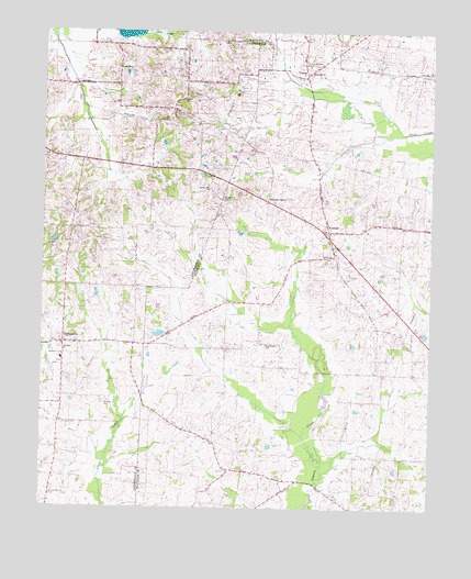
Durhamville, TN USGS Topographic Map
Click on map above to begin viewing in our Map Viewer.

This topographic map contains these locations and features:
Feature Name Type Latitude Longitude GNIS ID View Map
Brownsville - Haywood County Fire Department District 9BuildingN35.6992°W89.3785°2654043View Map
Cane Creek Dam Number FifteenDamN35.7351°W89.4901°1302105View Map
Cane Creek Lake Number FifteenReservoirN35.7351°W89.4901°1302104View Map
Commissioner District 10CivilN35.6295°W89.3878°2464312View Map
Commissioner District 2CivilN35.7452°W89.4784°2463942View Map
Conner ChurchChurchN35.7323°W89.4554°1281093View Map
Conners School (historical)SchoolN35.7292°W89.4581°1318073View Map
Cox Store (historical)LocaleN35.6445°W89.4517°1318968View Map
Currins SchoolSchoolN35.7398°W89.3795°1303435View Map
Doctor Robert Anthony DamDamN35.6717°W89.4617°1307144View Map
Doctor Robert Anthony LakeReservoirN35.6706°W89.4624°1307143View Map
Doris Irvin DamDamN35.6951°W89.4984°1302047View Map
Doris Irvin LakeReservoirN35.6951°W89.4964°1302046View Map
Durham CemeteryCemeteryN35.6523°W89.4795°1283226View Map
DurhamvillePopulated PlaceN35.6681°W89.4931°1283234View Map
Durhamville Baptist ChurchChurchN35.6648°W89.4934°1318078View Map
Durhamville School (historical)SchoolN35.6640°W89.4937°1318079View Map
Edward GrovePopulated PlaceN35.7054°W89.4276°1315005View Map
Edward Grove School (historical)SchoolN35.7059°W89.4281°1318973View Map
Elam ChurchChurchN35.6651°W89.4948°1283590View Map
Flag Grove SchoolSchoolN35.6679°W89.4276°1284353View Map
Greater Zion ChurchChurchN35.6281°W89.4967°1286055View Map
Holmes CemeteryCemeteryN35.6984°W89.4895°1288130View Map
Maranatha ChurchChurchN35.7395°W89.4148°1292654View Map
Marys ChapelChurchN35.7406°W89.4765°1292866View Map
Neboth Church (historical)ChurchN35.6340°W89.4315°1319002View Map
NutbushPopulated PlaceN35.6981°W89.4081°1296030View Map
Nutbush Division (historical)CensusN35.7292°W89.3784°1648769View Map
Nutbush Post Office (historical)Post OfficeN35.6979°W89.4081°1651137View Map
Nutbush School (historical)SchoolN35.6956°W89.4081°1319003View Map
Saint Luke ChurchChurchN35.7423°W89.4162°1319009View Map
Saint Lukes SchoolSchoolN35.7423°W89.4151°1300468View Map
Saint Pauls CemeteryCemeteryN35.6470°W89.4934°1300500View Map
Saint Pauls ChurchChurchN35.6662°W89.4929°1300510View Map
Spring Hill CemeteryCemeteryN35.7065°W89.4423°1271104View Map
Spring Hill ChurchChurchN35.7087°W89.4465°1271109View Map
ToulonPopulated PlaceN35.7384°W89.4156°1272790View Map
Toulon Post Office (historical)Post OfficeN35.7404°W89.4162°1651144View Map
Trinity CemeteryCemeteryN35.6906°W89.4084°1319027View Map
Trinity ChurchChurchN35.6909°W89.4065°1272888View Map

Note: Coordinates in the location and feature list above are referenced to NAD83 datum.


Copyright (C) 2008-2024 Ryan Niemi / Sunset Dynamics ... All Rights Reserved