TopoQuest Logo
Do you find TopoQuest useful?
Help keep TopoQuest running and adding new maps/features by donating!
Bitcoin:  19c7KJd3qBynnjoSw5npx9KScwjBe4ifkT
Litecoin:  LXs6TkuXGGXo1vDsWCkWVdjQX94eUKd6ui
Home View Maps Find Maps Find Places Resources & Links


Holmesville, New York Topographic Map

USGS Map Title: Holmesville, NY
USGS Map MRC: 42075E4
DRG (GeoTIFF) Download: o42075e4.tif


Neighboring USGS Topographic Map Quads:


  Earlville, NY  
42075F5
 

  Sherburne, NY  
42075F4
 

  New Berlin North, NY  
42075F3
 

  Norwich, NY  
42075E5
 

  Holmesville, NY  
42075E4
 

  New Berlin South, NY  
42075E3
 

  Oxford, NY  
42075D5
 

  Guilford, NY  
42075D4
 

  Gilbertsville, NY  
42075D3


Map MRC Location:

N43°
W76°
N43°
W75°
H8 H7 H6 H5 H4 H3 H2 H1
G8 G7 G6 G5 G4 G3 G2 G1
F8 F7 F6 F5 F4 F3 F2 F1
E8 E7 E6 E5 E4 E3 E2 E1
D8 D7 D6 D5 D4 D3 D2 D1
C8 C7 C6 C5 C4 C3 C2 C1
B8 B7 B6 B5 B4 B3 B2 B1
A8 A7 A6 A5 A4 A3 A2 A1
N42°
W76°
N42°
W75°

Holmesville, NY USGS 1:24K Topographic Map Preview:
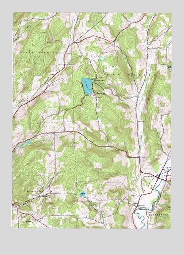
Holmesville, NY USGS Topographic Map
Click on map above to begin viewing in our Map Viewer.

This topographic map contains these locations and features:
Feature Name Type Latitude Longitude GNIS ID View Map
Alishauskas DairyLocaleN42.5664°W75.4983°2556822View Map
AmblervillePopulated PlaceN42.5412°W75.3999°942418View Map
Amblerville CemeteryCemeteryN42.5375°W75.3996°2559162View Map
Bloom CemeteryCemeteryN42.6015°W75.4580°944281View Map
Burwell CornersLocaleN42.6079°W75.4510°945300View Map
Central SchoolSchoolN42.5345°W75.3805°946297View Map
Chenango LakeLakeN42.5827°W75.4413°946486View Map
Chenango LakePopulated PlaceN42.5851°W75.4352°946487View Map
Ditch Road BridgeBridgeN42.5113°W75.3945°2614894View Map
Dyer CemeteryCemeteryN42.6115°W75.4160°948891View Map
Edmonds CemeteryCemeteryN42.5728°W75.4020°2559161View Map
Flagpole HillSummitN42.5773°W75.4291°950225View Map
Great BrookStreamN42.5115°W75.3927°951619View Map
Hidden Ponds StablesLocaleN42.5358°W75.4647°2556827View Map
HolmesvillePopulated PlaceN42.5129°W75.4013°953022View Map
Holmesville CemeteryCemeteryN42.5170°W75.3994°2559163View Map
King Settlement CemeteryCemeteryN42.5947°W75.4635°2559160View Map
Kings SettlementLocaleN42.5945°W75.4591°954674View Map
Madison PondLakeN42.5978°W75.4314°956260View Map
Norwich CemeteryCemeteryN42.5551°W75.4669°959026View Map
Riverside CemeteryCemeteryN42.5239°W75.3883°962581View Map
School Number 11 (historical)SchoolN42.6078°W75.4519°2108272View Map
School Number 2 (historical)SchoolN42.5834°W75.4713°975171View Map
School Number 6 (historical)SchoolN42.5790°W75.4002°975468View Map
School Number 6 (historical)SchoolN42.5203°W75.4717°2108268View Map
School Number 7 (historical)SchoolN42.5062°W75.4268°975526View Map
School Number 7 (historical)SchoolN42.5147°W75.4003°2108269View Map
South New BerlinPopulated PlaceN42.5295°W75.3852°965824View Map
South New Berlin Free LibraryBuildingN42.5300°W75.3844°2617434View Map
South New Berlin Post OfficePost OfficeN42.5298°W75.3859°2618133View Map
South New Berlin Volunteer Fire DepartmentBuildingN42.5307°W75.3846°2734746View Map
SpringvalePopulated PlaceN42.5195°W75.4735°973110View Map
Town of New BerlinCivilN42.5846°W75.3948°979256View Map
Town of North NorwichCivilN42.6051°W75.4986°979291View Map
Town of NorwichCivilN42.5085°W75.4881°979297View Map
Union ChurchChurchN42.5183°W75.4794°2108266View Map
WCHN-AM (Norwich)TowerN42.5067°W75.4910°978459View Map
West Branch Great BrookStreamN42.5751°W75.3977°969123View Map
Whites PondLakeN42.5199°W75.4445°971159View Map
Wightman CemeteryCemeteryN42.5622°W75.4014°971228View Map
WKXZ-FM (Norwich)TowerN42.5479°W75.4516°978568View Map

Note: Coordinates in the location and feature list above are referenced to NAD83 datum.


Copyright (C) 2008-2024 Ryan Niemi / Sunset Dynamics ... All Rights Reserved