TopoQuest Logo
Do you find TopoQuest useful?
Help keep TopoQuest running and adding new maps/features by donating!
Bitcoin:  19c7KJd3qBynnjoSw5npx9KScwjBe4ifkT
Litecoin:  LXs6TkuXGGXo1vDsWCkWVdjQX94eUKd6ui
Home View Maps Find Maps Find Places Resources & Links


Blooming Valley, Pennsylvania Topographic Map

USGS Map Title: Blooming Valley, PA
USGS Map MRC: 41080F1
DRG (GeoTIFF) Download: o41080f1.tif


Neighboring USGS Topographic Map Quads:


  Edinboro South, PA  
41080G2
 

  Cambridge Springs, PA  
41080G1
 

  Millers Station, PA  
41079G8
 

  Meadville, PA  
41080F2
 

  Blooming Valley, PA  
41080F1
 

  Townville, PA  
41079F8
 

  Geneva, PA  
41080E2
 

  Cochranton, PA  
41080E1
 

  Sugar Lake, PA  
41079E8


Map MRC Location:

N42°
W81°
N42°
W80°
H8 H7 H6 H5 H4 H3 H2 H1
G8 G7 G6 G5 G4 G3 G2 G1
F8 F7 F6 F5 F4 F3 F2 F1
E8 E7 E6 E5 E4 E3 E2 E1
D8 D7 D6 D5 D4 D3 D2 D1
C8 C7 C6 C5 C4 C3 C2 C1
B8 B7 B6 B5 B4 B3 B2 B1
A8 A7 A6 A5 A4 A3 A2 A1
N41°
W81°
N41°
W80°

Blooming Valley, PA USGS 1:24K Topographic Map Preview:
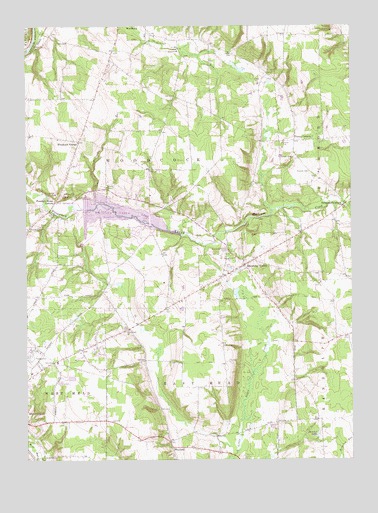
Blooming Valley, PA USGS Topographic Map
Click on map above to begin viewing in our Map Viewer.

This topographic map contains these locations and features:
Feature Name Type Latitude Longitude GNIS ID View Map
Beech SchoolSchoolN41.7187°W80.0737°1200676View Map
Black Ash SwampSwampN41.7084°W80.0564°1200674View Map
Blooming ValleyPopulated PlaceN41.6812°W80.0409°1169850View Map
Blooming Valley CemeteryCemeteryN41.6847°W80.0470°1169851View Map
Blooming Valley Volunteer Fire Department 2BuildingN41.6822°W80.0412°2645267View Map
Borough of Blooming ValleyCivilN41.6797°W80.0396°1215130View Map
Bossard RunStreamN41.6981°W80.0978°1170016View Map
Coulter School (historical)SchoolN41.7209°W80.0448°1200677View Map
Crawford CountyCivilN41.6847°W80.1063°1213666View Map
Delamater CornersPopulated PlaceN41.6989°W80.0020°1173118View Map
Delamater School (historical)SchoolN41.6876°W80.0037°1200672View Map
East Mead Volunteer Fire Company Department 9BuildingN41.6288°W80.0636°2645507View Map
Ellis SchoolSchoolN41.6362°W80.1151°1200665View Map
Fountain House CornersPopulated PlaceN41.6998°W80.1137°1175052View Map
Gibson SchoolSchoolN41.6809°W80.1131°1200670View Map
Gilmer SchoolSchoolN41.7392°W80.0906°1200679View Map
Gravel Run AirportAirportN41.7423°W80.0783°1194279View Map
Grubb SchoolSchoolN41.7192°W80.1226°1200675View Map
Hatch SchoolSchoolN41.6587°W80.0489°1200669View Map
Hemlock LakesLakeN41.6323°W80.0137°1176811View Map
Lang SchoolSchoolN41.7445°W80.0539°1200680View Map
McCullough SchoolSchoolN41.6951°W80.0514°1200673View Map
Moore School (historical)SchoolN41.6542°W80.0789°1200668View Map
Mount Blair CemeteryCemeteryN41.7007°W80.1108°1181645View Map
Pierson SchoolSchoolN41.6267°W80.1234°1200664View Map
Pinney CornersPopulated PlaceN41.7170°W80.0212°1183953View Map
Pinney School (historical)SchoolN41.7176°W80.0173°1200678View Map
Plank Road SchoolSchoolN41.6362°W80.0131°1200666View Map
Pleasant Valley ChurchChurchN41.6926°W80.1234°1184075View Map
Rolf SchoolSchoolN41.6542°W80.1148°1200667View Map
Shutz SchoolSchoolN41.6814°W80.0898°1200671View Map
Spaid RunStreamN41.6934°W80.0962°1946486View Map
State Road ChurchChurchN41.6626°W80.0856°1188558View Map
Townley CemeteryCemeteryN41.7077°W80.0157°1189692View Map
Township of East MeadCivilN41.6252°W80.0565°1216304View Map
Township of West MeadCivilN41.6267°W80.1247°1216327View Map
Township of WoodcockCivilN41.7128°W80.0868°1216330View Map
WaylandPopulated PlaceN41.6287°W80.0692°1190709View Map
West Mead Township District 1 Volunteer Fire Company Department 28BuildingN41.6261°W80.1208°2645716View Map
Wilkinson School (historical)SchoolN41.7476°W80.0089°1200681View Map
Woodcock Creek DamDamN41.6957°W80.1019°1195740View Map
Woodcock Creek LakeReservoirN41.6963°W80.0884°1191726View Map
Woodcock GrangePopulated PlaceN41.7170°W80.1042°1191727View Map

Note: Coordinates in the location and feature list above are referenced to NAD83 datum.


Copyright (C) 2008-2024 Ryan Niemi / Sunset Dynamics ... All Rights Reserved