TopoQuest Logo
Do you find TopoQuest useful?
Help keep TopoQuest running and adding new maps/features by donating!
Bitcoin:  19c7KJd3qBynnjoSw5npx9KScwjBe4ifkT
Litecoin:  LXs6TkuXGGXo1vDsWCkWVdjQX94eUKd6ui
Home View Maps Find Maps Find Places Resources & Links


Wagoner, Missouri Topographic Map

USGS Map Title: Wagoner, MO
USGS Map MRC: 37093F8
DRG (GeoTIFF) Download: o37093f8.tif


Neighboring USGS Topographic Map Quads:


  El Dorado Springs South, MO  
37094G1
 

  Filley, MO  
37093G8
 

  Caplinger Mills, MO  
37093G7
 

  Montevallo, MO  
37094F1
 

  Wagoner, MO  
37093F8
 

  Stockton, MO  
37093F7
 

  Jerico Springs, MO  
37094E1
 

  Cedarville, MO  
37093E8
 

  Crisp, MO  
37093E7


Map MRC Location:

N38°
W94°
N38°
W93°
H8 H7 H6 H5 H4 H3 H2 H1
G8 G7 G6 G5 G4 G3 G2 G1
F8 F7 F6 F5 F4 F3 F2 F1
E8 E7 E6 E5 E4 E3 E2 E1
D8 D7 D6 D5 D4 D3 D2 D1
C8 C7 C6 C5 C4 C3 C2 C1
B8 B7 B6 B5 B4 B3 B2 B1
A8 A7 A6 A5 A4 A3 A2 A1
N37°
W94°
N37°
W93°

Wagoner, MO USGS 1:24K Topographic Map Preview:
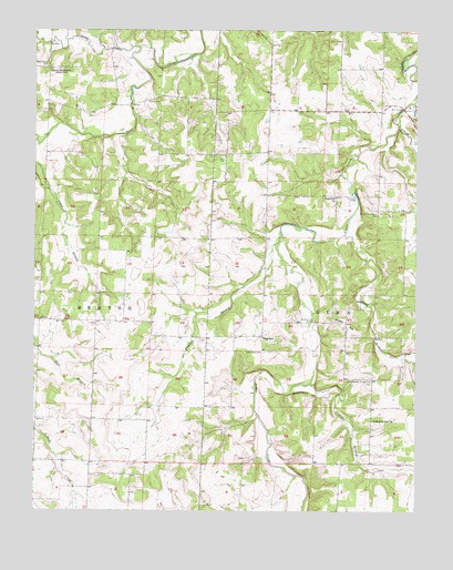
Wagoner, MO USGS Topographic Map
Click on map above to begin viewing in our Map Viewer.

This topographic map contains these locations and features:
Feature Name Type Latitude Longitude GNIS ID View Map
Amity Community HallBuildingN37.7025°W93.8880°729835View Map
Bell BridgeBridgeN37.7298°W93.8794°754999View Map
Boston BluffCliffN37.6562°W93.9133°714546View Map
Buckfoot BranchStreamN37.7312°W93.8758°714978View Map
Cedar Bluff CemeteryCemeteryN37.6664°W93.9252°715568View Map
Cedar Bluff School (historical)SchoolN37.6675°W93.9260°746225View Map
Edsall (historical)Populated PlaceN37.7400°W93.9005°740583View Map
English BranchStreamN37.6956°W93.9199°717596View Map
Fowler School (historical)SchoolN37.6484°W93.9724°746223View Map
Hall CemeteryCemeteryN37.6745°W93.9935°719003View Map
Hamby CemeteryCemeteryN37.7317°W93.9594°719023View Map
Highpoint School (historical)SchoolN37.7400°W93.8994°746224View Map
Hopewell BridgeBridgeN37.7075°W93.8952°755219View Map
Hopewell ChurchChurchN37.7070°W93.9019°719802View Map
Hudson School (historical)SchoolN37.6900°W93.9688°746222View Map
Hyder HillSummitN37.6720°W93.8960°720063View Map
Independence ChurchChurchN37.6487°W93.8897°720092View Map
Independence Community HallLocaleN37.6589°W93.8897°729906View Map
Lake LouiseReservoirN37.6934°W93.9686°763255View Map
Mossy Hill DamDamN37.6934°W93.9686°763254View Map
Polecat CreekStreamN37.7248°W93.8810°724705View Map
Potter School (historical)SchoolN37.7328°W93.9502°746226View Map
Sand Ridge CemeteryCemeteryN37.7406°W93.9985°726018View Map
Sand Ridge School (historical)SchoolN37.7392°W93.9952°726019View Map
Snag BranchStreamN37.6973°W93.8985°726652View Map
Stinking CreekStreamN37.7456°W93.9661°727114View Map
Teague BranchStreamN37.6584°W93.9097°727502View Map
TingleyPopulated PlaceN37.6612°W93.9991°740057View Map
Vasser Ford BridgeBridgeN37.6745°W93.9083°755443View Map
WagonerPopulated PlaceN37.6706°W93.9255°728241View Map

Note: Coordinates in the location and feature list above are referenced to NAD83 datum.


Copyright (C) 2008-2024 Ryan Niemi / Sunset Dynamics ... All Rights Reserved