TopoQuest Logo
Do you find TopoQuest useful?
Help keep TopoQuest running and adding new maps/features by donating!
Bitcoin:  19c7KJd3qBynnjoSw5npx9KScwjBe4ifkT
Litecoin:  LXs6TkuXGGXo1vDsWCkWVdjQX94eUKd6ui
Home View Maps Find Maps Find Places Resources & Links


Little Prairie, Wisconsin Topographic Map

USGS Map Title: Little Prairie, WI
USGS Map MRC: 42088G5
DRG (GeoTIFF) Download: o42088g5.tif


Neighboring USGS Topographic Map Quads:


  Rome, WI  
42088H6
 

  Palmyra, WI  
42088H5
 

  Eagle, WI  
42088H4
 

  Whitewater, WI  
42088G6
 

  Little Prairie, WI  
42088G5
 

  East Troy, WI  
42088G4
 

  Delavan, WI  
42088F6
 

  Elkhorn, WI  
42088F5
 

  Springfield, WI  
42088F4


Map MRC Location:

N43°
W89°
N43°
W88°
H8 H7 H6 H5 H4 H3 H2 H1
G8 G7 G6 G5 G4 G3 G2 G1
F8 F7 F6 F5 F4 F3 F2 F1
E8 E7 E6 E5 E4 E3 E2 E1
D8 D7 D6 D5 D4 D3 D2 D1
C8 C7 C6 C5 C4 C3 C2 C1
B8 B7 B6 B5 B4 B3 B2 B1
A8 A7 A6 A5 A4 A3 A2 A1
N42°
W89°
N42°
W88°

Little Prairie, WI USGS 1:24K Topographic Map Preview:
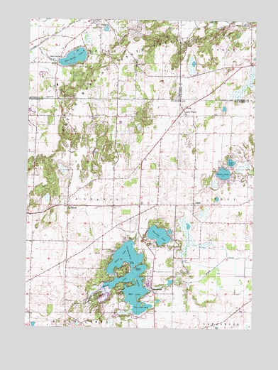
Little Prairie, WI USGS Topographic Map
Click on map above to begin viewing in our Map Viewer.

This topographic map contains these locations and features:
Feature Name Type Latitude Longitude GNIS ID View Map
AdamsPopulated PlaceN42.8006°W88.5329°1560680View Map
Adams CemeteryCemeteryN42.8011°W88.5329°2002801View Map
Battle Creek SchoolSchoolN42.8600°W88.6070°1561305View Map
Blue Spring LakeLakeN42.8594°W88.6002°1561958View Map
Blue Springs Lake 2WP1137 DamDamN42.8583°W88.6084°1791942View Map
Cedar Grove PondLakeN42.7689°W88.5455°2764437View Map
Deakin IslandIslandN42.7747°W88.5645°1563786View Map
Dewings IslandIslandN42.7597°W88.5604°1851242View Map
Don Jean BayBayN42.7578°W88.5618°1564048View Map
Dunhams BayBayN42.7683°W88.5604°1851244View Map
Eagle Oak Opening State Natural AreaParkN42.8664°W88.5337°2054642View Map
Ewings LandingLocaleN42.7772°W88.5773°1851250View Map
Green LakeLakeN42.7792°W88.5704°1565815View Map
Hillside CemeteryCemeteryN42.8731°W88.5867°2781332View Map
Kettle Moraine Oak Opening State Natural AreaParkN42.8506°W88.5945°1988738View Map
La GrangePopulated PlaceN42.7997°W88.6023°1567678View Map
LauderdalePopulated PlaceN42.7653°W88.5557°1567874View Map
Lauderdale - LaGrange Fire DepartmentBuildingN42.7997°W88.6015°2698144View Map
Lauderdale LakesReservoirN42.7708°W88.5679°1567875View Map
Lauderdale Lakes 12ReservoirN42.7650°W88.5568°1792063View Map
Lauderdale Lakes 2-WP-618 DamDamN42.7650°W88.5568°1792062View Map
Lauderdale Lakes Census Designated PlaceCensusN42.7709°W88.5778°2586523View Map
Lauderdale ShoresPopulated PlaceN42.7808°W88.5611°2508623View Map
Little PrairiePopulated PlaceN42.8389°W88.5390°1568373View Map
Little Prairie CemeteryCemeteryN42.8367°W88.5368°2002806View Map
Long PointCapeN42.7764°W88.5679°1568592View Map
Middle LakeLakeN42.7708°W88.5668°1569423View Map
Mill LakeLakeN42.7667°W88.5584°1569483View Map
Palmyra - Eagle High SchoolSchoolN42.8738°W88.5930°1840412View Map
Palmyra - Eagle Middle SchoolSchoolN42.8742°W88.5927°1840413View Map
Peters LakeLakeN42.8131°W88.5173°1571259View Map
Pleasant IslandIslandN42.7700°W88.5648°1851314View Map
Pleasant LakeLakeN42.7879°W88.5519°1571609View Map
Round Prairie CemeteryCemeteryN42.7992°W88.5779°1572682View Map
Skoponong CemeteryCemeteryN42.8430°W88.6159°1574241View Map
Sportsman CenterLocaleN42.8653°W88.5193°1574575View Map
Spring Prairie PointCapeN42.7756°W88.5632°1851338View Map
Stewarts BayBayN42.7745°W88.5607°1851339View Map
Swift LakeLakeN42.8177°W88.5130°1575188View Map
Tamarack AirportAirportN42.8283°W88.5746°1582140View Map
Town of La GrangeCivilN42.7994°W88.6018°1583507View Map
Tratts PointCapeN42.7795°W88.5634°1851340View Map
Wilkinsons PointCapeN42.7611°W88.5634°1851366View Map
Wolfs PointCapeN42.7692°W88.5612°1851373View Map

Note: Coordinates in the location and feature list above are referenced to NAD83 datum.


Copyright (C) 2008-2025 Ryan Niemi / Sunset Dynamics ... All Rights Reserved