TopoQuest Logo
Do you find TopoQuest useful?
Help keep TopoQuest running and adding new maps/features by donating!
Bitcoin:  19c7KJd3qBynnjoSw5npx9KScwjBe4ifkT
Litecoin:  LXs6TkuXGGXo1vDsWCkWVdjQX94eUKd6ui
Home View Maps Find Maps Find Places Resources & Links


Arkdale, Wisconsin Topographic Map

USGS Map Title: Arkdale, WI
USGS Map MRC: 44089A8
DRG (GeoTIFF) Download: o44089a8.tif


Neighboring USGS Topographic Map Quads:


  New Miner, WI  
44090B1
 

  Arkdale NW, WI  
44089B8
 

  Arkdale NE, WI  
44089B7
 

  Necedah, WI  
44090A1
 

  Arkdale, WI  
44089A8
 

  Roche A Cri, WI  
44089A7
 

  Kelly, WI  
43090H1
 

  Dellwood, WI  
43089H8
 

  Adams, WI  
43089H7


Map MRC Location:

N45°
W90°
N45°
W89°
H8 H7 H6 H5 H4 H3 H2 H1
G8 G7 G6 G5 G4 G3 G2 G1
F8 F7 F6 F5 F4 F3 F2 F1
E8 E7 E6 E5 E4 E3 E2 E1
D8 D7 D6 D5 D4 D3 D2 D1
C8 C7 C6 C5 C4 C3 C2 C1
B8 B7 B6 B5 B4 B3 B2 B1
A8 A7 A6 A5 A4 A3 A2 A1
N44°
W90°
N44°
W89°

Arkdale, WI USGS 1:24K Topographic Map Preview:
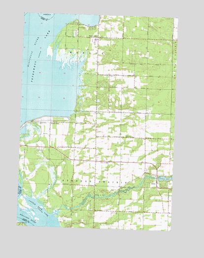
Arkdale, WI USGS Topographic Map
Click on map above to begin viewing in our Map Viewer.

This topographic map contains these locations and features:
Feature Name Type Latitude Longitude GNIS ID View Map
ArkdalePopulated PlaceN44.0272°W89.8879°1560936View Map
Arkdale 3WR1429 DamDamN44.0309°W89.8860°1792110View Map
Arkdale Census Designated PlaceCensusN44.0252°W89.8862°2586451View Map
Arkdale LakeReservoirN44.0306°W89.8815°1560937View Map
Big Roche a Cri CreekStreamN44.0075°W89.9701°1561759View Map
East Arkdale CemeteryCemeteryN44.0252°W89.8771°1564271View Map
Edwardson CemeteryCemeteryN44.0538°W89.9143°1564458View Map
Monroe CenterPopulated PlaceN44.1119°W89.9396°1569658View Map
Monroe Center CemeteryCemeteryN44.1183°W89.9504°1569659View Map
Petenwell County ParkParkN44.1202°W89.9576°1571252View Map
Roche-A-Cri Elementary SchoolSchoolN44.0387°W89.9287°1572418View Map
South Arkdale CemeteryCemeteryN44.0102°W89.9187°1574384View Map
Strongs PrairiePopulated PlaceN44.0614°W89.9760°1577843View Map
Strongs Prairie CemeteryCemeteryN44.0608°W89.9851°1574987View Map
Town of MonroeCivilN44.1087°W89.9424°1583739View Map
Town of Strongs PrairieCivilN44.0240°W89.9207°1584236View Map
West Arkdale CemeteryCemeteryN44.0244°W89.9173°1576444View Map

Note: Coordinates in the location and feature list above are referenced to NAD83 datum.


Copyright (C) 2008-2024 Ryan Niemi / Sunset Dynamics ... All Rights Reserved