TopoQuest Logo
Do you find TopoQuest useful?
Help keep TopoQuest running and adding new maps/features by donating!
Bitcoin:  19c7KJd3qBynnjoSw5npx9KScwjBe4ifkT
Litecoin:  LXs6TkuXGGXo1vDsWCkWVdjQX94eUKd6ui
Home View Maps Find Maps Find Places Resources & Links


Enterprise NE, Alabama Topographic Map

USGS Map Title: Enterprise NE, AL
USGS Map MRC: 31085D7
DRG (GeoTIFF) Download: o31085d7.tif


Neighboring USGS Topographic Map Quads:


  Victoria, AL  
31085E8
 

  Brundidge SE, AL  
31085E7
 

  Ariton, AL  
31085E6
 

  New Brockton, AL  
31085D8
 

  Enterprise NE, AL  
31085D7
 

  Ozark, AL  
31085D6
 

  Goodman, AL  
31085C8
 

  Enterprise, AL  
31085C7
 

  Daleville, AL  
31085C6


Map MRC Location:

N32°
W86°
N32°
W85°
H8 H7 H6 H5 H4 H3 H2 H1
G8 G7 G6 G5 G4 G3 G2 G1
F8 F7 F6 F5 F4 F3 F2 F1
E8 E7 E6 E5 E4 E3 E2 E1
D8 D7 D6 D5 D4 D3 D2 D1
C8 C7 C6 C5 C4 C3 C2 C1
B8 B7 B6 B5 B4 B3 B2 B1
A8 A7 A6 A5 A4 A3 A2 A1
N31°
W86°
N31°
W85°

Enterprise NE, AL USGS 1:24K Topographic Map Preview:
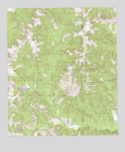
Enterprise NE, AL USGS Topographic Map
Click on map above to begin viewing in our Map Viewer.

This topographic map contains these locations and features:
Feature Name Type Latitude Longitude GNIS ID View Map
Baggett Mill CreekStreamN31.3777°W85.8524°135292View Map
Bowles CreekStreamN31.4207°W85.8291°114773View Map
Boy Scout Lake DamDamN31.4202°W85.8533°129813View Map
Camp AlafloLocaleN31.4102°W85.8552°135309View Map
Crumper School (historical)SchoolN31.4060°W85.8027°135319View Map
Daniels Mill (historical)LocaleN31.3866°W85.8038°166053View Map
Dickers Mill (historical)LocaleN31.4313°W85.8655°135320View Map
Ebenezer CemeteryCemeteryN31.4860°W85.7802°117810View Map
Ebenezer ChurchChurchN31.4857°W85.7797°150028View Map
El Bethel ChurchChurchN31.4963°W85.8369°149955View Map
Essayons LakeReservoirN31.4202°W85.8533°129812View Map
Farmers Academy (historical)SchoolN31.4682°W85.8488°135332View Map
Gateway EstatesPopulated PlaceN31.3793°W85.8619°155756View Map
Gateway LakeReservoirN31.3813°W85.8623°129795View Map
Gateway Lake DamDamN31.3802°W85.8583°129796View Map
Harpers Mill (historical)LocaleN31.4124°W85.8558°135344View Map
Harris Mill CreekStreamN31.3838°W85.8091°119809View Map
Hayes Store (historical)LocaleN31.4710°W85.8024°135346View Map
Jones Store (historical)LocaleN31.4641°W85.8388°135360View Map
Longstreet School (historical)SchoolN31.4846°W85.7797°133503View Map
Mathews CreekStreamN31.3824°W85.8447°122378View Map
Mount Liberty Church (historical)ChurchN31.4091°W85.7685°133519View Map
Nesterville (historical)LocaleN31.4266°W85.7847°133523View Map
Old Tabernacle CemeteryCemeteryN31.4954°W85.8347°137089View Map
Old Tabernacle Methodist ChurchChurchN31.4952°W85.8369°152797View Map
Parish BridgeBridgeN31.3999°W85.7510°133526View Map
Pattle BranchStreamN31.4099°W85.8272°124494View Map
Pea River Baptist ChurchChurchN31.4918°W85.8402°150035View Map
Pea River CemeteryCemeteryN31.4913°W85.8402°157728View Map
Pimpkins CreekStreamN31.4129°W85.8274°152906View Map
Pittman Brothers LakeReservoirN31.4251°W85.8695°129816View Map
Pittman Brothers Lake DamDamN31.4235°W85.8683°129817View Map
Rex Post Office (historical)Post OfficeN31.3866°W85.8038°169254View Map
Richland CreekStreamN31.3804°W85.7672°133540View Map
Rocky Head School (historical)SchoolN31.4888°W85.7724°157659View Map
Shivers BranchStreamN31.4688°W85.8219°135423View Map
Shivers Mill (historical)LocaleN31.4657°W85.8177°135424View Map
Stokes BranchStreamN31.4591°W85.8177°135429View Map
Syrup CreekStreamN31.3849°W85.8266°135430View Map
TabernaclePopulated PlaceN31.4513°W85.8713°127619View Map
Tanyard BranchStreamN31.4454°W85.8227°127673View Map
Wesley Chapel CemeteryCemeteryN31.4104°W85.8463°137102View Map
Wesley Chapel Methodist ChurchChurchN31.4099°W85.8472°153929View Map

Note: Coordinates in the location and feature list above are referenced to NAD83 datum.


Copyright (C) 2008-2024 Ryan Niemi / Sunset Dynamics ... All Rights Reserved