TopoQuest Logo
Do you find TopoQuest useful?
Help keep TopoQuest running and adding new maps/features by donating!
Bitcoin:  19c7KJd3qBynnjoSw5npx9KScwjBe4ifkT
Litecoin:  LXs6TkuXGGXo1vDsWCkWVdjQX94eUKd6ui
Home View Maps Find Maps Find Places Resources & Links


Fourmile Lake, Minnesota Topographic Map

USGS Map Title: Fourmile Lake, MN
USGS Map MRC: 46095A8
DRG (GeoTIFF) Download: o46095a8.tif


Neighboring USGS Topographic Map Quads:


  Dayton Hollow Dam, MN  
46096B1
 

  Dalton, MN  
46095B8
 

  Stalker Lake, MN  
46095B7
 

  Wendell, MN  
46096A1
 

  Fourmile Lake, MN  
46095A8
 

  Ashby, MN  
46095A7
 

  Trisko Lake, MN  
45096H1
 

  Elbow Lake, MN  
45095H8
 

  Erdahl, MN  
45095H7


Map MRC Location:

N47°
W96°
N47°
W95°
H8 H7 H6 H5 H4 H3 H2 H1
G8 G7 G6 G5 G4 G3 G2 G1
F8 F7 F6 F5 F4 F3 F2 F1
E8 E7 E6 E5 E4 E3 E2 E1
D8 D7 D6 D5 D4 D3 D2 D1
C8 C7 C6 C5 C4 C3 C2 C1
B8 B7 B6 B5 B4 B3 B2 B1
A8 A7 A6 A5 A4 A3 A2 A1
N46°
W96°
N46°
W95°

Fourmile Lake, MN USGS 1:24K Topographic Map Preview:
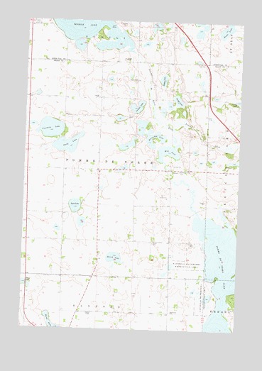
Fourmile Lake, MN USGS Topographic Map
Click on map above to begin viewing in our Map Viewer.

This topographic map contains these locations and features:
Feature Name Type Latitude Longitude GNIS ID View Map
Beebe LakeLakeN46.1222°W95.8846°639864View Map
Bethlehem CemeteryCemeteryN46.0069°W95.9137°640051View Map
Bethlehem Lutheran ChurchChurchN46.0069°W95.9136°2068451View Map
Briggs LakeLakeN46.0930°W95.9117°640478View Map
Burns CemeteryCemeteryN46.0672°W95.8819°2068476View Map
Christ CemeteryCemeteryN46.0350°W95.9248°641184View Map
Field LakeLakeN46.0747°W95.9754°643618View Map
Fourmile LakeLakeN46.0810°W95.9854°643852View Map
Grinder LakeLakeN46.0904°W95.9352°644485View Map
Hagen LakeLakeN46.1014°W95.9206°644563View Map
Hjerdal CemeteryCemeteryN46.0941°W95.9575°645037View Map
Horseshoe LakeLakeN46.0740°W95.9242°645221View Map
Larson LakeLakeN46.0930°W95.8768°646509View Map
Mill PondLakeN46.0719°W95.9171°647855View Map
Pelican CreekStreamN46.0805°W95.9145°649232View Map
Pomme de Terre CemeteryCemeteryN46.0644°W95.9100°649617View Map
Pomme de Terre LakeLakeN46.0234°W95.8833°649619View Map
School Number 11 (historical)SchoolN46.0642°W95.9108°2112830View Map
School Number 15 (historical)SchoolN46.0933°W95.9564°2112829View Map
School Number 37 (historical)SchoolN46.0464°W95.9775°2112835View Map
School Number 38 (historical)SchoolN46.0061°W95.9328°2112833View Map
School Number 55 (historical)SchoolN46.1006°W95.9303°2112828View Map
School Number 63 (historical)SchoolN46.0361°W95.9253°2112834View Map
Scott LakeLakeN46.0498°W95.9702°651804View Map
Skunk LakeLakeN46.0290°W95.9466°652134View Map
Ten Mile Lake DamDamN46.1150°W95.9403°1776241View Map
Tipsinah Mound Golf CourseLocaleN46.0028°W95.8758°2068450View Map
Township of Pomme de TerreCivilN46.0648°W95.9563°665333View Map

Note: Coordinates in the location and feature list above are referenced to NAD83 datum.


Copyright (C) 2008-2024 Ryan Niemi / Sunset Dynamics ... All Rights Reserved